A few years ago, we visited Kapetanovo Jezero (Captain’s Lake) for the first time. That trip, in the rain and cold, was a special experience, but we planned to go back one day in spring (second half of May), as we wanted to see the famous flower fields of Lukavica in their full splendour.
 This week it was the right time for a round trip to Kapetanovo Jezero and back through the Lukavica plateau. And indeed, never in my life have I seen so many wild flowers. It was an unforgettable tour!
The route
Kapetanovo Jezero is located at a distance of about 45 km from Nikšić. The road leads along the „Zagrad“ bauxite mines to Bara Bojovića near Mount Mali Žurim, from where it continues to the Lake. The last macadam stretch is suitable for all-terrain vehicles (4×4 and robust SUVs) only, but you can also continue on foot (or by bike).
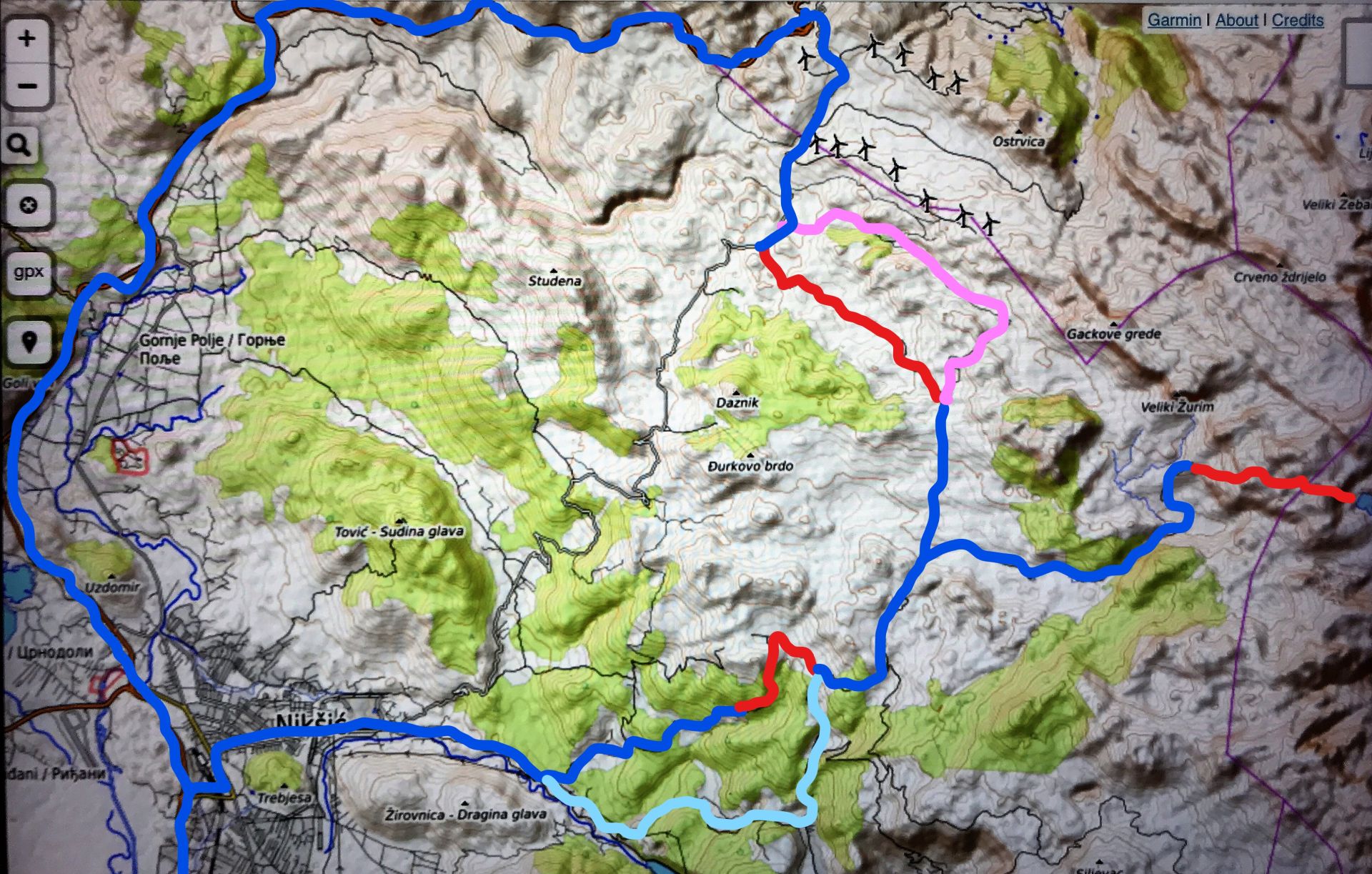
 However, for the time being, the road through Zagrad (bauxite mines) is closed each day from 8.00 – 12.30 h., as it is under reconstruction (pale blue line on the map). Fortunately, there is an alternative shortcut, the last stretch of which is a dirt road that leads uphill through “Katuns” (shepherds’ settlements) and beech forests (blue and red line on the map). The road then continues to Bara Bojovića, opening a fantastic view of the Lukavica plateau.
Turn right at the signpost of Kapetanovo Jezero (red line) and follow the macadam road to the Lake (8.5 km). After getting back, continue to the first junction and turn sharp right until the next junction. Here you can continue straight ahead, following the dirt road over the plateau (red line on the map) and turn right after passing a newly built ethno-resort with green roofs. Soon you will arrive at the old road from Šavnik to Nikšić, where you should turn left in order to return to Nikšić.
 Instead of the dirt road over the plateau, you can also turn right uphill (pink line on the map). After a short stretch of narrow asphalt, follow the macadam road that runs below the windmills of Krnovo. This road is recommended after heavy rain, as the lower road might be muddy. (Under reserve, as we did not check the quality of the whole dirt road).
The asphalt road that leads from Šavnik back to Nikšić is narrow and winding, but offers magnificent views.
Map
At the end of this post I have attached a map of the region, where the complete route is indicated in different colors.
 Župa Nikšićka: Lukavica and Kapetanovo Jezero
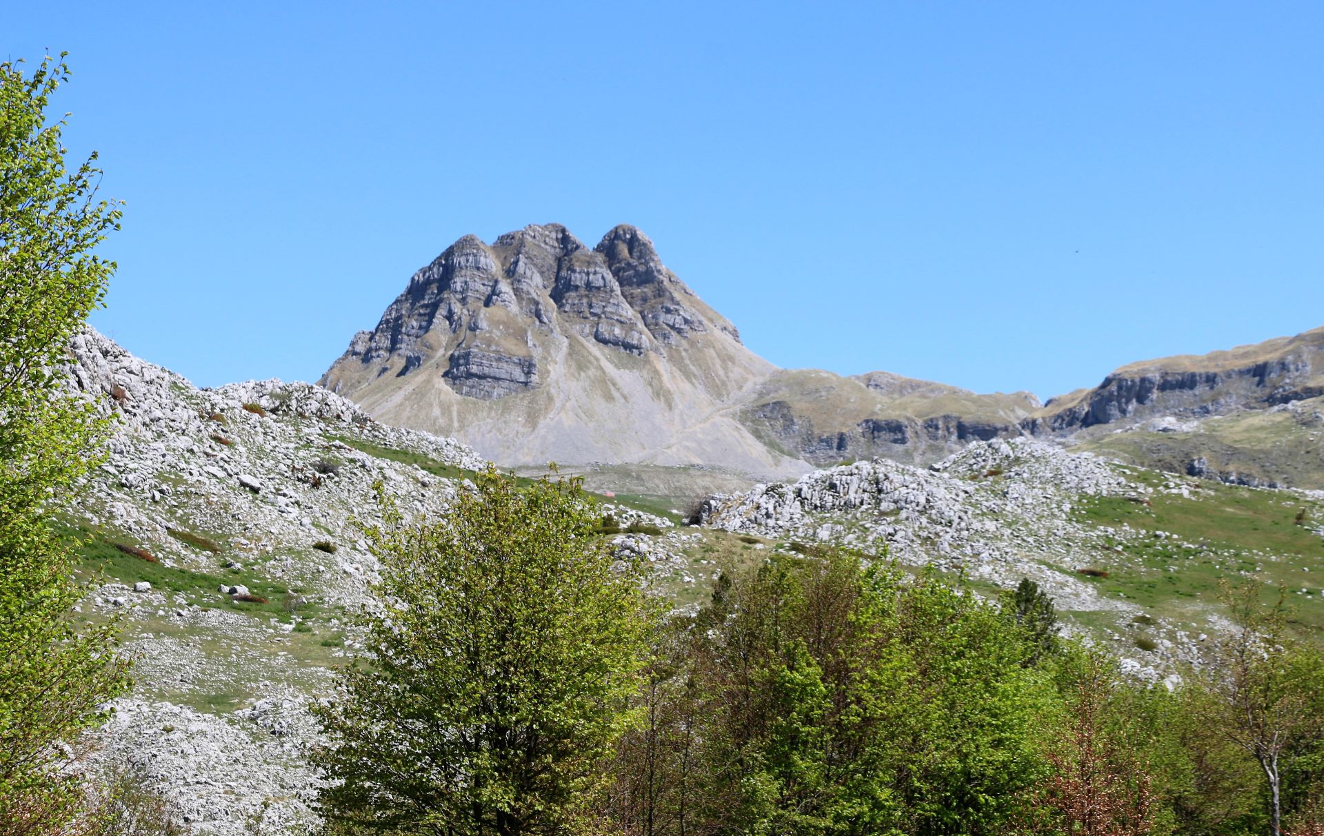
The green Lukavica plateau lies in the middle of the Moračke Planine mountain range, in the geographic heart of Montenegro: Župa Nikšićka. It is crossed by numerous – even 380 – springs and water streams. According to legend, the name Lukavica (lukavo = cunning) is based on the fact that the weather in this area is rather deceptive: you can start hiking on a sunny day, without any clouds, and half an hour later you can be surprised by wind and storm.
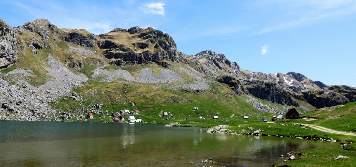
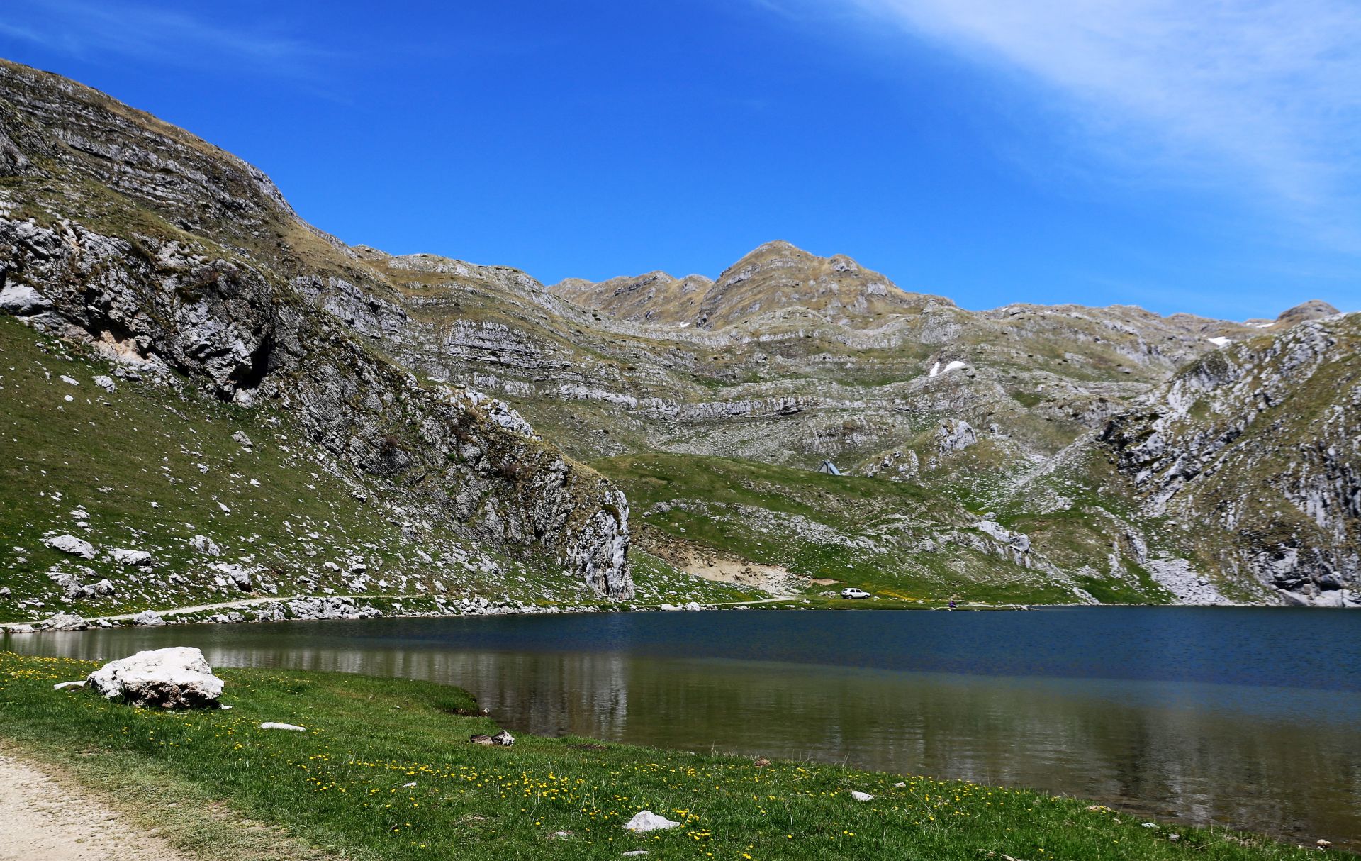
Kapetanovo Jezero or the “Captain’s Lake” is a glacial lake, situated at an altitude of 1678 m. It is 480 m long, 330 m wide and 37 m deep.
 The Legend
Why is this lake called Captain’s Lake? Well, there is an interesting legend about it. During the Ottoman occupation of Montenegro, a certain Captain Mušović from Nikšić was very fond of his beautiful summer pastures and house that stood at the place of today’s lake. In the rocks above this place was a spring that bubbled up from the cliffs. The keys to the spring were kept by mountain fairies. Every night, the fairies would come to the spring to unlock it and bathe in its transparent waters. But one night, the last fairy to leave forgot to lock the spring and its waters flooded the valley below. The next evening, when the fairies returned and saw the flooded valley, they were enchanted by the striking beauty of the scenery and decided to move the spring into the depths of the emerald-green floodwaters, thus creating a new lake. This is how – by the negligence of a fairy (or the magic of nature) Kapetanovo Jezero was created – and Captain Mušović lost his mountain pastures.
 Our Tour
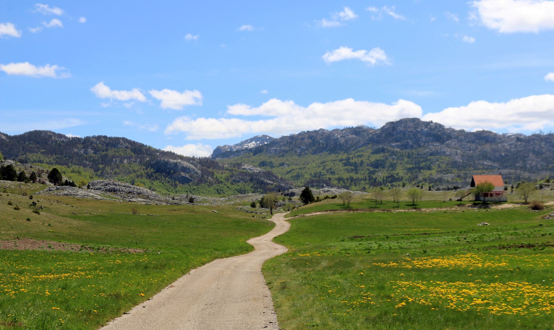
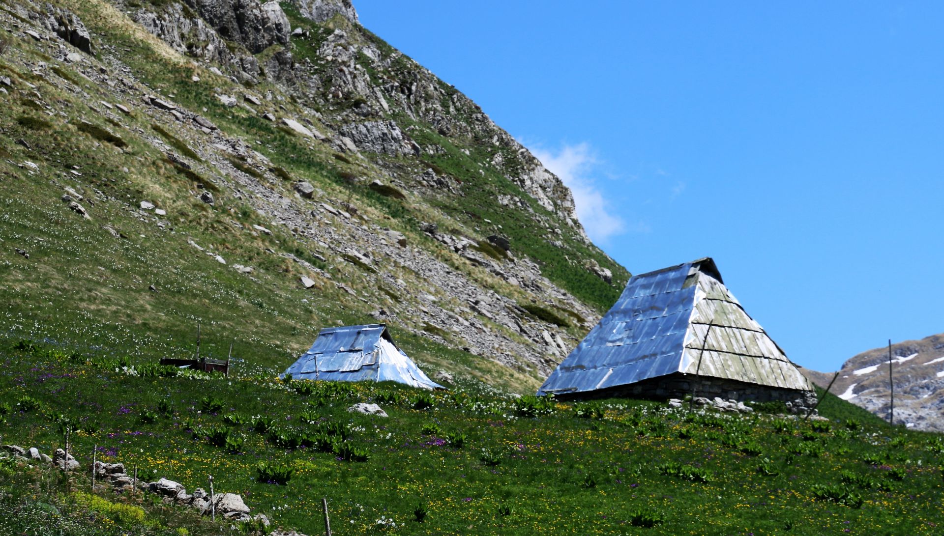
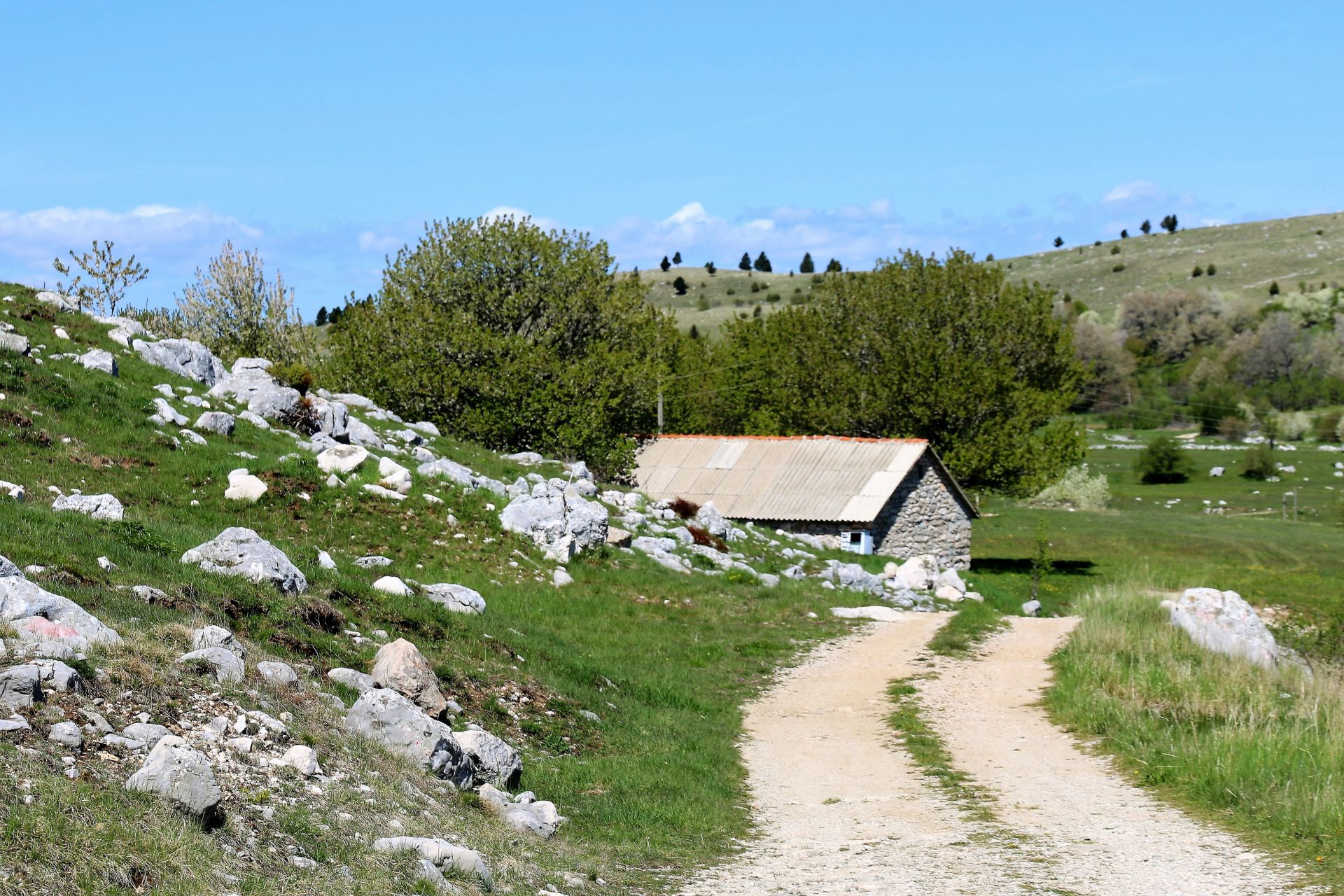
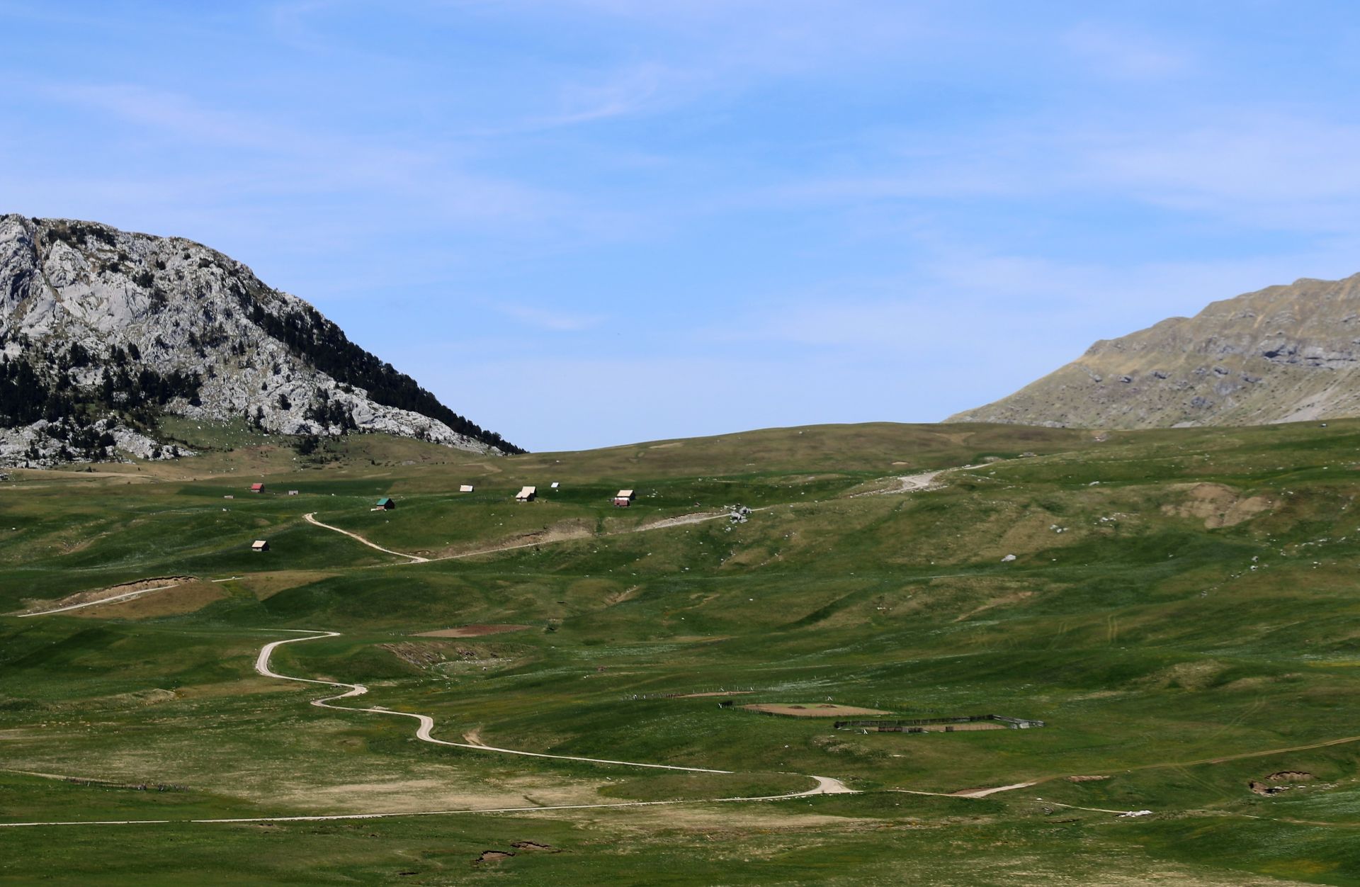
Our trip from Nikšić to Bara Bojovića was unexpectedly interrupted by a road-block: the road through Zagrad appeared to be under reconstruction. We had to take an alternative route that took us uphill to a few almost abandoned “Katuns” (shepherds’ settlements). The mountain setting was magnificent. After a while, the narrow asphalt road turned into a rocky forest road and we drove uphill through dense beech forests. We passed across a mountain pass and soon we got back to the “main road”. In front of us was Lukavica.
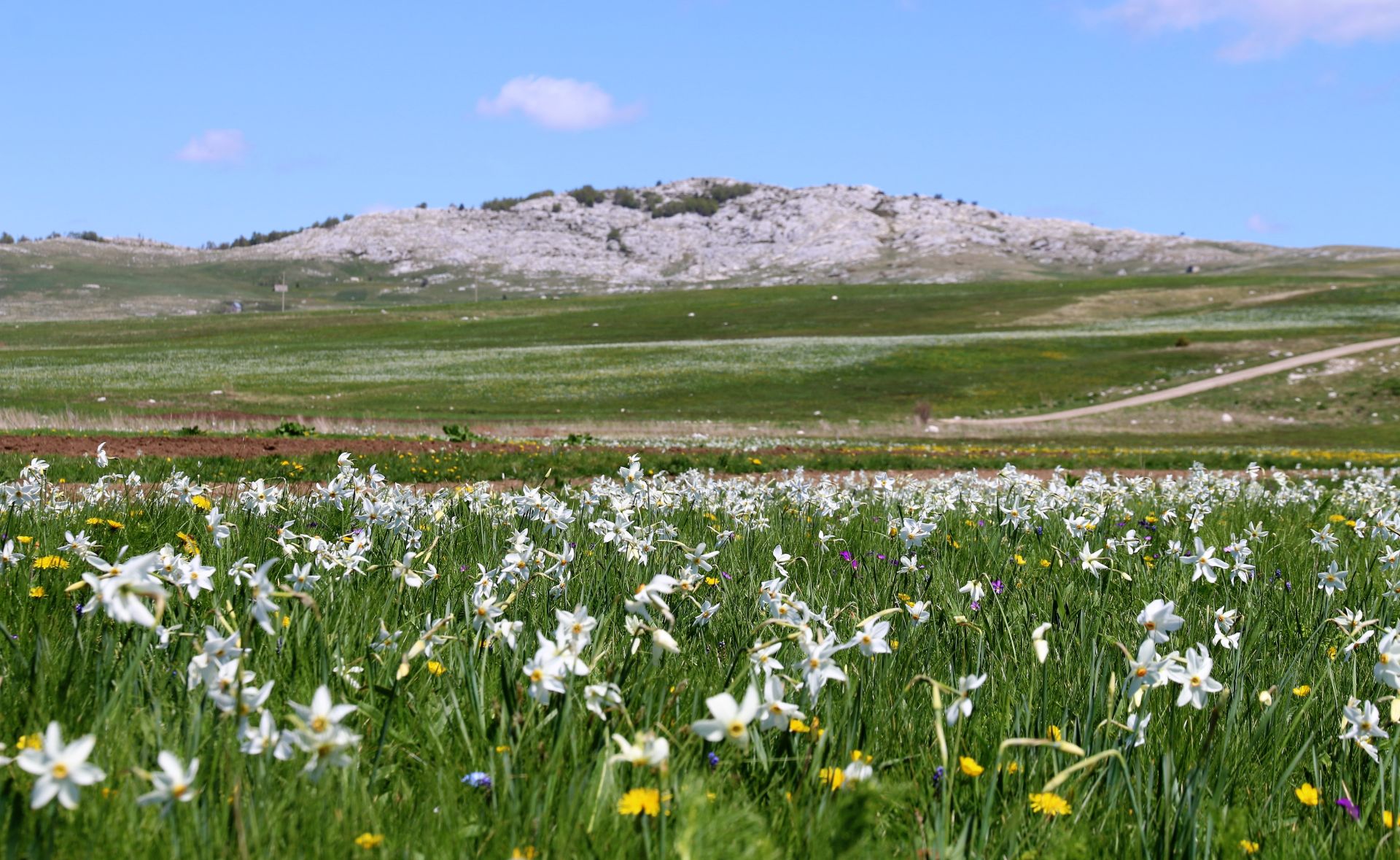
There were still some patches of snow on the rough summits of the surrounding mountains. But what was most striking were the white fields covered with millions of wild daffodils (Narcis poeticus), which offered a striking contrast with the deep green meadows and the threatening rocky summits of Veliki Žurim (2036 m above sea level) and Mali Žurim (1984 m above sea level).
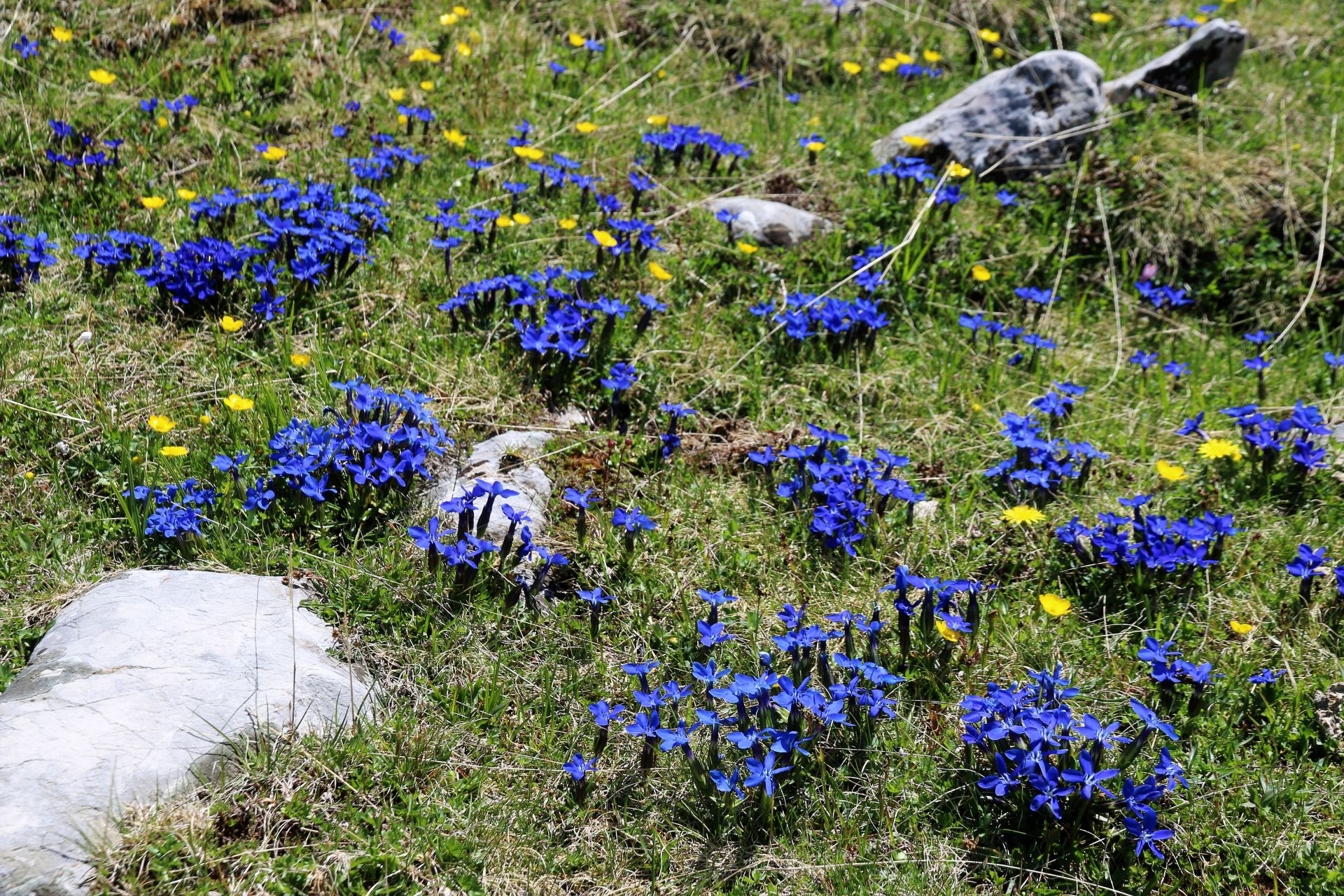
 We followed the bad macadam road through the rough karst landscape. Numerous spring flowers created colorful mosaics on the fields: dandelions (Taraxacum), wild orchids, veronica, grape hyacinths (Muscari) and even dark blue Gentiana (see photo). We listened to the sounds of birds and crickets and enjoyed the quiet.
On our way we passed the newly built St. Elias Church with a pink stone façade and soon we arrived at Kapetanovo Jezero. Unless many other lakes in Montenegro, there are no trees around the lake, but the view of the surrounding mountains gives the lake a special beauty.
We parked the car on the grass beside the Lake and enjoyed our picnic. Sitting on a big rock at the bank of the lake, we were captivated by the transparent, green water and the reflection of the surrounding karst rocks. There were just a few people around: some of them were fishing, other ones were just sitting there. Yes, this is the right place for total relaxation!
 In the afternoon we continued our tour. Of course, we didn’t take the same road back. At the first junction we turned sharp right. Soon the narrow asphalt road stopped and we continued ahead over a dirt road that would probably be quite muddy after heavy rainfall.
Following the rather narrow and winding asphalt road back to Nikšić, we enjoyed once more the beautiful views and settings in this part of the country.
Hiking
Lukavica, with its mountain peaks of Veliki Žurim and Mali Žurim, is one of the most beautiful parts of Župa Nikšićka. The hiking tour from Mali Žurim to Kapetanovo Jezero (8.5 km) takes around 2-2.5 hours and can be qualified as a magnificent and easy tour.
Not far from Kapetanovo Jezero, at an easy walk of around 40 minutes, lies Manito Jezero at an altitude of 1773 m above sea level. .
Conclusion
Župa Nikšićka, and in particular Lukavica with Kapetanovo Jezero, is a paradise for nature lovers. It is still unknown to foreign tourists and even many Montenegrins have never been here… Are you a fan of hiking, biking, photography, flora? Are you interested in a nice off-road adventure? Make this amazing round trip!
Prachtig
[…] The flower splendour of Lukavica and Kapetanovo Jezero von montenegroforme […]