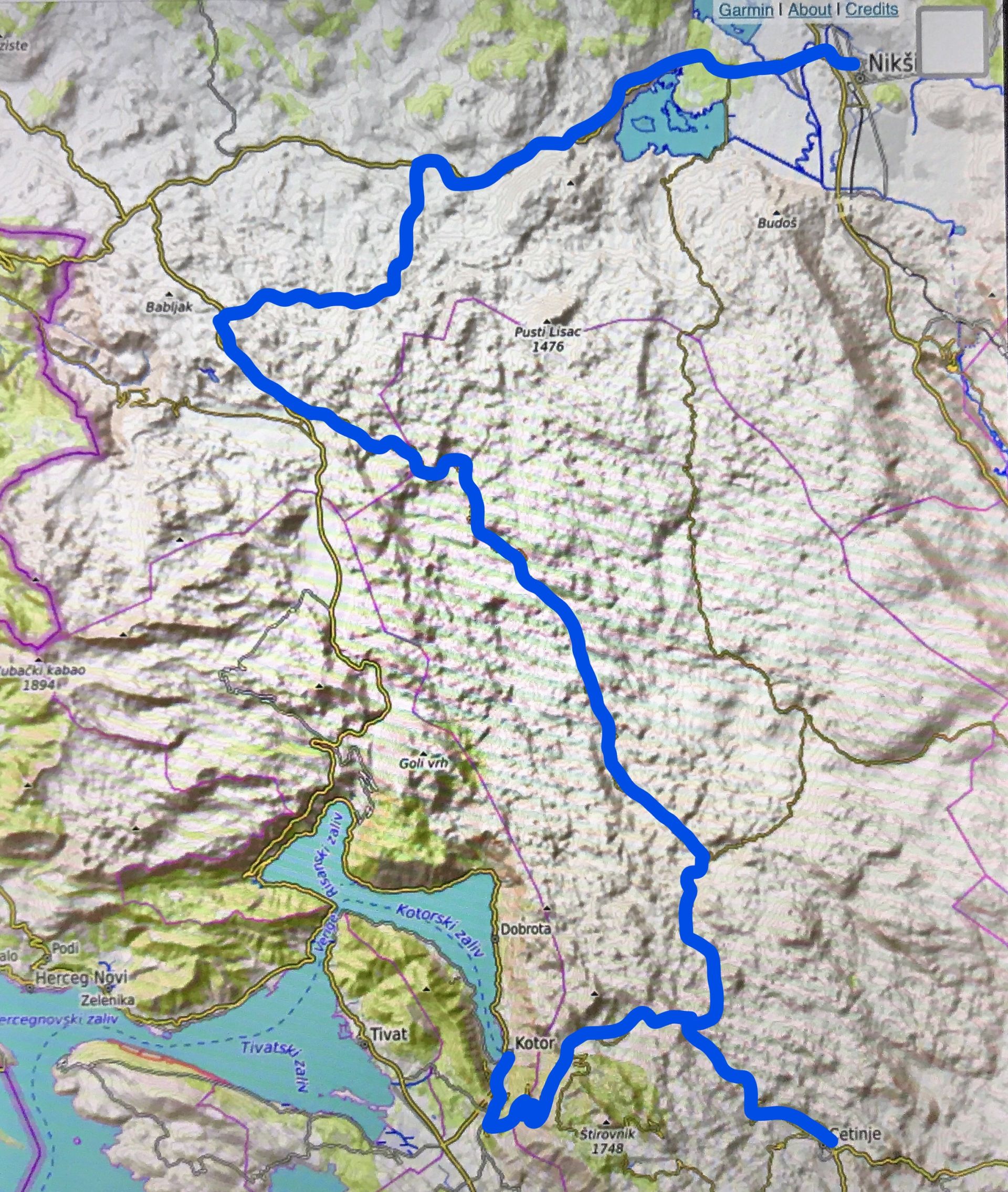
There are some roads through the karst region of Old Montenegro that are mainly unknown to foreign tourists. A few years ago, I described the road that leads from Danilovgrad to Čevo en further to Cetinje. Now I would like to depict another trip we made last week: from Nikšić over a shortcut to Grahovo and further through the western part of Katunska Nahija through Resna and Čeklići to Kotor.
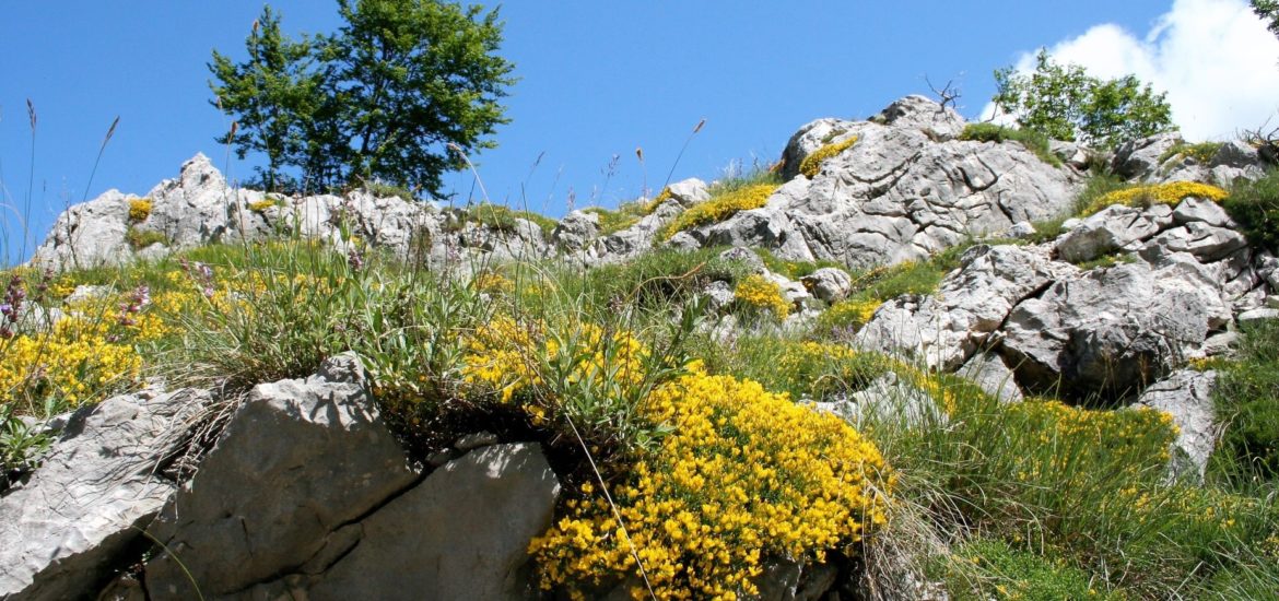
 This is another authentic part of Montenegro: no tourists, hardly any traffic, magnificent views, old traditional stone houses, rough karst mountains with fertile pockets, and abundant flora and fauna.
The route
The highway Nikšić-Grahovo-Risan leads through Vilusi, but in these times you will find a road block after the village of Rudine: due to reconstruction works, the road is closed each day between 8.00 and 16.00 h. Fortunately, there is another possibility, which is even much more interesting. Directly before the road block, turn left and just follow the narrow asphalt road until you join the highway again (near Osječenica).
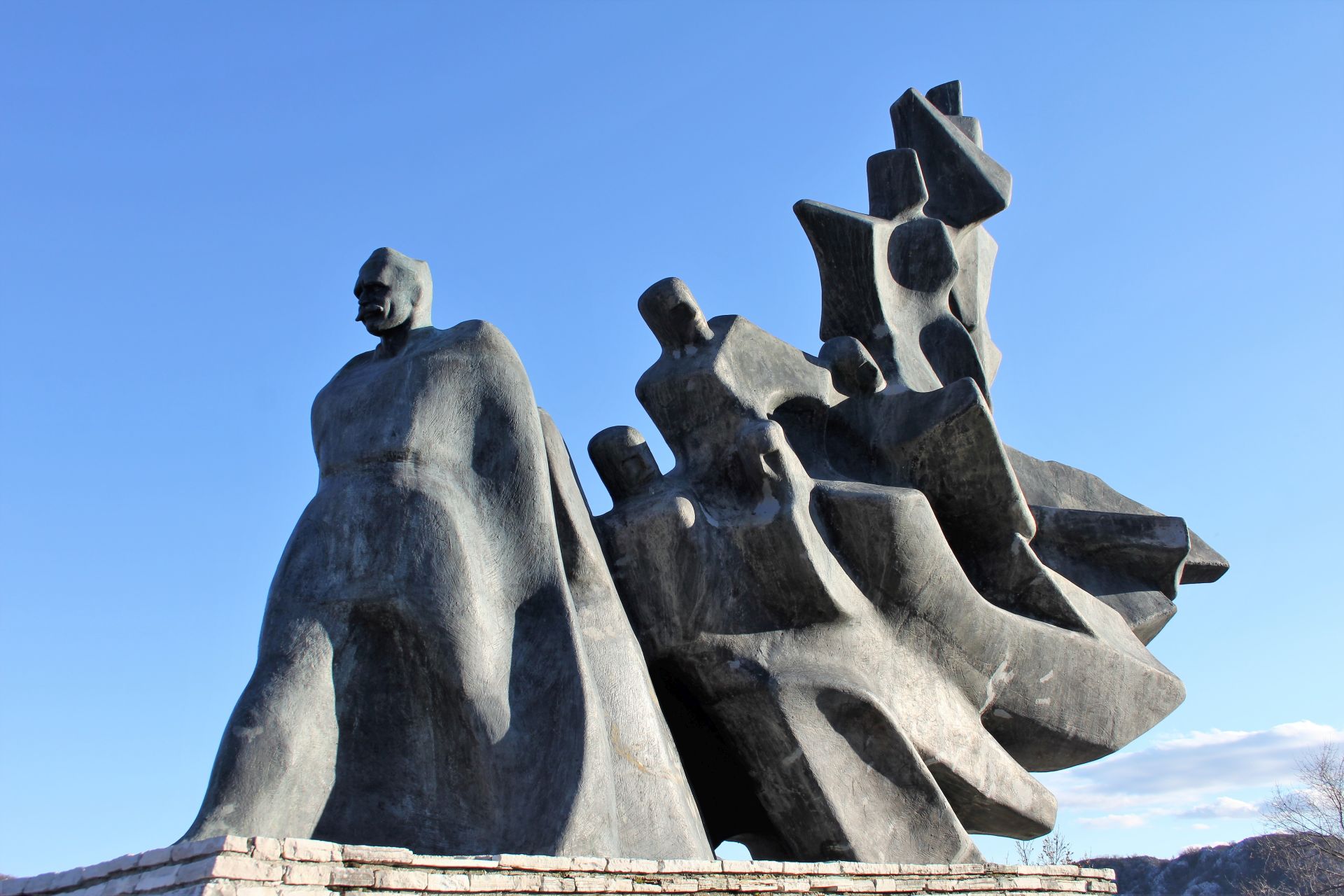 You will soon reach Grahovo (around 45 km from Nikšić). Turn right to the center of the almost abandoned townlet (and don’t forget to visit the WWII memorial complex!).
From the center, follow the signpost to Cetinje. The narrow and winding asphalt road passes under the highway and runs further uphill through a rough karst landscape until you arrive at the junction with the road Čevo-Cetinje (35 km from Grahovo). Turn right and follow the road to Bukovica. Here you can continue ahead to the village of Njeguši and further along the famous 25 serpentines to Kotor (40 km) or turn left and continue to Cetinje (9 km).
The complete tour from Nikšić to Kotor is around 120 km or around 90 km if your end point is Cetinje.
 Old Montenegro
It is always interesting to explore „Old Montenegro“, the authentic central region with its endless and rough karst landscapes, often covered by maquis and Mediterranean leave forests.
The Principality of Montenegro (19th century) covered four nahija’s or administrative districts with 22 tribes or clans. Do you know what a „nahija“ is? In Turkish, „nahija“ means sub-district and this expression was used during the Ottoman occupation. The biggest of them was Katunska nahija.
Katunska nahija consists of nine tribes and has around 20,000 inhabitants. The described tour mainly covers the western part of this region, homeland of the tribes of Cuce, Bjelice, Čeklići and Njeguši.
 The Dutch writer Van der Velde passed through this region at the end of the 19th century and wrote: „There is no place where you can spend the night in this pathless country that resembles a moon desert…“
The tour
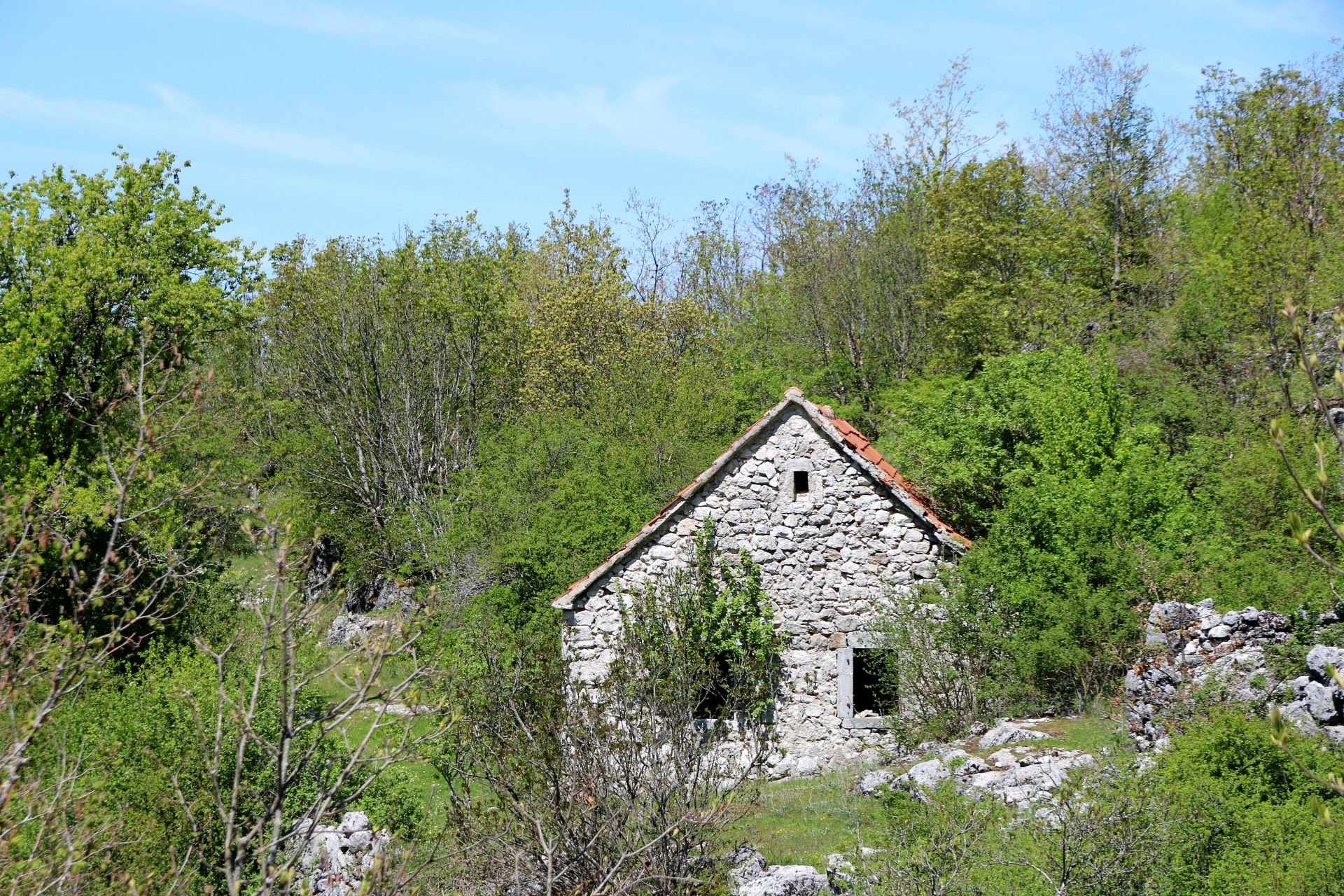
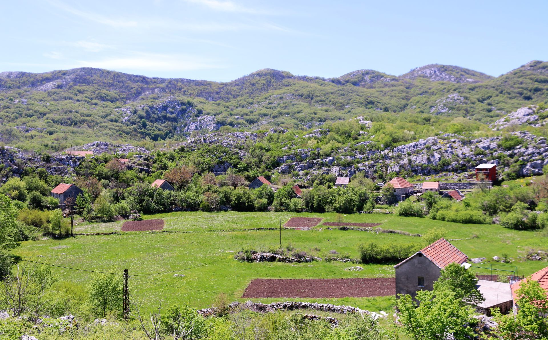
Coming from Nikšić, the unexpected shortcut (due to the above mentioned road block) appeared to be a picturesque road through a typical lonely karst landscape. Here and there we saw some abandoned stone houses and green meadows, but the region seemed to be almost deserted.
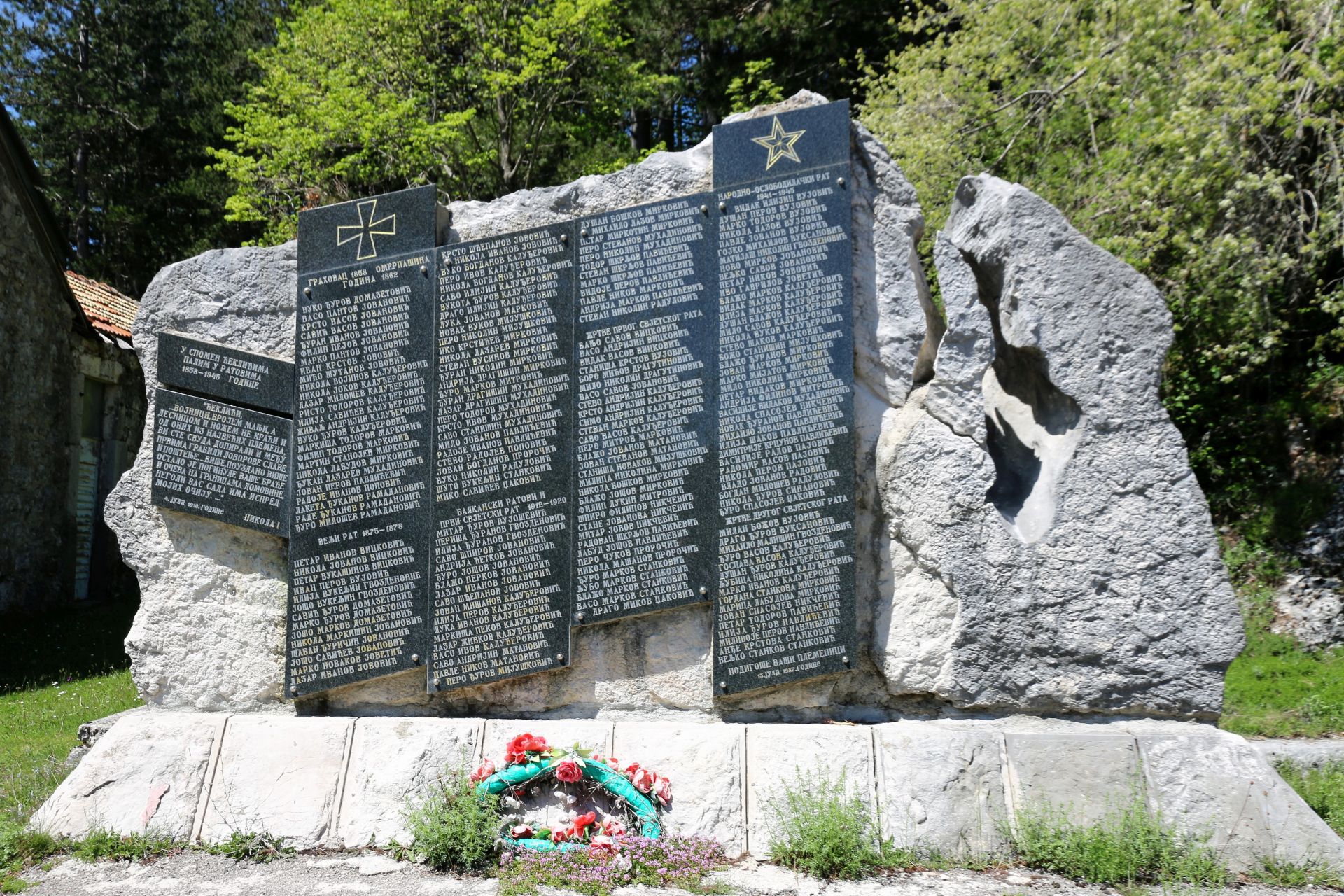
Soon we got back on the highway and after a while we reached Grahovo. Once, Grahovo was a prosperous municipality, but the earthquake of 1979 destroyed many houses, most of which were never rebuilt. The place is dominated by a huge war monument on the top of the Umac hill, a „must see“ for all visitors!.
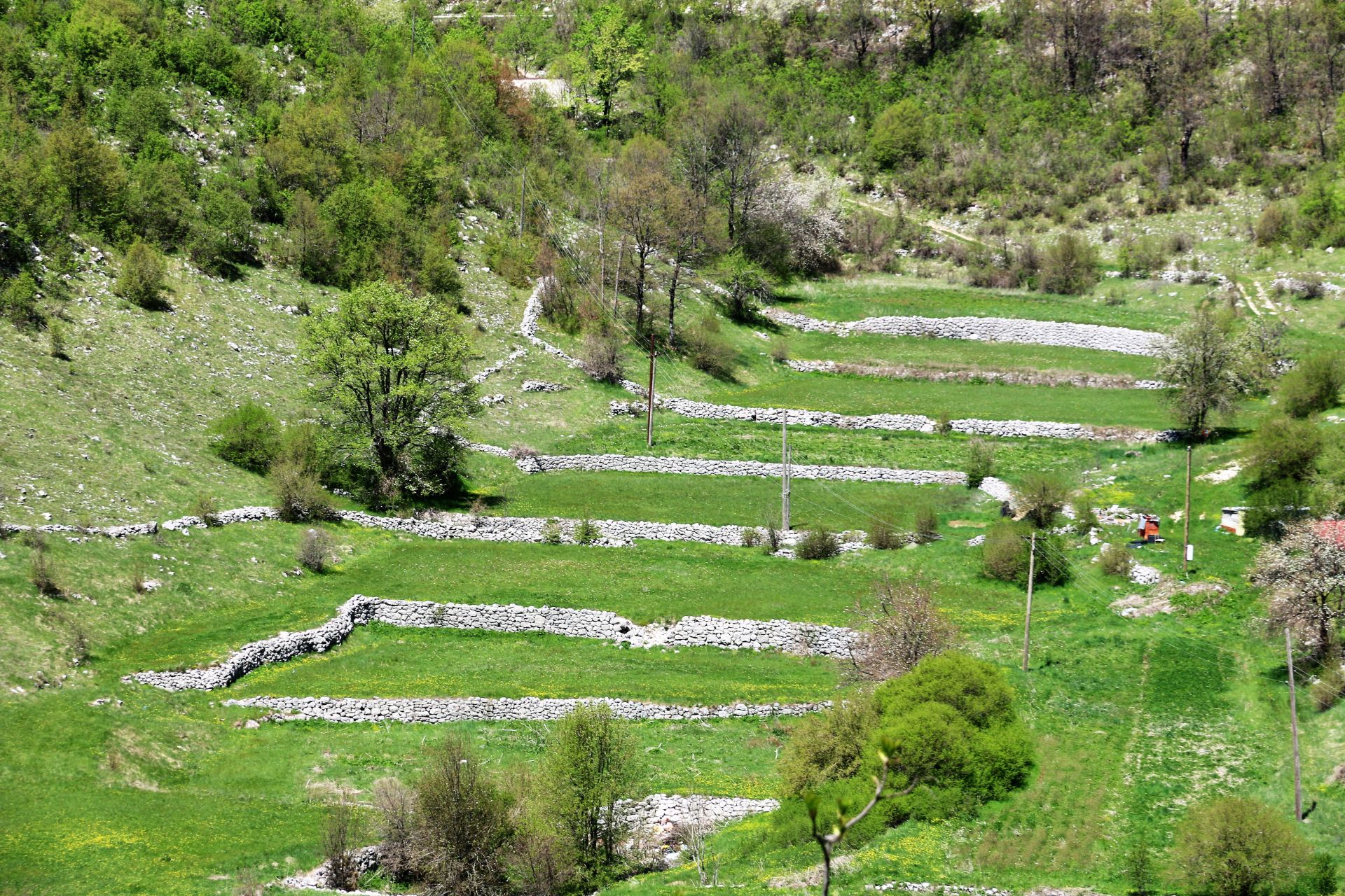
 We took the narrow asphalt road that passed under the new highway and continued further uphill. The lonely road twisted through the wild karst landscape, interrupted by green fertile pockets. We passed old stone houses, abandoned hamlets and colorful flower fields.
In Resna we reached the junction and joined the road Čevo-Cetinje. Everything in this area breathes history. The church of the Milić family tells the story about nine Milić brothers who defended the church against the Turks for seven days, but were all killed at the end.
The road that leads further south testifies of heavy Partisan fights, as we saw several war monuments along the road: in Bata a marble obelisk with a red star on top and another one in Čeklići with the names of many fallen fighters.
 Our trip through the karst desert came to end and we soon reached Bukovica and Njeguši.
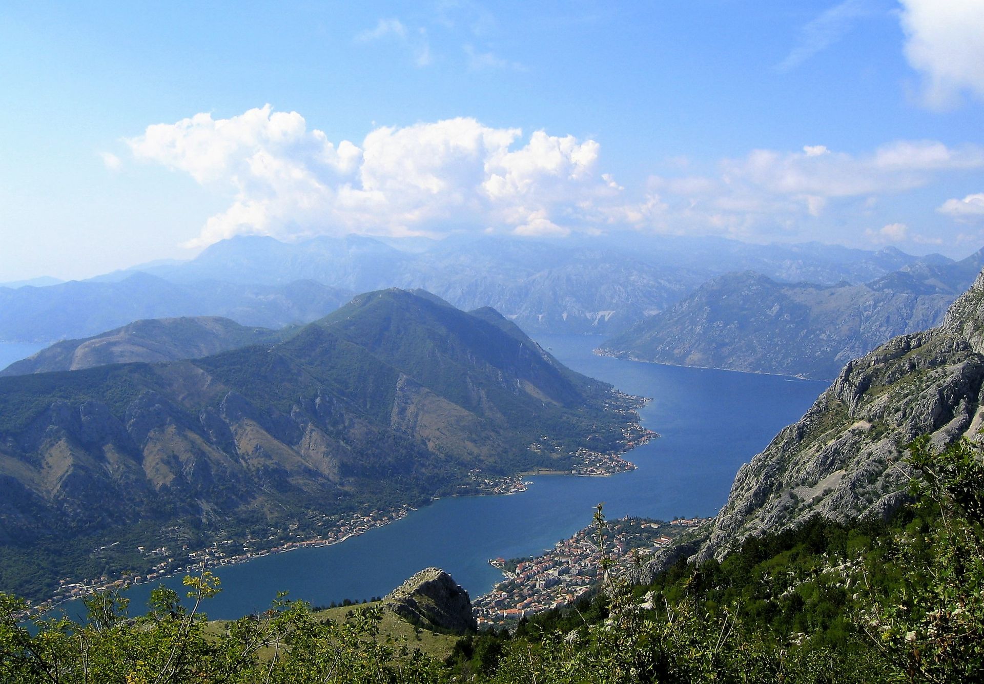
Driving down to Kotor along the famous serpentines with a breathtaking view of the Bay of Kotor, we concluded once more that Montenegro offers unbelievable natural beauties on a small territory.
There are many beautiful things to see in Montenegro, but if you want to discover authentic landscapes, make a tour through the typical karst areas that have not been discovered by tourists yet.
There is an old saying: The road less travelled is the one you remember!
I have been reading your posts for a few years now, and I love the ideas for exploration. You eye for interesting spots and suggestions for stopping points are invaluable.
I especially appreciate the inclusion of the map. We have sometimes gone ten or twenty k down a road only to find there is no connecting road. The map is a big planning help.
We are currently in the US, but looking to return as soon as possible. Glad you are staying well.
[…] plants. People from the mountain villages of Durmitor and Bjelasica, but also from the central karst region and the coastal mountains, have a profound knowledge of herbs and their healing power. You can ask […]