Although I have been living in Montenegro for several decades, one of the rare places I had never visited is Brskut, a mountain village on the border between Kučka Krajina and the region of the Bratonožići tribe.
 You can reach Brskut following the road to Mateševo and Kolašin (around 50 km), but when you have an all-terrain vehicle (or robust SUV), it is much nicer to make a round trip. Travelling along local roads in Kučka Krajina offers you fantastic views, pure nature and hidden villages and hamlets, where time seems to have stood still.
We did the tour last weekend, on a beautiful sunny day. I think that spring is the best time for such an adventure, as the color nuances of green trees, meadows and maquis vegetation, together with the blooming acacia trees and the snow-covered mountain backdrop, are an unbelievable experience.
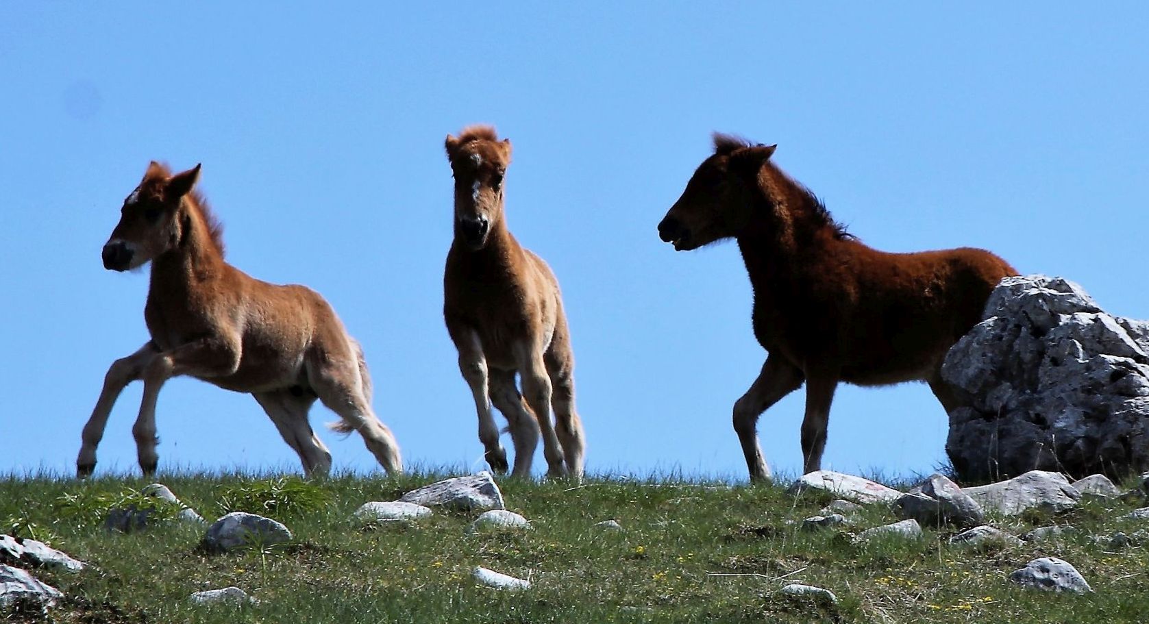
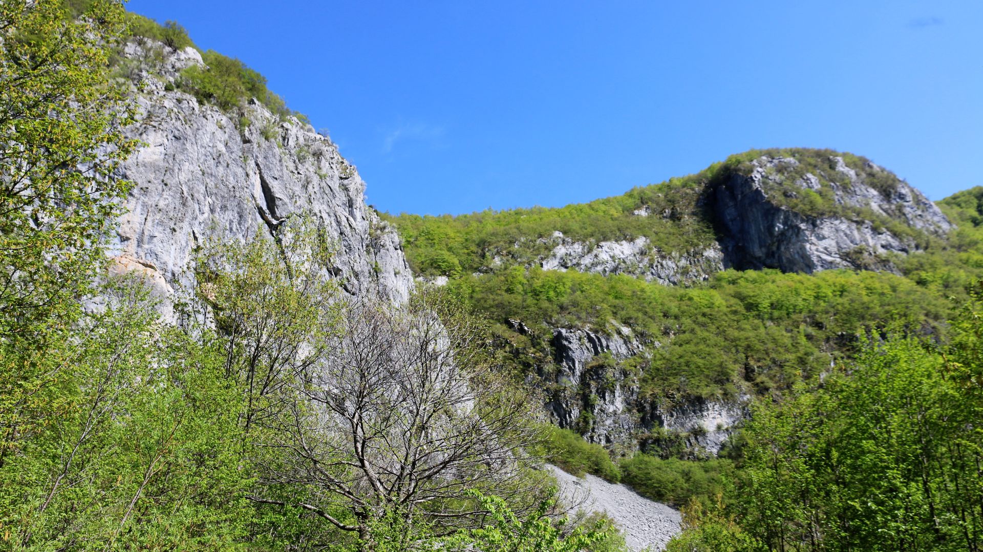
 The narrow, winding mountain road offered breathtaking vistas. There was hardly any traffic and we enjoyed the silence that was only interrupted by the odd sounds of the birds. Herds of wild horses were playing on the rocky pastures. Fields of wild orchids and other spring flowers stretched along the road, alternated by huge karst rocks that looked like modern sculptures. Old stone houses were bedded into the hilly terrain, surrounded by meadows and arable land. Genuine and unpolluted Montenegrin land can still be found in Kučka Krajina!
How to get there?
Although the round tour is more than 100 km long, the travel time is not less than 4 hours and if you really want to enjoy this adventure and make some marvelous photos – take your lunch with you and make a day trip.
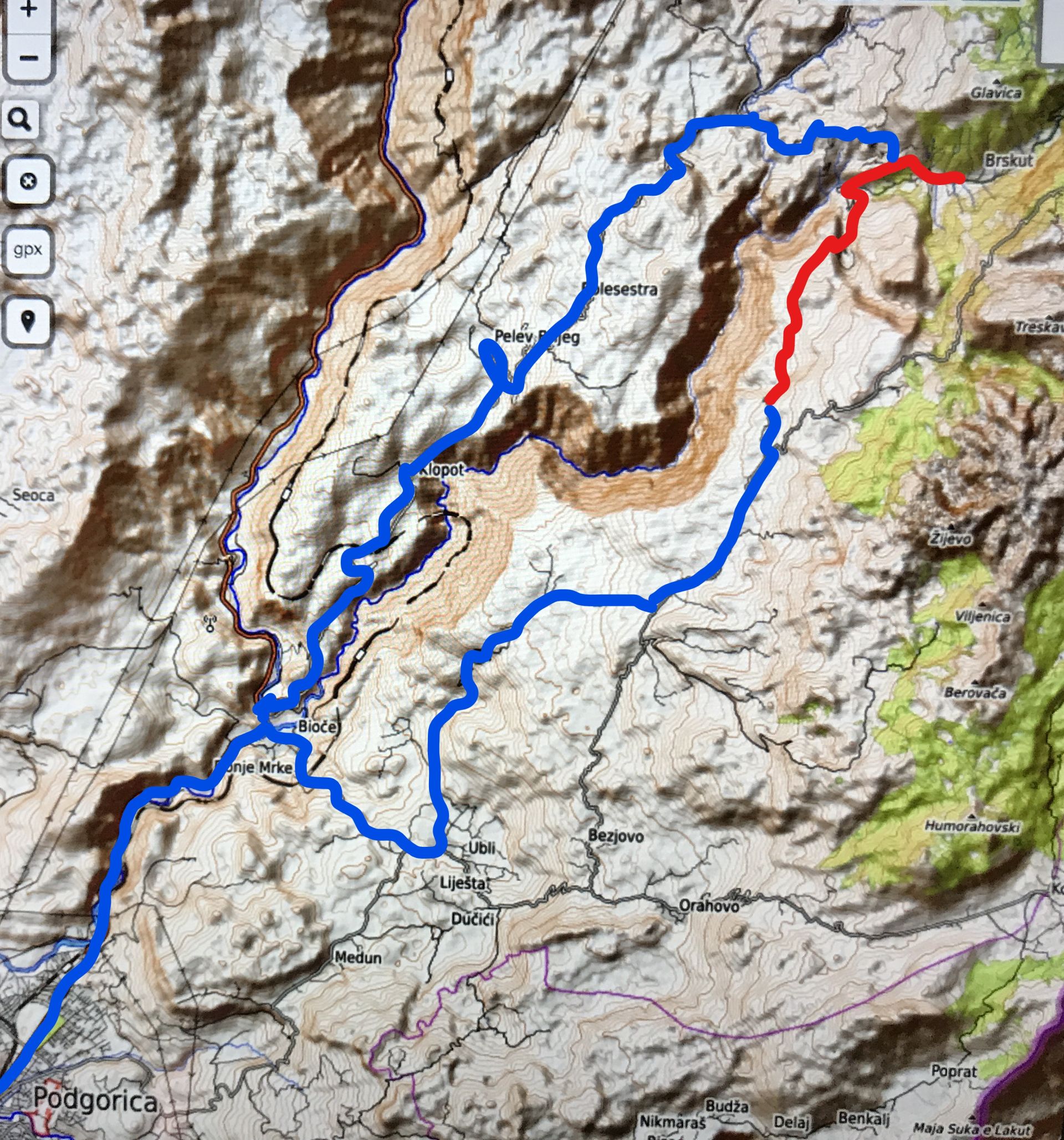
We travelled through an unknown part of Kučka Krajina. At first we took the road along the Morača river towards Kolašin and after around 6 km we turned right at the Mijović Restaurant in Bioče. This local road may not be mentioned by your navigation system, as the local road (at first you should pass the bridge over the Morača river and continue straight uphill) soon turns into a brand new, but narrow and unprotected asphalt road that runs through the mountains, high above the railway, to the village of Ubli (around 8 km).
 Near Ubli, turn left in the direction of Momče and Ubalac and follow the local road until you get back to the main road to Kučka Korita that is part of Panoramic Road No. 4 (“Circuit around Korita”). After a few kilometers you will see the signposts to Stravče and Brskut: turn left and follow the narrow local road. After the village of Stravče, the narrow asphalt road turns into a forest road that leads through the mountains to Brskut (around 7 km dirt road).
When you arrive in the village of Brskut, keep left, follow the road to Lijeva Rijeka, and soon you will join the main road from Mateševo to Podgorica, where you have to turn left once more in order to return to Podgorica.
The route
The brand new asphalt road from Bioče to Ubli offered breathtaking views of the surroundings. We stopped for a moment at the bridge over the Morača river. The view of the emerald green river was great!
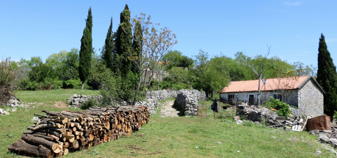
 But our adventure really started when we left the main road (No. 4) and took the local road, passing Momče and Ubalac. These beautiful villages showed why the old Montenegrins did not need architects. Just take a look at the village of Ubalac – isn’t it a great picture of how a village should look like? We got the impression that people are returning to their properties, dealing with agriculture and cattle breeding, as we saw a lot of farmers working on the land.
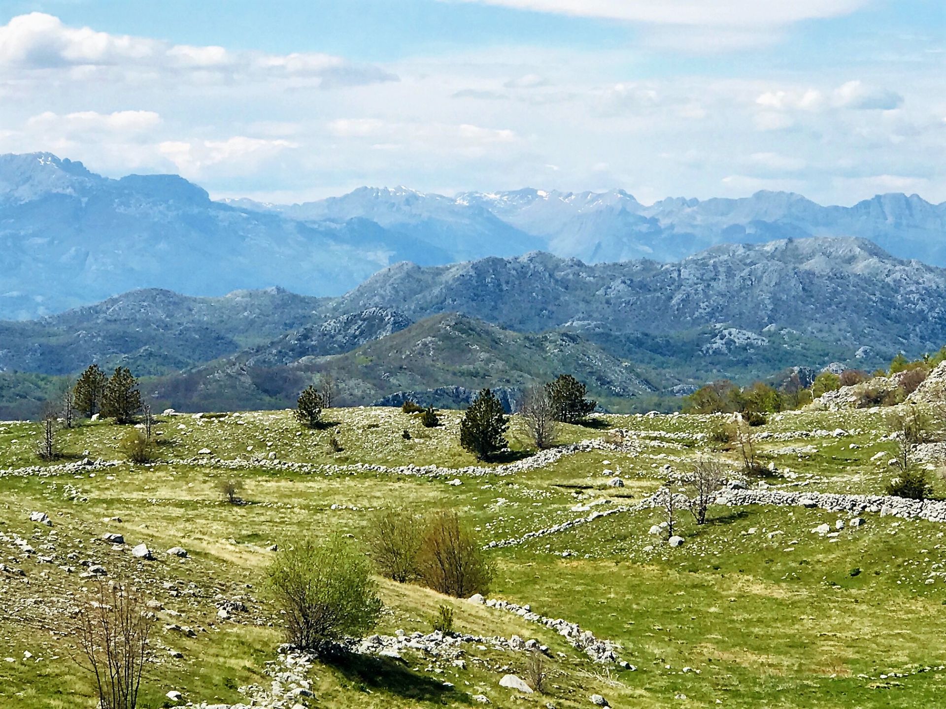
Nature seemed to be covered by a blanket in all shades of green. The acacia trees were blooming and far away we saw the peaks of the mountains of Kučka Krajina, still covered with snow.
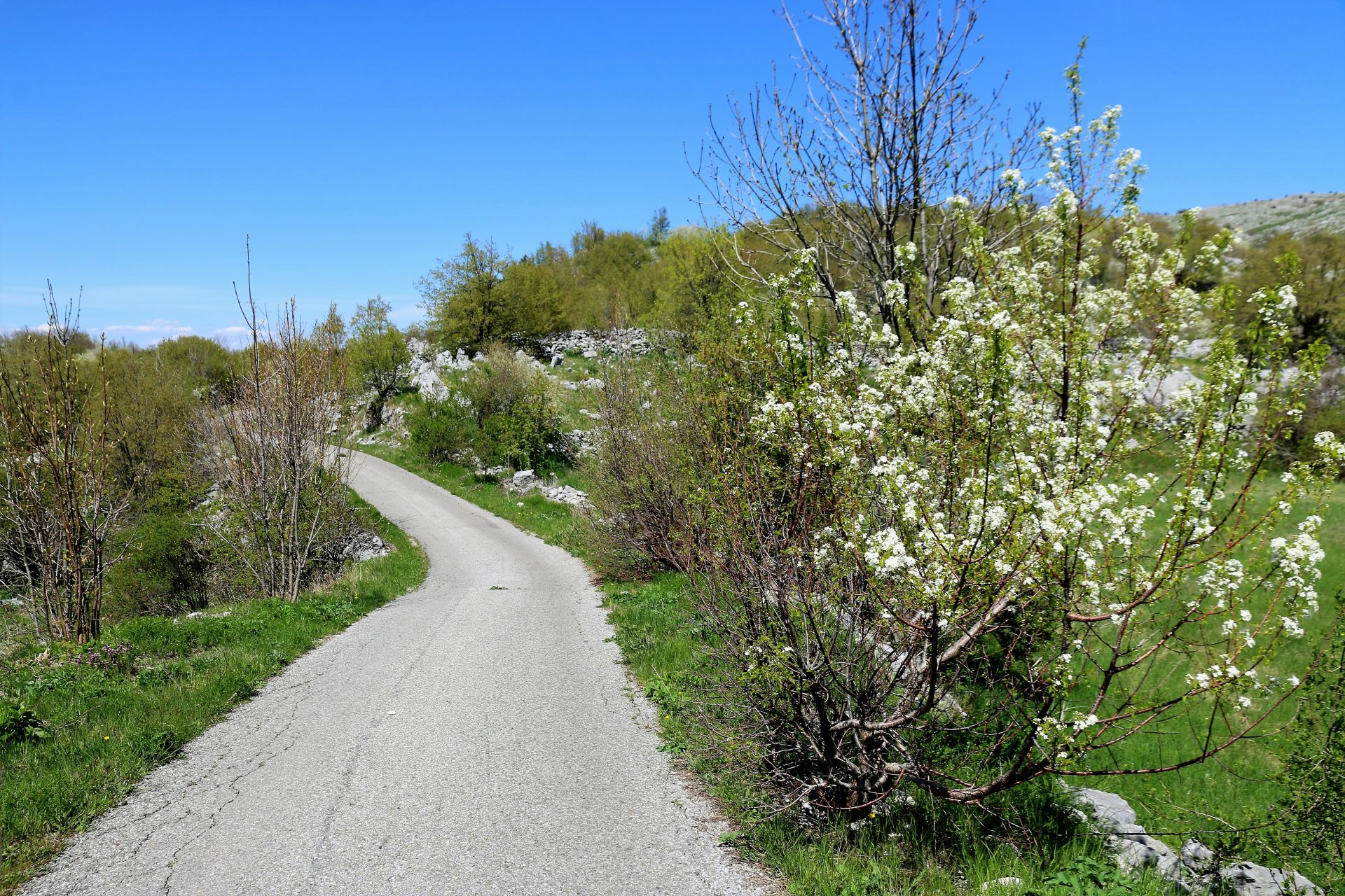
 Back on the main road we soon saw the signpost to Stravče (and a smaller one to Brskut) and we turned left. And yes, after the first village, the asphalt road stopped and a narrow forest road took us further towards Brskut. I had read before that this road was built in 2016 by the Montenegrin army. It was rather narrow and unprotected, but the quality was not so bad at all.
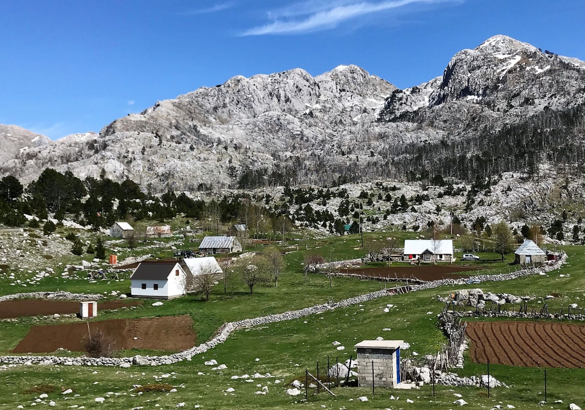
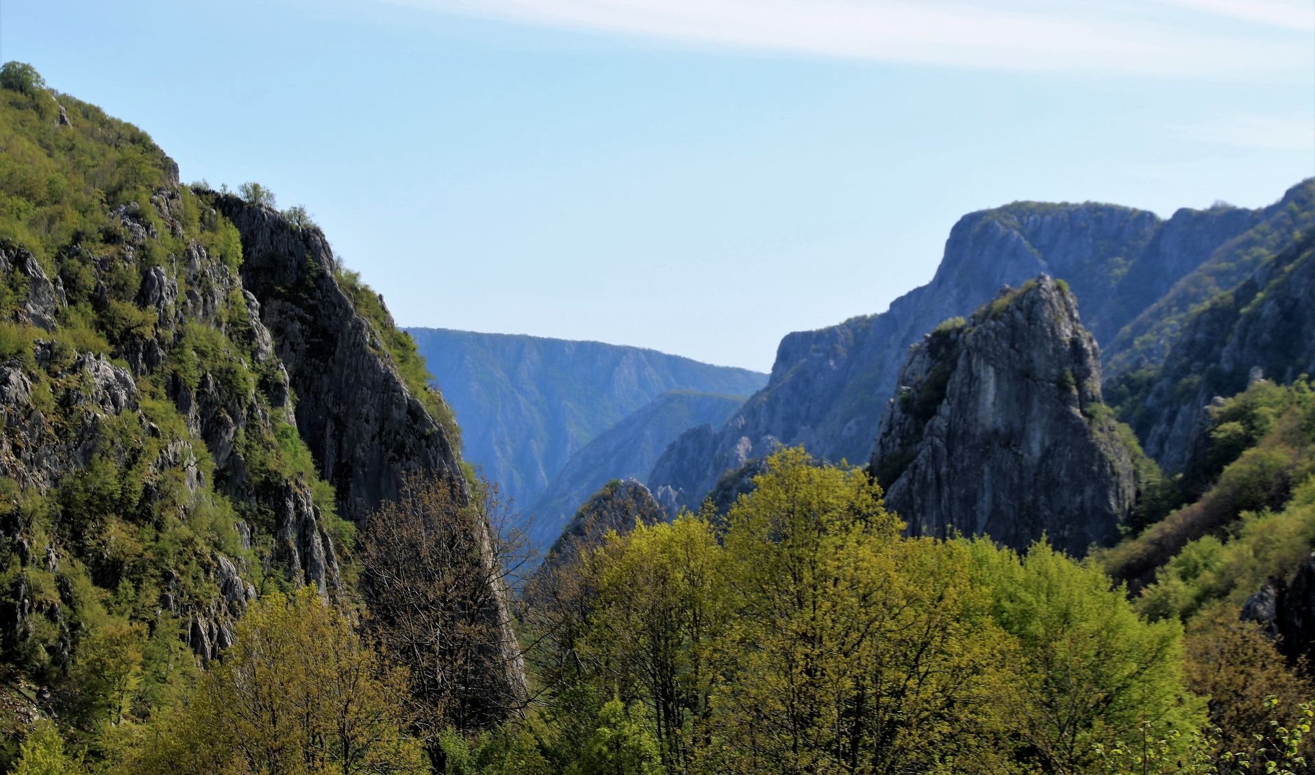
We continued travelling through the mountains with breathtaking views on all sides. Nature in this part of Montenegro is really magnificent! As Brskut is situated high in the mountains, we continued to drive uphill, passing through dense beech and needle forests. In these wild areas where we could hardly pass between trees and bushes on both sides of the road, we were happy that we did not meet any cars or trucks loaded with wood…
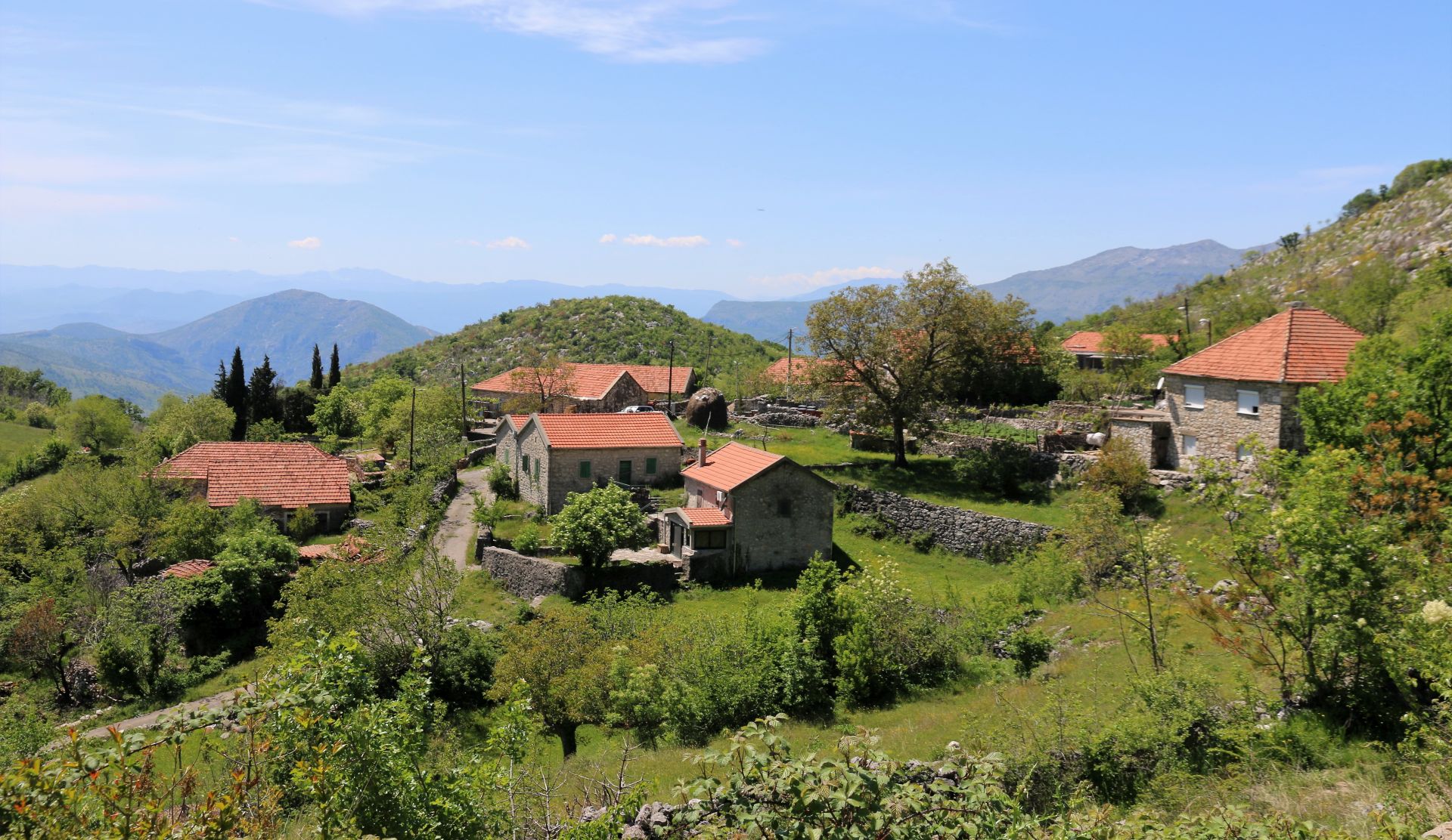
Only when we arrived in Brskut, we got aware that we were in a real village. We saw new houses, cars, people working on the land, and there were also some (domestic) tourists around.
 Brskut
Although this place was once a municipality with nine mills, 300 houses and 1800 inhabitants, in 2003 the village had 19 inhabitants only (according to the census). Brskut had a school in the middle of the 19th century and its first phone was introduced in 1917, during the Austro-Hungarian occupation. But … it was only in 1970 that the village got electricity.
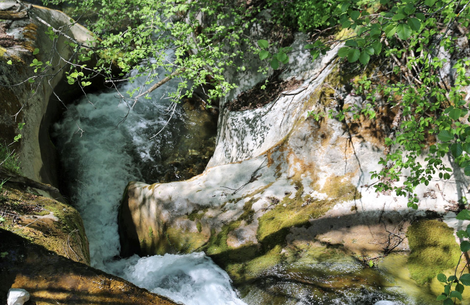
Can you imagine that this area, at an altitude of 750 to 1250 m above sea level, has around 60 water sources? There is no house without a natural water source. If compared to many villages in Kučka Krajina, which depend on rain water reservoirs, Brskut has excellent conditions for agriculture, but also for tourism: magnificent nature, fresh mountain air and enough water for all kinds of activities. And we were also told that Brskut is getting more and more popular as a destination for extreme canyoning: the Brskut canyon is very attractive for this type of active tourism!
 All water sources of Brskut come together into the Brskut river, or better said brook. As we knew that there was a road connection between Brskut through Ubogi Do to the area of Bukumirsko jezero, we tried to follow the river eastwards, but soon we came to the conclusion that the road was too bad, even for our 4×4. It was covered by sharp stones, mud and water streams, and we had the feeling that we were driving through the river bed. So we decided to go back and take the other road that leads to the main connection between Podgorica and Mateševo. I read that this road eastwards, through Ubogi Do, will be reconstructed this year – this is certainly a good idea and it will no doubt contribute to the development of tourism in this region.
 On our way back, we saw the Chinese compounds and building sites of the new highway Bar – Boljari. The negative impact on the landscape was obvious, but unavoidable. We also had a view of the highest railway bridge of Europa, the Mala Rijeka Viaduct (500 m long, 200 m high) before we reached Podgorica. Really impressive!
Conclusion
Kučka Krajina (also called Žijovo) is a rather unknown gem of Central Montenegro. Tourism is being developed, as is demonstrated by the development of Panoramic Road No. 4 “Circuit around Korita”.
But other areas at this almost untouched, pristine and quiet karst plateau also offer great possibilities for the development of active tourism. Mountain bikers, hikers, botanists and nature lovers (and in Brskut also lovers of extreme canyoning) will certainly find a paradise in this region!
A sketch of the route is given below: blue = asphalt, red = forest road
Heel mooi