The area of Crkvice is famous for the fact that it has the largest annual rainfall in Europe, but those who are interested in history and Austro-Hungarian heritage can find the remains of an old military encampment here. The hiker’s guide „The Austro-Hungarian Fortresses of Montenegro“ by Bernard Sullivan had made us curious and we were looking forward to explore this place, situated on the high plateau of Krivošije.
Annual precipitation at Crkvice, an abandoned village above the Bay of Kotor, is around 5,000 mm. Rainfall occurs principally during the colder part of the year.
But how is it possible that the region is nonetheless very dry? If you know that it has one of the deepest limestone layers in the world, it should not be surprising that Crkvice is an area without water, as all the rain water disappears into the karst!
Nowadays it is hard to imagine that Crkvice was once, from the middle of the 19th century to the end of World War I, a place where the Austro-Hungarian army used to have a large military complex. During that period, more than 150 facilities were built here. The encampment served as a defence against the bordering Ottoman Empire. Unfortunately, it now lies in ruins.
History
After the insurrections of 1869 and 1881/1882, the Austro-Hungarians started an enormous building program in order to secure the karst area above Risan. In the area of the Crkvice ‘kettle’, a huge karst depression at an altitude of 1100 m above sea level, they built two fortresses (Kom and Stražnik), a large complex of barracks and stables, a hospital, a bakery, a church, a canteen and many other facilities, even a funicular and tennis courts for the officers.
During World War I, the Crkvice encampment consisted of about 6,500 soldiers, who often brought their families with them, so that the population could grow to 10,000. Since the end of WWI, most signs of this Austro-Hungarian heritage have disappeared and the old military buildings have been left to the ravages of time.
How to get there?
Take the old road from Risan to Crkvice (left from the hospital, along the Roman mosaics uphill), cross the highway and continue ahead on the other side. You can also start from the highway, just follow the signpost to Crkvice.
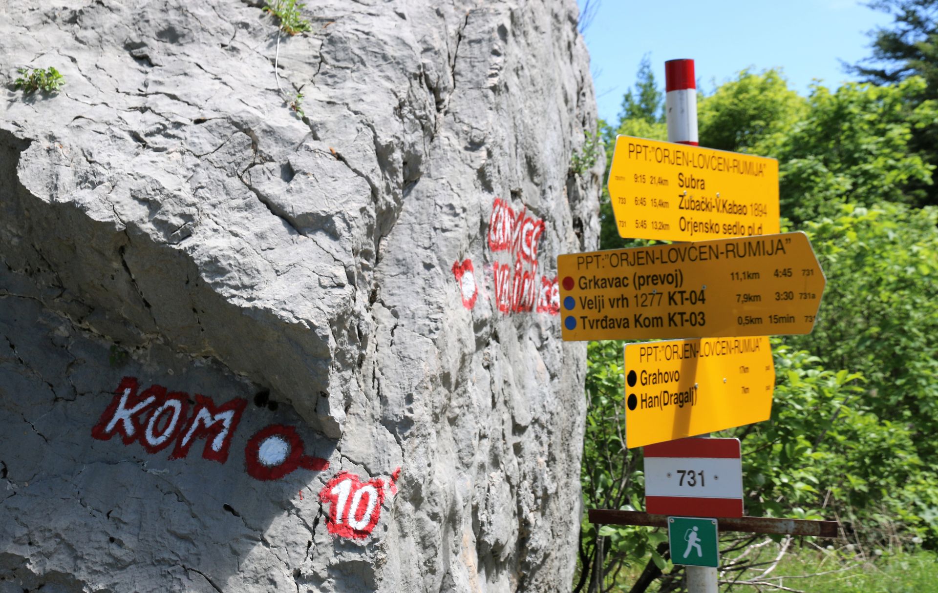
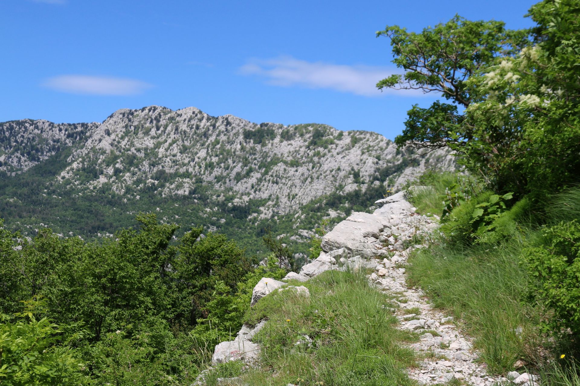
 A narrow asphalt road leads to the fortification of Kom. Park your car near the signpost and walk uphill to the fortress (10-15 minutes). Signposts and newly painted trail marks point at numerous hiking possibilities. There is a complete network of old roads and trails between the ruined facilities. From the asphalt road, you need around 30 minutes for a hike to the Stražnik fortress.
On your way back you can make a small round trip Crkvice – Polje – Unijerina and return to the Bay of Kotor. This road is very narrow, but it leads you through wonderful beech forests and offers magnificent views of Mount Orjen and the glacial deposits. From Unijerina and Dragoševo selo you can also take the highway back to Risan.
Austro-Hungarian roads
We have always admired the roads that were built by the Austro-Hungarians around the Bay of Kotor and through the hinterland of the Montenegrin coast. Although they have not been maintained and repaired since World War I, they are still in a good condition. Most of them are now covered with an asphalt layer, but they still have the same width, often 2 m only.
The roads were built by domestic “masters of stone”, without any binding material. Stone walls were built on both sides of the road and everything was done under the surveillance of the Austro-Hungarian authorities, who gave a 100 year’s guarantee for their construction.
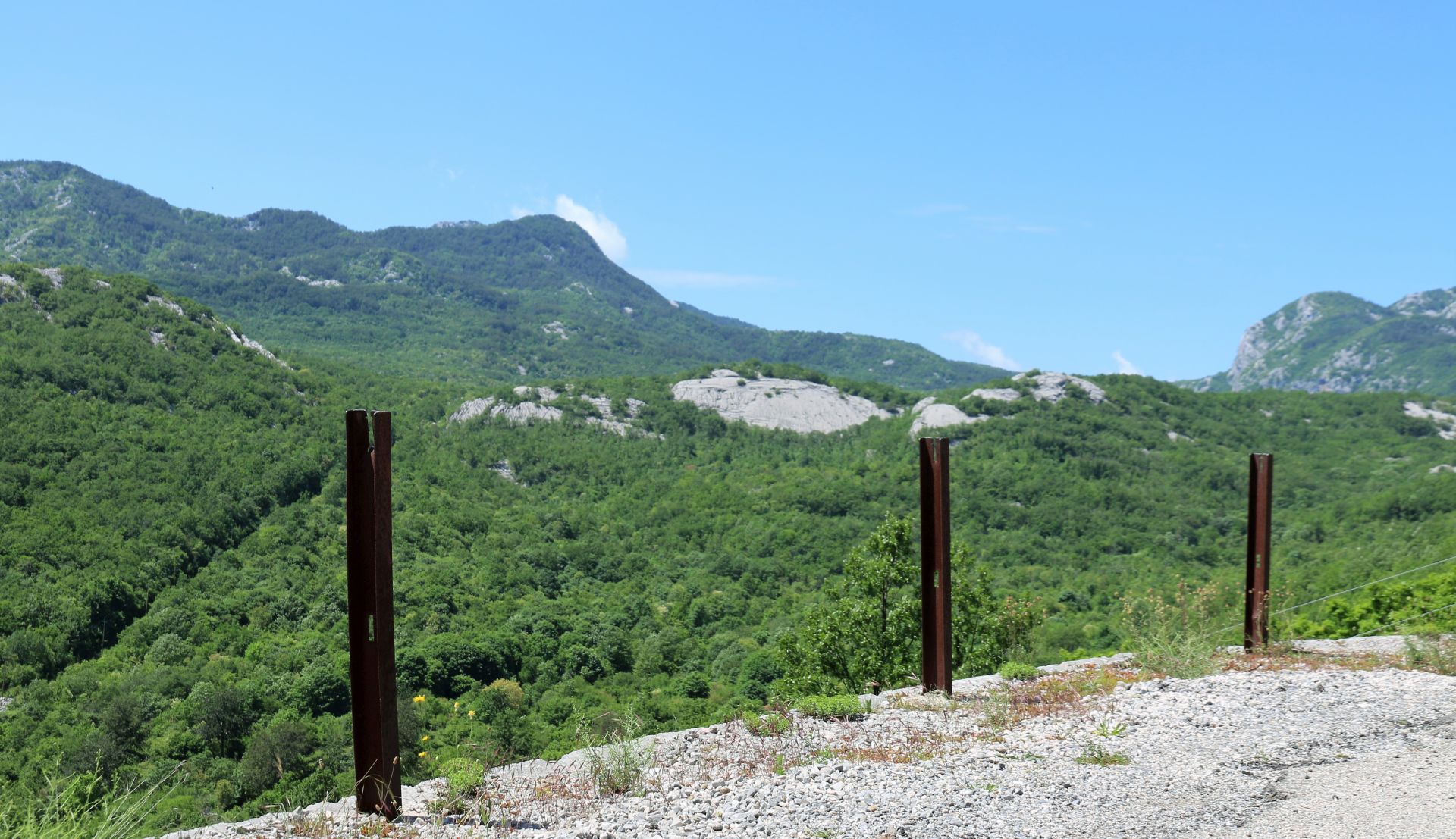
At many places along the road we saw rusty metal rods with slots at the upper side and holes in the middle. Although we could not find any info on the internet, we supposed that they had served as a kind of protection rails in Austro-Hungarian times.
What is there to see?
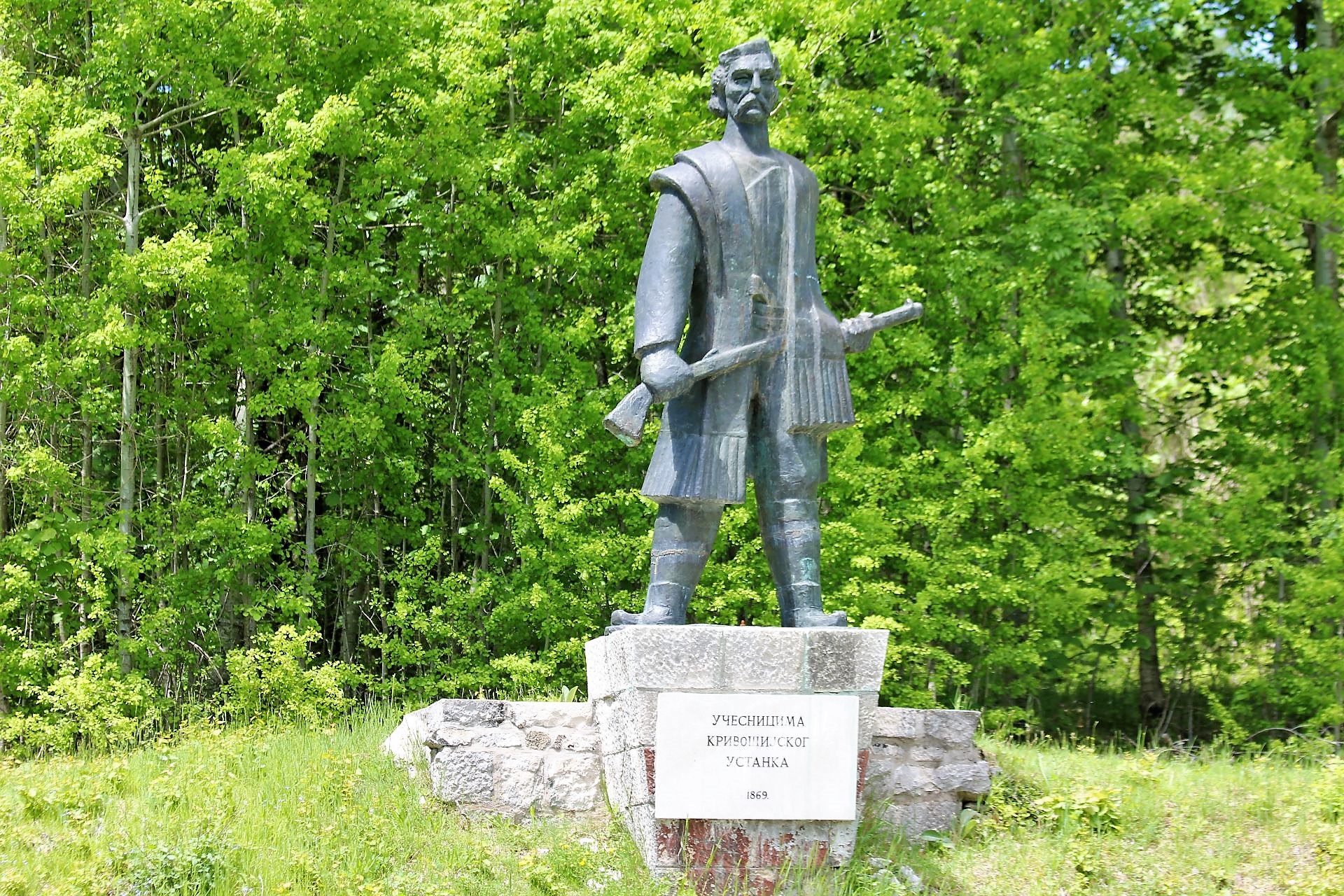
Driving through the dense beech forests, we saw a huge statue of a brave Montenegrin warrior. According to the memorial plate, the statue was dedicated to the rebels of the 1869 Krivošije uprising.
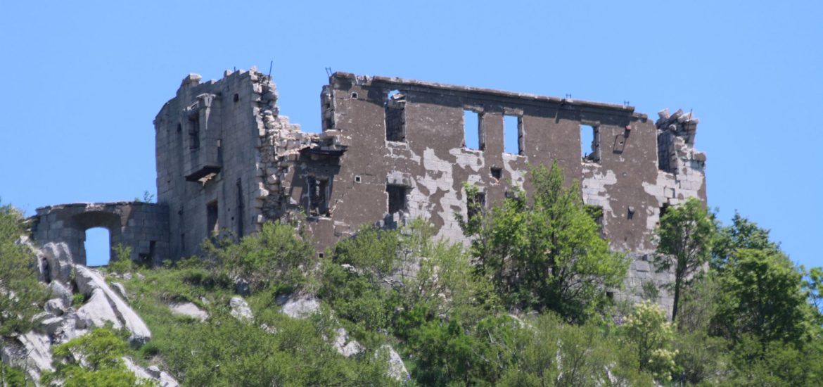
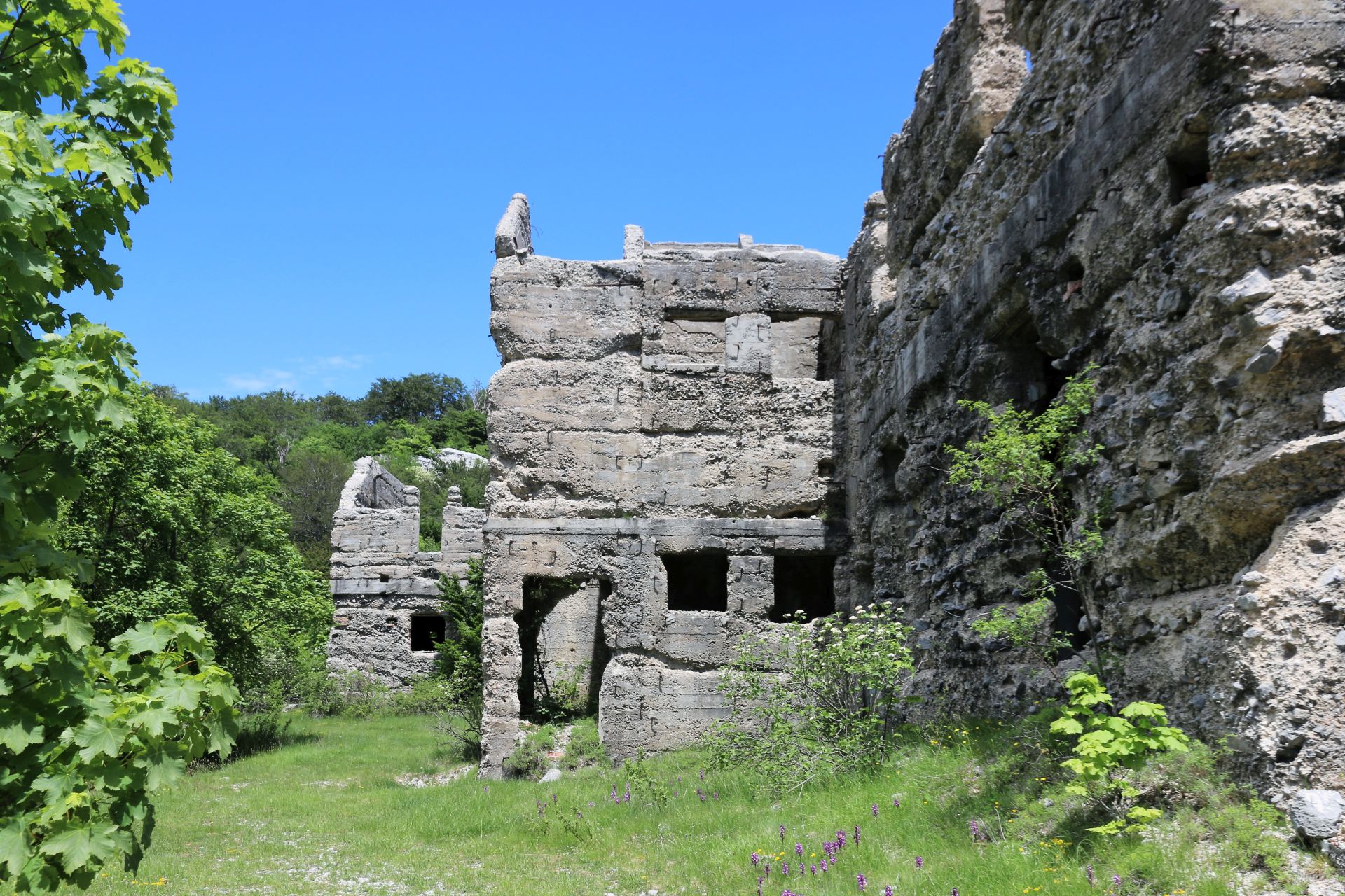
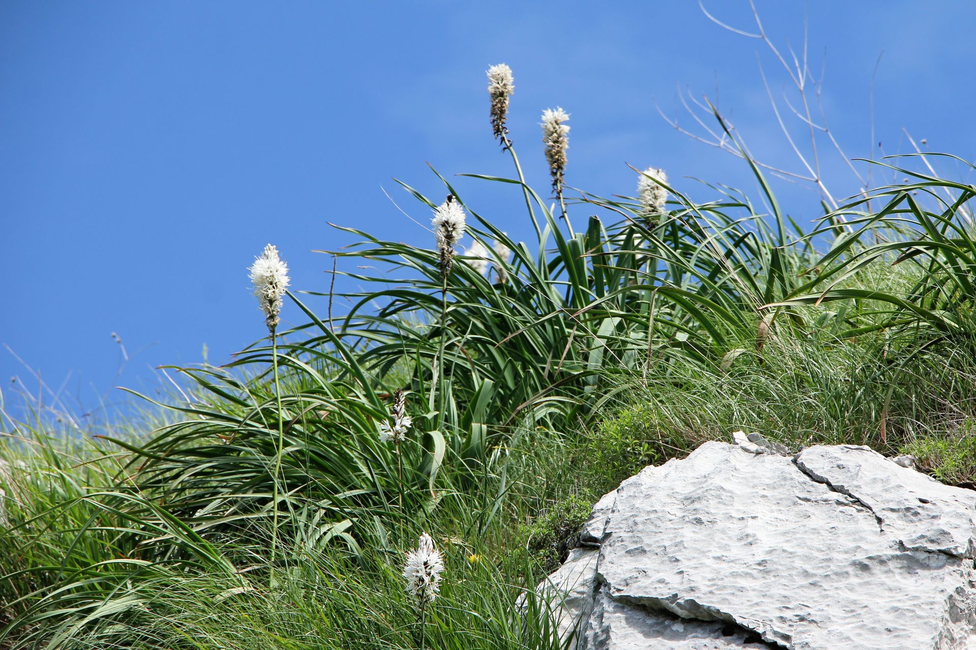
From the road, the Kom fortress (see cover photo) could be spotted high on a ridge, overlooking the area. Soon we discovered several signposts and a place where we could park the car. The narrow pathway uphill to Kom (10-15 minutes) appeared to be clearly marked by red and white markers. Following the trail, we enjoyed the view and the beautiful aphodels blooming among the karst rocks. But what a pity to discover that the Kom fortress, built between 1882 and 1883, is in a totally dilapidated condition!
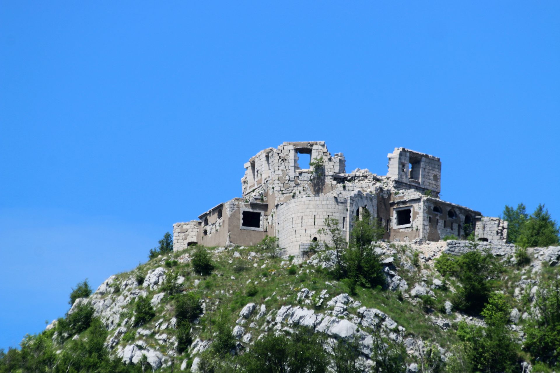 From the grassy area outside the Fort Kom (also called Ostfort Crkvice) we could also see Fort Stražnik or Westfort Crkvice, about 1 km away on the next ridge to the west. Both fortresses were very important for the Austro-Hungarian defence system.
One of the most interesting buildings of the former encampment was the old bakery, built in 1907, which provided bread to the military garrison. It is hard to imagine that this bakery once delivered 24 tons of bread per day and that there was a real cinema on the second floor! Of course, the machinery has been removed, the roof has collapsed, but it is still impressive to see the remains of such a huge building in the middle of nowhere.
We didn’t make the 30-minutes hike to the Stražnik fortress, a magnificent structure with an unusual hexagonal outline and a central circular gallery. But it was quite clear to us that also this fortress is in a deplorable state.
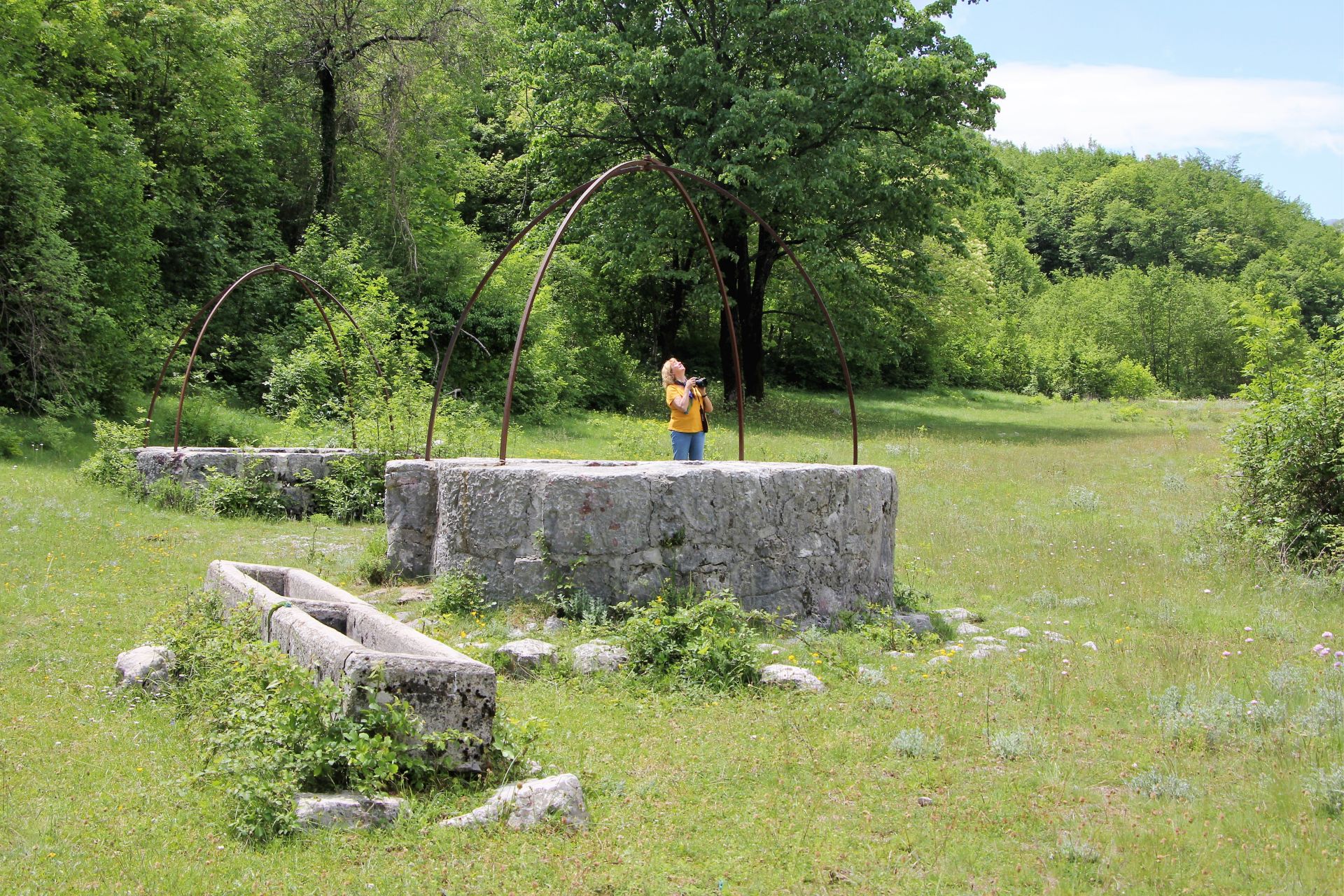 On our way back, we stopped at a small meadow, where we spotted four big wells with drinking basins for the cattle, carved into stone. They were in a good condition, and although there was a tree growing from one of them, we could still see the clear water inside and the vaulted horizontal tunnels that connected them.
Conclusion
It is really a great experience to explore this important Austro-Hungarian heritage in the hinterland of the Bay of Kotor. We did it mainly by car, but the area is a paradise for hikers and nature lovers with historical interests!
[…] miss the Crkvice ‘kettle’, which lies on the slopes of Mount Orjen, at an altitude of 1,100 m above the Bay of […]
[…] For detailed information see my blog post: THE AUSTRO-HUNGARIAN HERITAGE OF CRKVICE. […]
[…] of these fortresses are located along the Montenegrin coast, especially in the area of the Bay of Kotor and around Budva. Most of these fortifications, built between 1838 and 1914, are abandoned and […]