Have you ever thought of exploring the old Austro-Hungarian fortresses in Montenegro? Many of these fortresses are located along the Montenegrin Coast and most of them can be found around the Bay of Boka Kotorska. The majority of these buildings is abandoned and dilapidated, but some of them are well-preserved and worth visiting. And of course, there are also some forts that have been sold to international or national companies. They have been reconstructed and serve as tourist attractions or for other purposes (Mamula, Budva, Fort Rose, Castel Lastva in Petrovac).
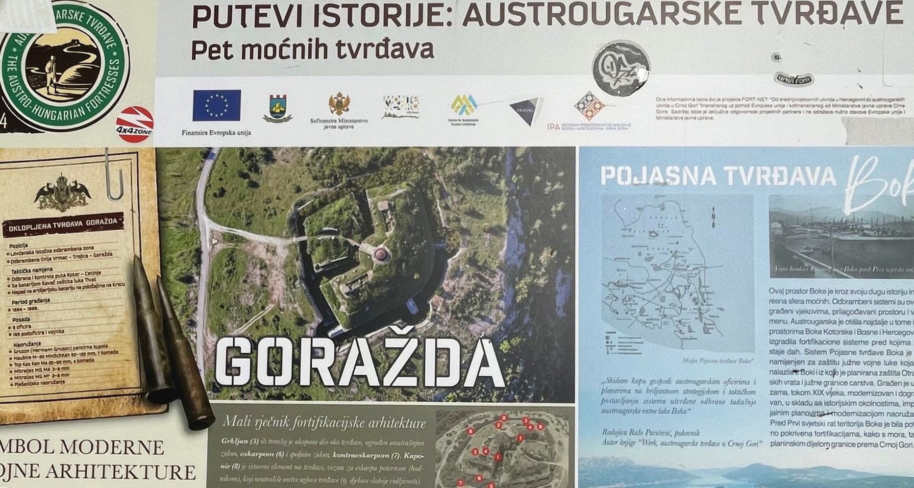
A few years ago, five thematic routes have been created in Montenegro and Herzegovina in order to promote the tourist significance of this important historical heritage. The project called FORT-NET was funded by the European Union and the Montenegrin part is called “Historical roads: Austro-Hungarian Fortresses”. Information boards show details about the history of the fortresses; it’s a pity that they are not in English…
Does the state have any other plans with this cultural heritage? As far as I know, there is no official information about this issue, but obviously not: although more than 2,000 sites in Montenegro are designated as cultural monuments, the Austro-Hungarian fortifications are not among them.
Unfortunately, for the time being there is only a small number of enthusiasts and foreigners who show interest in this cultural heritage. Many fortifications can be reached by car, other ones are popular destinations for hikers.
Let me describe three interesting fortifications around the Bay of Boka Kotorska.
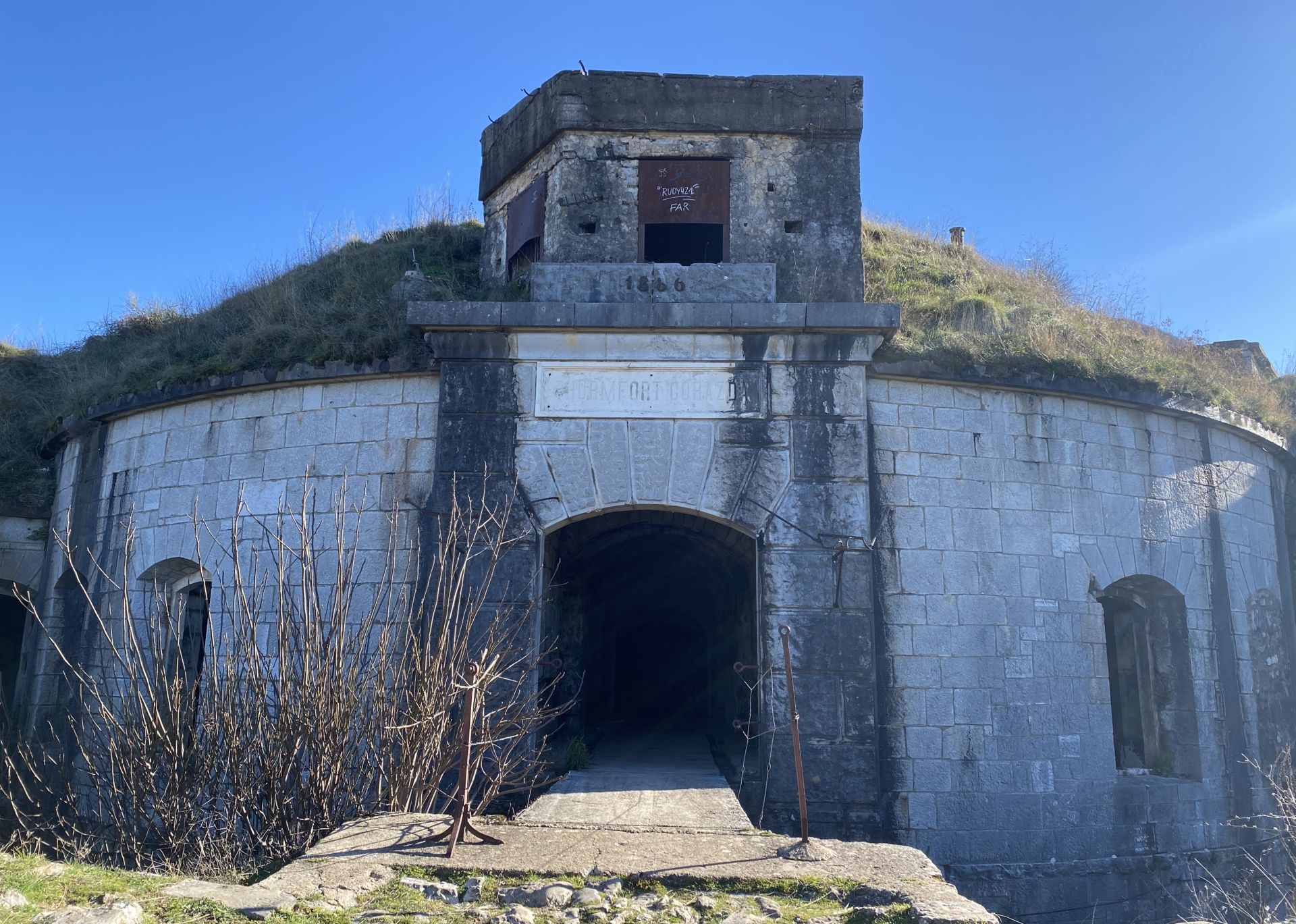
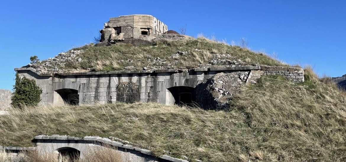
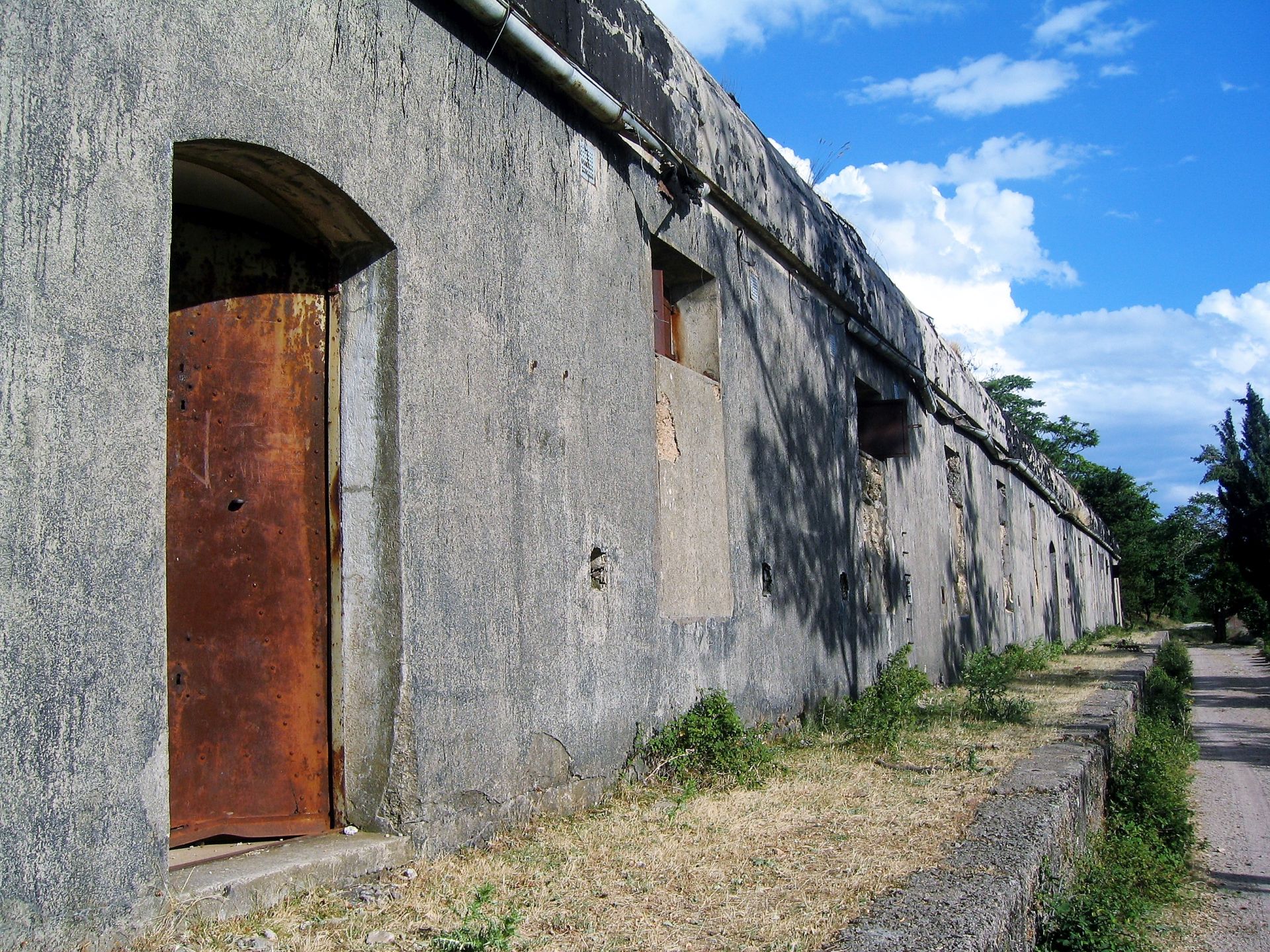
Thurmfort Goražda
Goražda is located close to the famous serpentine road between Kotor and Mount Lovćen. Coming from Kotor, take the road to Njeguši. Around 4 km from the Trojica junction you should turn right at the brown signpost to Goražda. Continue another 4 km and you will see the remains of this impressive fortress.
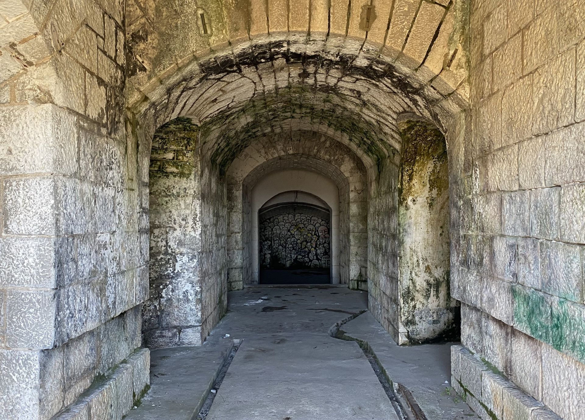
The fortress is a typical “armored fort”. It was built between 1869 and 1878 at an altitude of 452 m above sea level, close to the former Montenegrin border, which was in the village of Mirac. Among many Austro-Hungarian fortresses on the Montenegrin coast, this is one of the best-preserved buildings. With a good torch you can enter the building and explore the rooms, stairways and corridors (at your own risk), but it is also possible to walk around the dry moat in order to get an idea about the fort’s function and the life of the crew that consisted of eight officers and 195 soldiers. The fort was used for the last time in October 1914, when it suffered major damage.
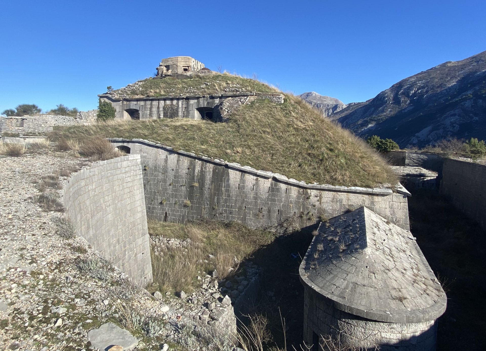
The huge ditch almost completely encircles the fort. Pay attention to the heavily protected “wings” with firing positions. These are “caponiers”, which enabled the defenders to fire upon any insurgents in the ditch.
Above the door you can see a plaque with the words “Thurmfort Gorazda”. From this point, you have a beautiful view across the Bay of Tivat.
Kom, Stražnik and the Crkvice Area
Take the old road from Risan to Crkvice (left from the hospital, along the Roman mosaics uphill), cross the highway and continue ahead on the other side. You can also start from the highway, just follow the signpost to Crkvice. A narrow asphalt road leads to the fortification of Kom. Signposts and newly painted trail marks point at numerous hiking possibilities, as there is a complete network of old roads and trails between the ruined facilities. From the asphalt road, you need around 10 minutes for a hike to the Kom fortress, also called Ostfort Crkvice, and 30 minutes for a hike to the Stražnik fortress or Westfort Crkvice.
After the insurrections of 1869 and 1881/1882, the Austro-Hungarians started an enormous building program in order to secure the karst area above Risan. In the area of the Crkvice ‘kettle’, a huge karst depression at an altitude of 1100 m above sea level, they built two fortresses (Kom and Stražnik), a large complex of barracks and stables, a hospital, a bakery, a church, a canteen, water wells and many other facilities, even a funicular and tennis courts for the officers.
During World War I, the Crkvice encampment consisted of about 6,500 soldiers, who often brought their families with them, so that the population could grow to 10,000. Since the end of WWI, most signs of this Austro-Hungarian heritage have disappeared and the old military buildings have been left to the ravages of time.
One of the most interesting buildings of the former encampment was the old bakery, built in 1907, which provided bread to the military garrison. It is hard to imagine that this bakery once delivered 24 tons of bread per day and that there was a real cinema on the second floor! Of course, the machinery has been removed, the roof has collapsed, but it is still impressive to see the remains of such a huge building in the middle of nowhere.
For detailed information see my blog post: THE AUSTRO-HUNGARIAN HERITAGE OF CRKVICE.
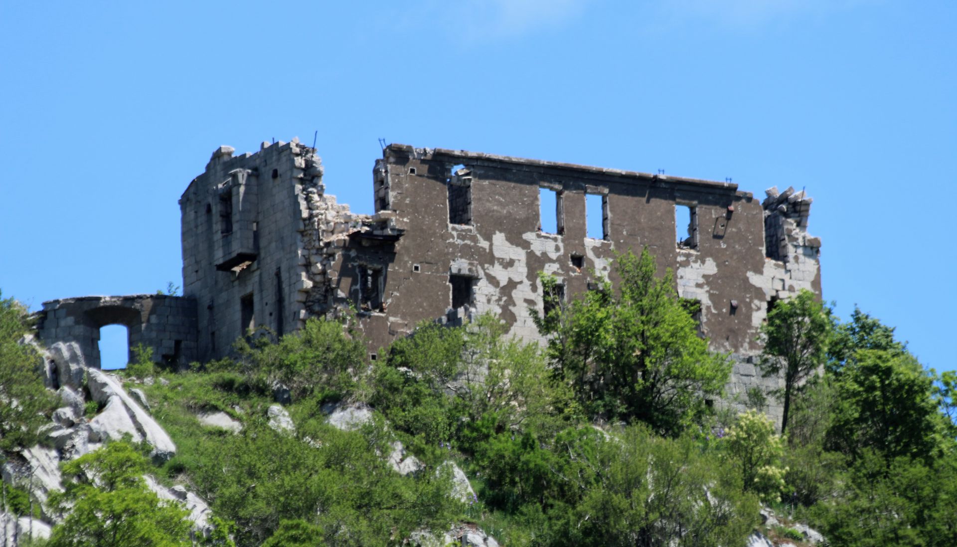
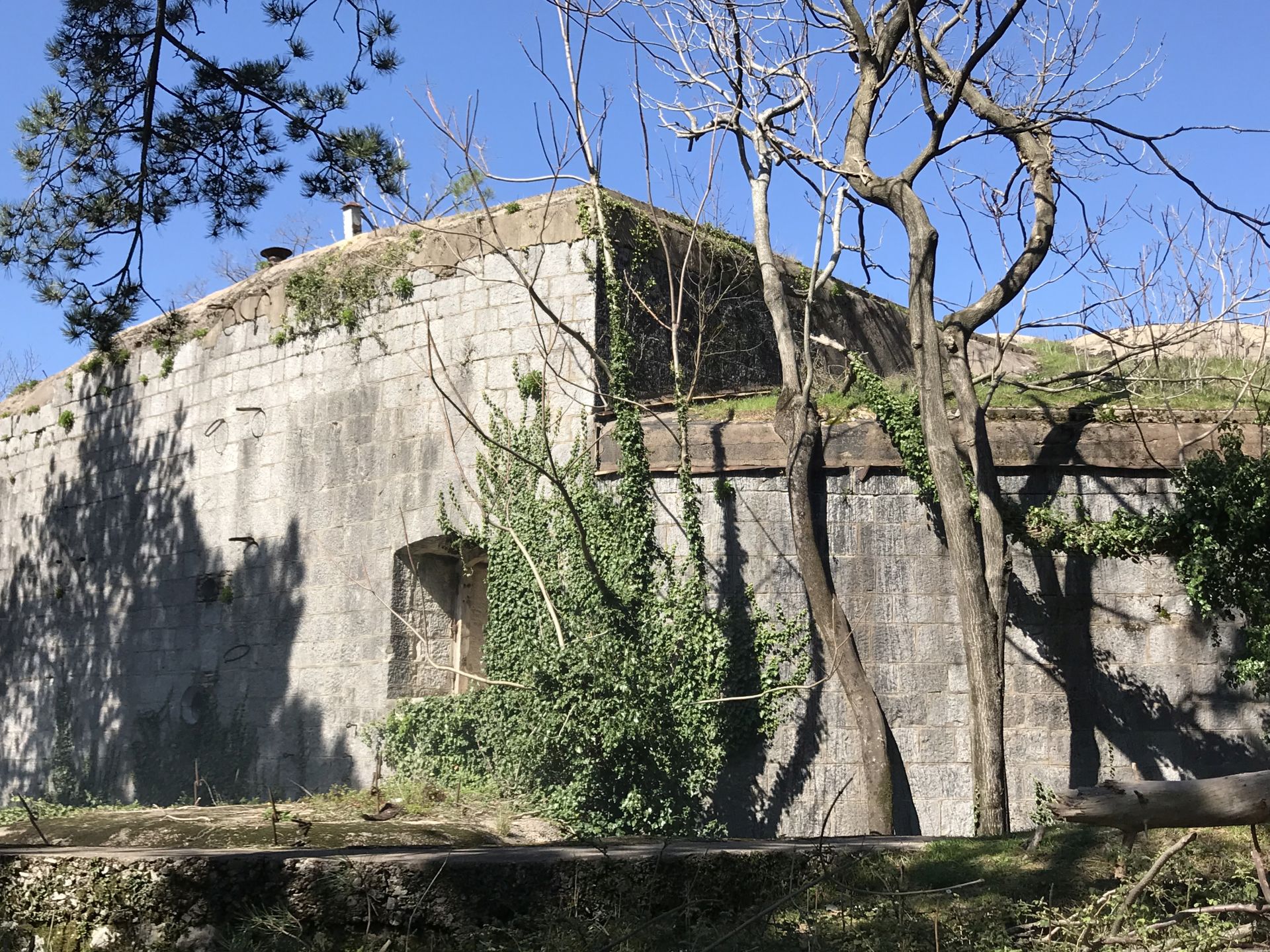
The Fortress of Vrmac
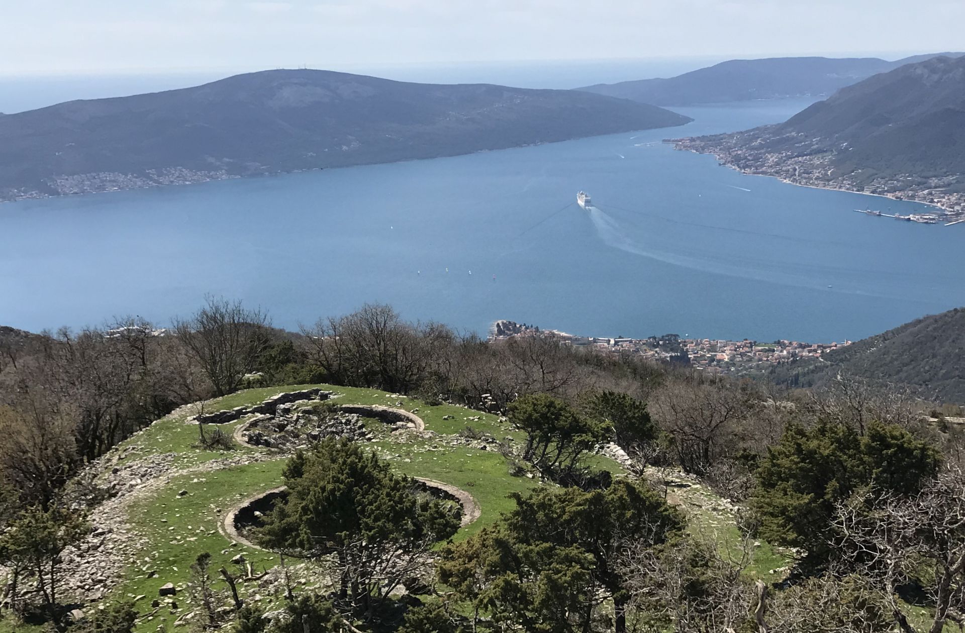
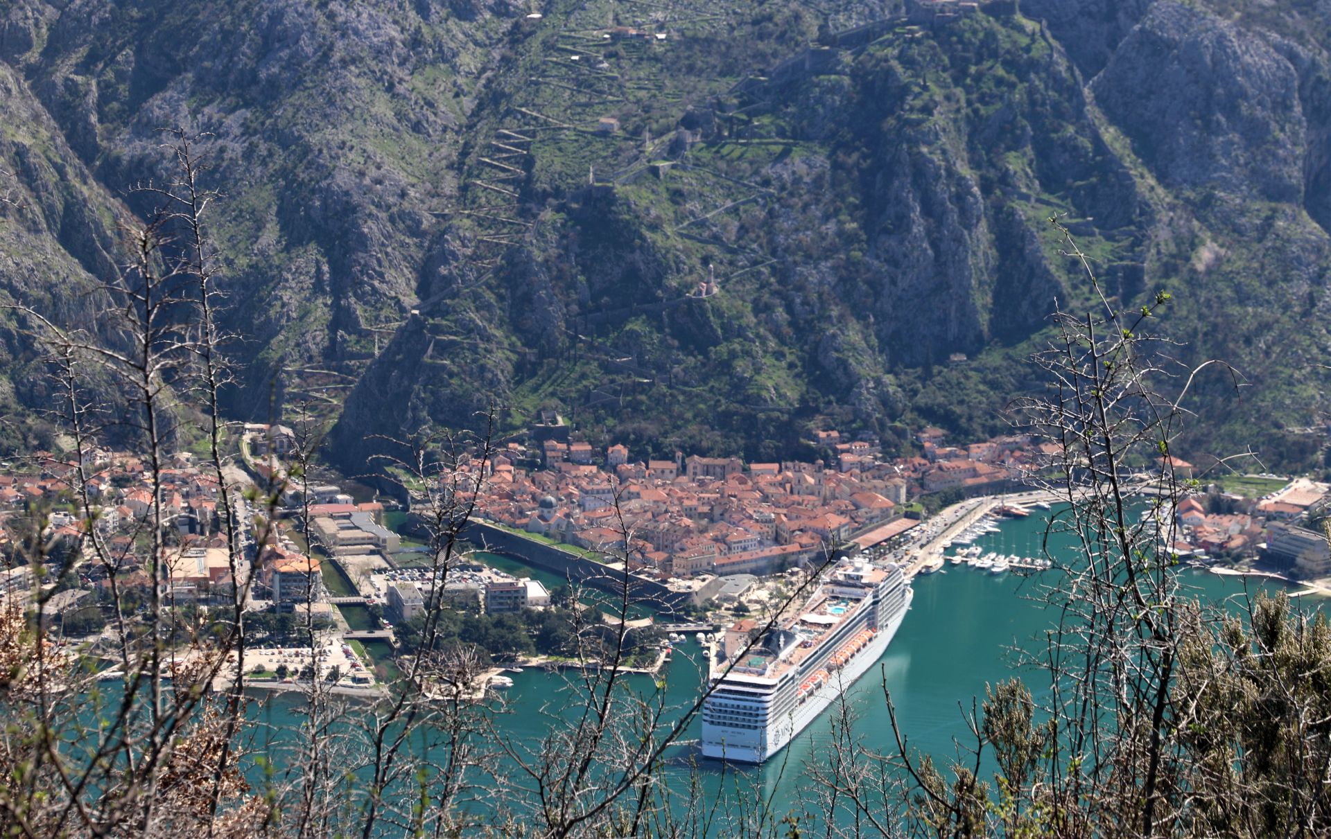
The fortress of Vrmac is located on the Vrmac peninsula, which divides Kotor Bay from Tivat Bay. It is situated at 485 meters above sea level on a small cliff between St. Ilija (766 m) and the Trojica Pass. The fortification can be reached via a road from Trojica built by the Austro-Hungarians after 1882.
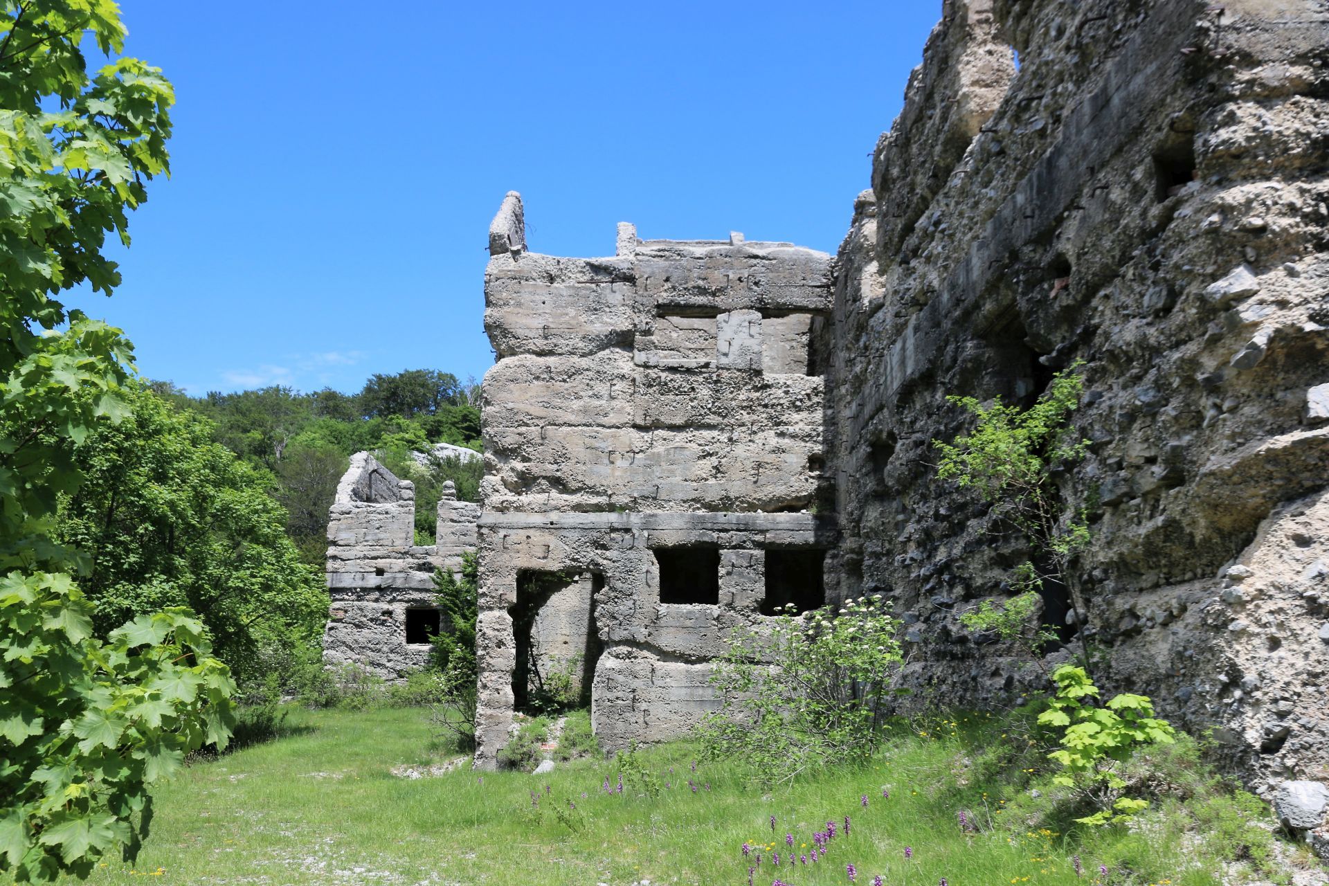
The best-preserved fortress is Werk Vrmac. It was established in 1860, but the present structure was built between 1894 and 1897. In those times, the fortress did not only provide accommodation for the soldiers, but there were also ammunition magazines, cisterns, hospitals… The big stone buildings are in surprisingly good condition, considering the fact that they have been left to the ravages of time. The windows are covered with rusty bars and the perimeter is riddled with large metal spikes, rising from the chaotic weedy ground.
You can make a beautiful hike, starting above the fortress. Passing in between several abandoned farm buildings, take the path through the shady forests. You will gradually ascend to a more exposed area with great vistas of the inner Bay of Kotor and get back to the old military road following the crest of the ridge, with stunning views to both sides of the peninsula.
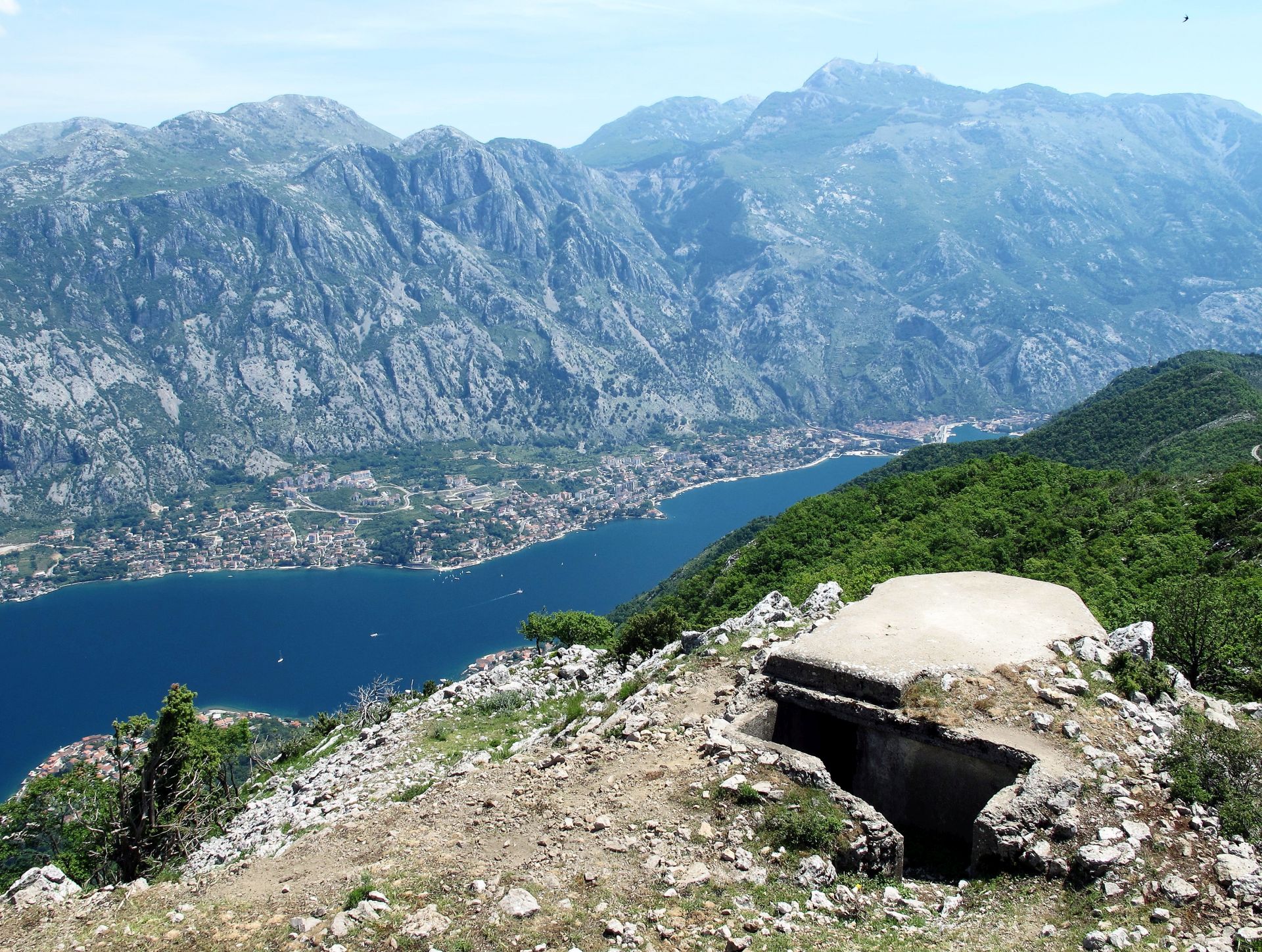
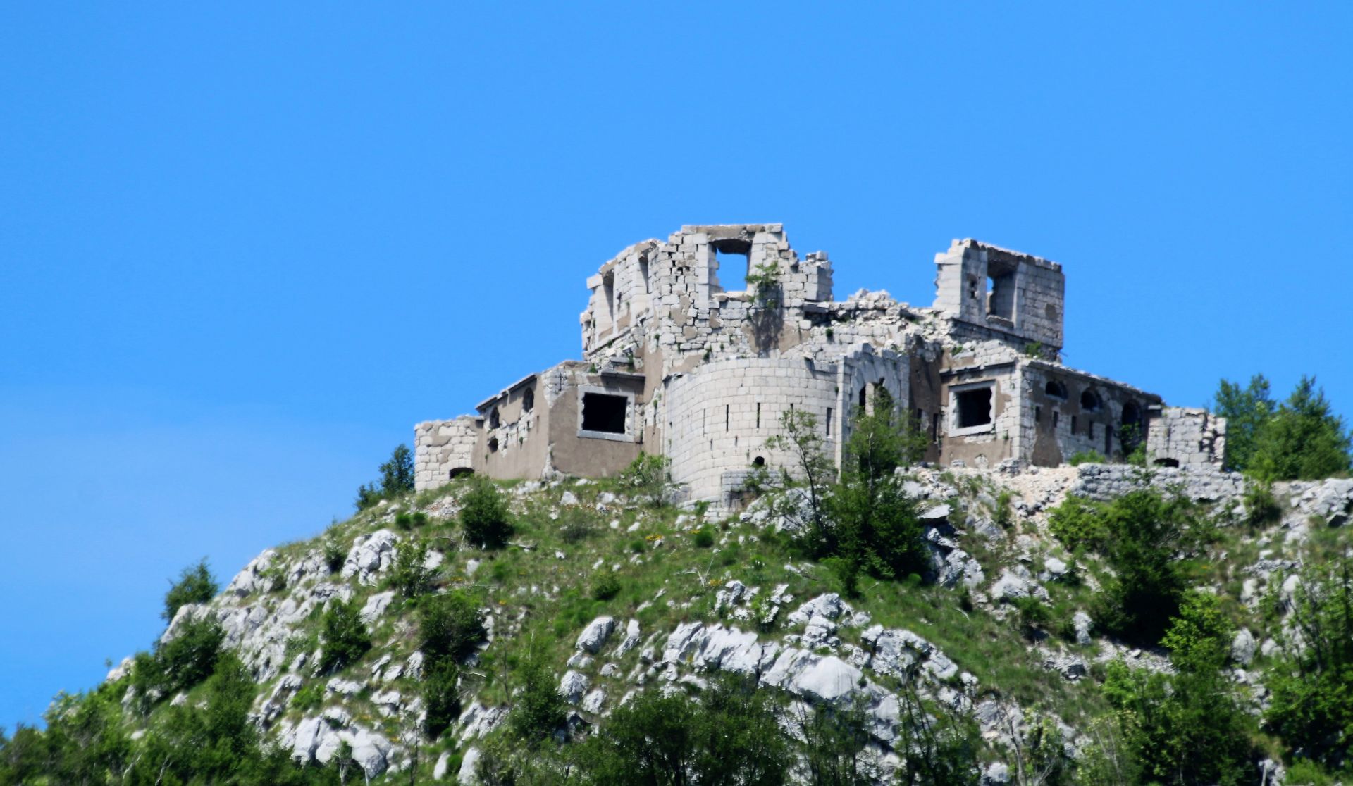
After more than 4 km, you will arrive at a junction. For the climb to the summit of Vrmac, Sveti Ilija, or “Hoher Vermac” as the Austrians called it, you have to turn right and continue uphill for another kilometer. You will pass several ruins overgrown with ivy; obviously, they used to be lookout posts and store rooms. There was also a huge and well-preserved water catchment.
On the summit of Sveti Ilija (St. Eliah) stands an abandoned building that once served for navigation purposes. What is more interesting are the remains of an observation bunker from 1910 – it once served as a permanent lookout. From the roof of the bunker, you will have incredible vistas of the surroundings.
The grassy plateau on the top of Sveti Ilija is a perfect place for a break and a picnic. Here you will have one of the most fantastic views of the Montenegrin Coast. Roaming around, you will discover the remains of two big embankments with cannon bunkers.
For more information see my blog post: HIKING ALONG THE VRMAC RIDGE.
The monumental edition of “Werk – Austro-Hungarian Fortresses in Montenegro” by Radojica-Rašo Pavićević offers a treasure of information, maps, drawings and photos, while the book “The Austro-Hungarian Fortresses of Montenegro – A Hiker’s Guide”, written by Bernard Sullivac, is very useful for hikers who want to discover the amazing network of footpaths and roads leading to and between these fortresses.
Anyway, it is very important to raise awareness of the existence of these structures in Montenegro. Most of them are in a tragic state of decay, ravaged by time, earthquakes and storm. I think that it is absolutely necessary to protect and conserve these fortresses for future generations!
Dear Marianne, all tables have QR code with English translation.