If you really want to explore Kučka Krajina, the vast karst plateau that stretches northeast of Podgorica, you should take the roads less traveled and visit the hidden villages in this area. Apart from Panoramic Road No. 4 – Circuit around Korita, adventure lovers will find many other possibilities to explore this magnificent region.
 We just consult our favorite map (www.opentopomap.org) and find some new routes, not knowing if the selected roads are asphalt, forest or dirt roads. But with our Dacia Duster we can just go and try!
A few days ago we made a trip through the southern part of Kučka Krajina, approaching the region from Dinoša, a village near Podgorica that is located on the Cijevna river. It was our intention to discover the area high above the Cijevna Canyon and indeed, we experienced several surprises, we saw villages we never heard of and we had a wonderful afternoon.
The route
- From Dinoša to Selište
Arriving in Dinoša, pass the bridge over the Cijevna river and follow the road along the left side of the river until the end of the village, where you should keep left uphill. The narrow and bumpy asphalt road runs high above the Cijevna Canyon. You pass the hamlets of Pikalja and Prifta, where you can see, on the right side, the village of Lofka, situated at the edge of the canyon. Soon you will reach Selište, where the asphalt road stops.
The dirt road that connects Selište with Panoramic Road No. 4 and Zatrijebač is in a very bad shape, so it’s better go back to Dinoša, from where you can explore another interesting village: Koći.
- From Dinoša to Koći
Return to the center of Dinoša and turn right uphill (there is a waste container at the junction).Turn right once more in front of the mosque and follow the narrow asphalt road uphill. When you arrive at the main road (No. 4), turn right and you will soon arrive at another junction. Turn left, uphill. Near the village of Krušćica, the road turns into a dirt road through rough karst fields. The condition of this road, covered with sharp stones, is rather bad, in particular the last part where you descend to the village of Koći.
From Koći, there is a narrow asphalt road that leads to Panoramic Road No. 4, north of Medun. Turn left to arrive in Podgorica. Of course, if you don’t have an all-terrain vehicle or SUV, you can also reach Koći by following this road from the other side (turn right north of Medun).
A map of the region is included: asphalt roads are indicated in BLUE, dirt roads in RED, and Panoramic Road No. 4 in GREEN. The complete round trip from Podgorica is around 80 km long.
Our trip
We started our trip in Dinoša, a village on the Cijevna river inhabited by ethnic Albanians. The narrow winding asphalt road took us gently uphill. From above we saw the entrance to the Cijevna Canyon and the reconstruction works on the road to the Albanian border.
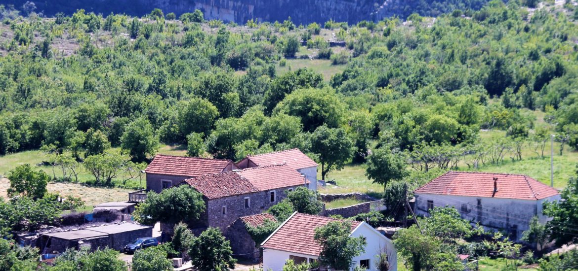
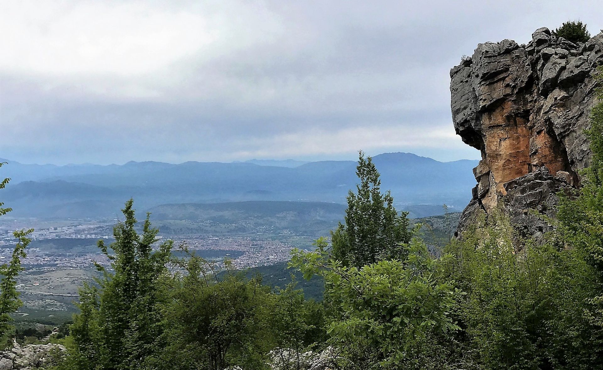
It was obvious that the area along the edge of the Cijevna canyon has favorable conditions for agriculture. We passed the villages of Pikalja and Prifta with their typical rural landscape and Mediterranean vegetation. On the right side was Lofka, a village at the very edge of the canyon (cover photo).
 From time to time we stopped the car and admired the abundance of flora: wild roses, sage and many other field flowers. Lizards were sunbathing on the rocks and we had to avoid some turtles that were slowly passing the road. We saw several sheltopusiks (Pseudopus apodus), also called European legless lizards. Most people think that these reptiles are snakes, but they are not dangerous or venous and it is a pity to kill them.
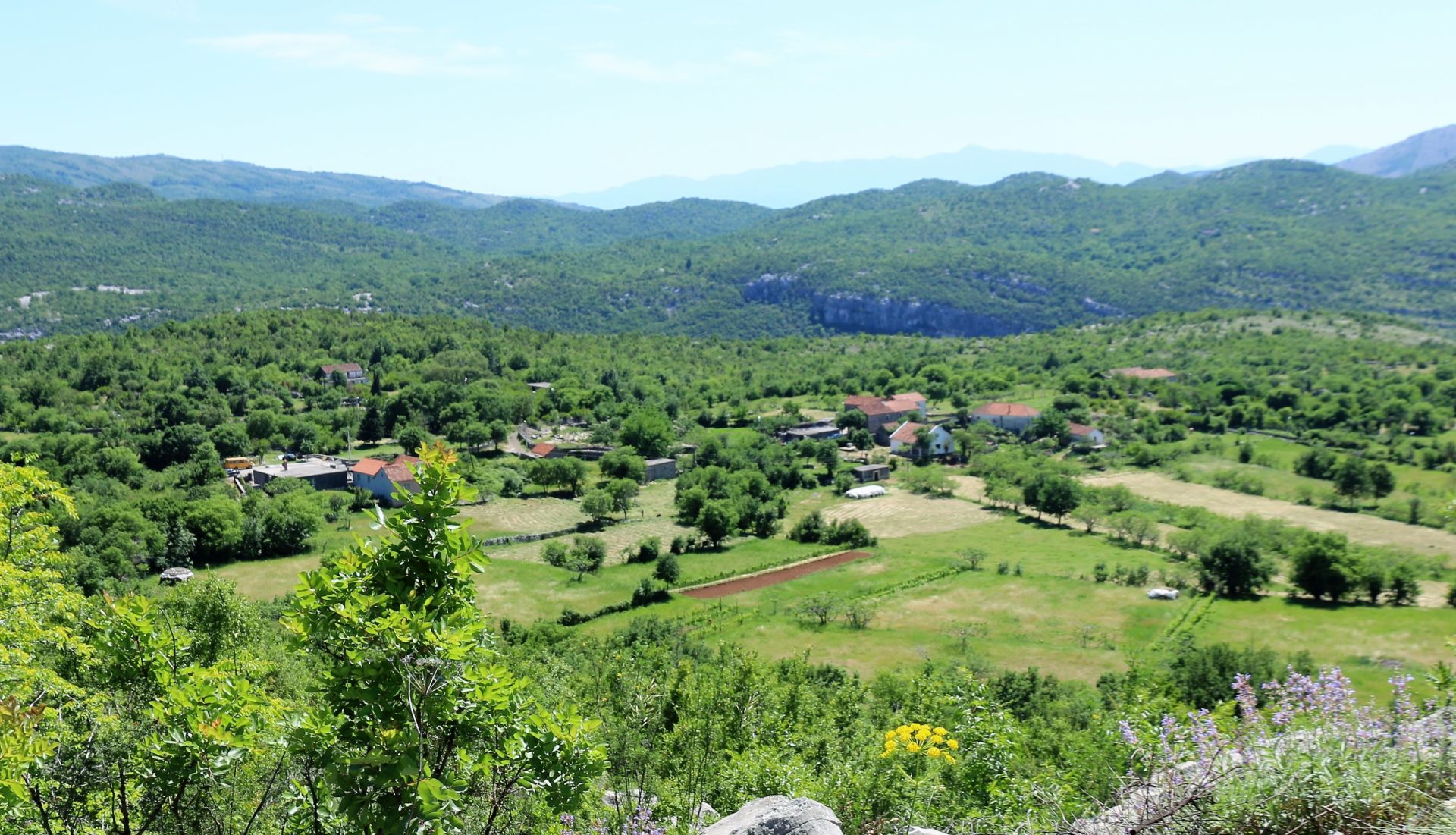
The road continued through dense oak forests. Some stretches were really narrow, as they ran exactly in between old dry-stone walls. Soon we arrived in a lively village: Selište (Selisht). And here, high above the Cijevna Canyon, the road stopped…. Indeed, we saw a forest path leading uphill, but obviously in a very bad shape.
 In the village, a dozen people were collecting hay. They greeted us friendly and strongly advised us against using the dirt road towards Zatrijebač. Although it had been promised a few years ago that this road would be reconstructed, nothing has happened so far. What a pity!
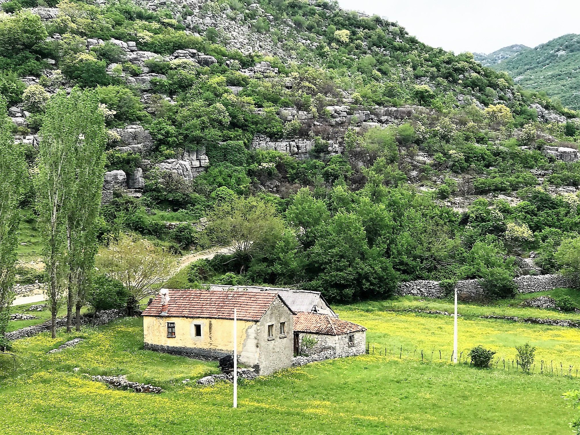
We slowly returned to Dinoša and turned right, steeply uphill. Following this narrow and bumpy asphalt road, full of potholes and, of course, without protection rails, we discovered a herd of wild horses and soon we could enjoy a wonderful view of Podgorica.
 Purple sage fields and Mediterranean maquis covered the rough karst fields on both sides of the road. Here and there was a fertile pocket with grass or arable land.
The lonely asphalt road (we have not seen a single car!) stopped in the village of Krušćica and turned into a rocky dirt road that, after a while, steeply descended to the village of Koći.
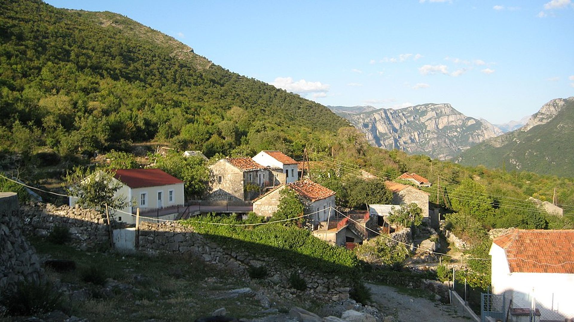
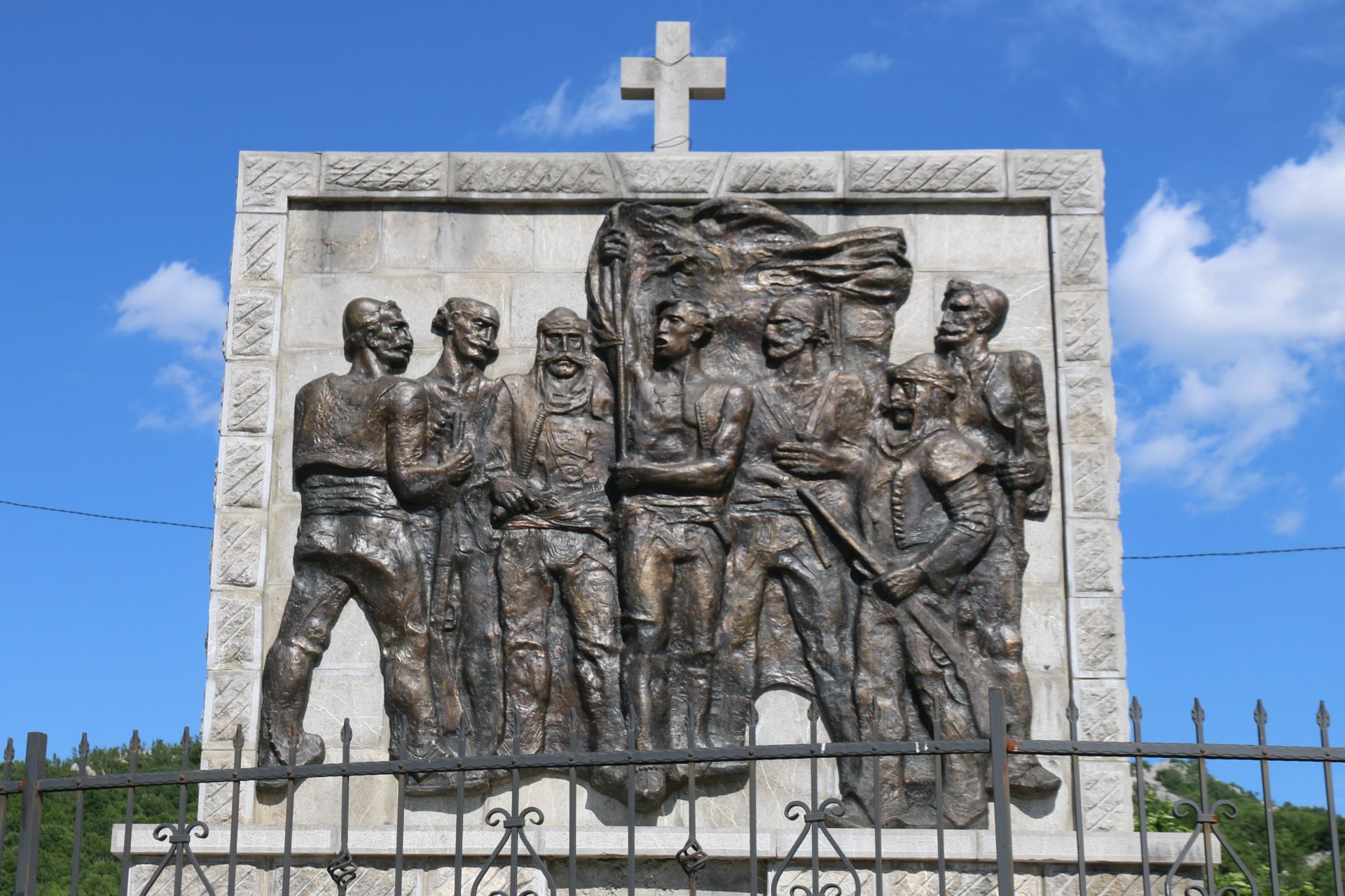
When we arrived in Koći, we were really surprised. Koći is an Albanian enclave with around 50 inhabitants, the center of which appeared to be quite modern and attractive. The rather new Catholic church was surrounded by a graveyard and a prominent monument overlooked the central square. The monument was obviously dedicated to the villagers who were killed during the Malissore uprising in 1911, one of many Albanian revolts against the Ottomans. I could not find anything about this monument on the internet and I even never heard the name of the village.
 However, I found some information about travel writer Arso Milatović, who stayed in Koći in 1904. He described it as ‘a village neighboring Malesia, misplaced and rugged, which a horse can’t reach, thus donkeys and mules walk the rocks as squirrels on branches’.
And yes, the village is really isolated. From one side a bad dirt road, from the other side a bumpy narrow asphalt road that leads to Panoramic Road No. 4, north of Medun.
After our visit of Koći we returned to Podgorica with the firm intention to continue exploring Kučka Krajina, a region that hides so many secrets!
