Whenever we want to enjoy the wild beauty of Montenegro, we make the tour that is officially called ‘Circuit around Korita‘ or Panoramic Road No. 4.
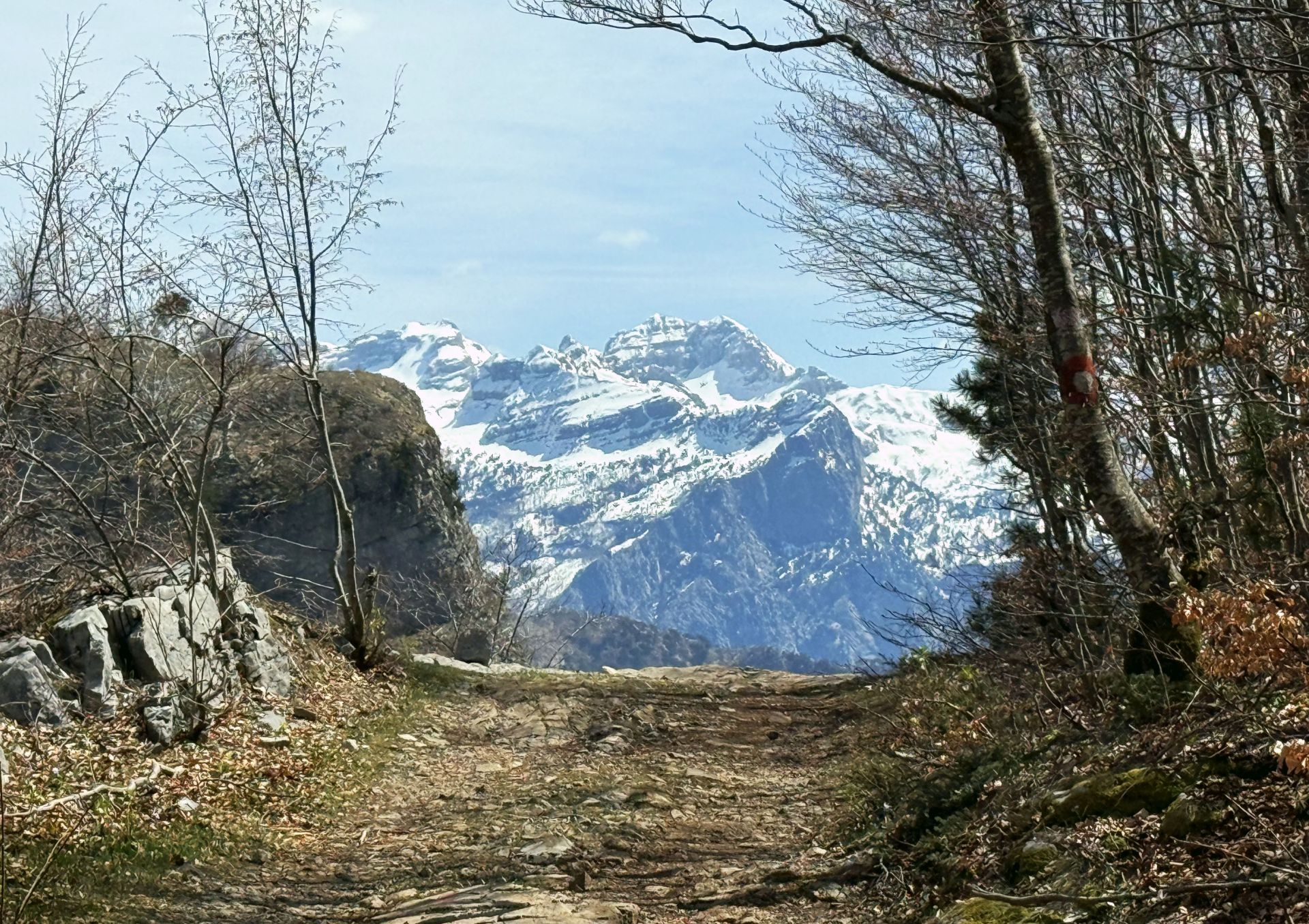
The Circuit around Korita, only 65 km long, contains a two-hour hiking trail along the old patrol path that was once used by border guards. This path leads to ‘Grlo Sokolovo‘ or Falcon’s Throat, a panorama point that offers a breathtaking view of the Cijevna Canyon and the Albanian Prokletije mountains, also called Albanian Alps.This is the place where Mount Sokol (meaning ‘Falcon’), with an altitude of 1,557 m above sea level, is overlooking the steep cliffs sloping towards the river.
But it is not my intention to give a detailed description of the Circuit around Korita, as you can find it in all available brochures and websites. I just want to give you my impression of our recent hiking tour to Grlo Sokolovo.
We made the tour on a sunny day in April. The drive over the winding road to Kučka Korita offered us a picturesque landscape. Almond trees decorated the hills with their white-pink flowers, while bladder-senna shrubs showed their bright yellow flowers along the road.
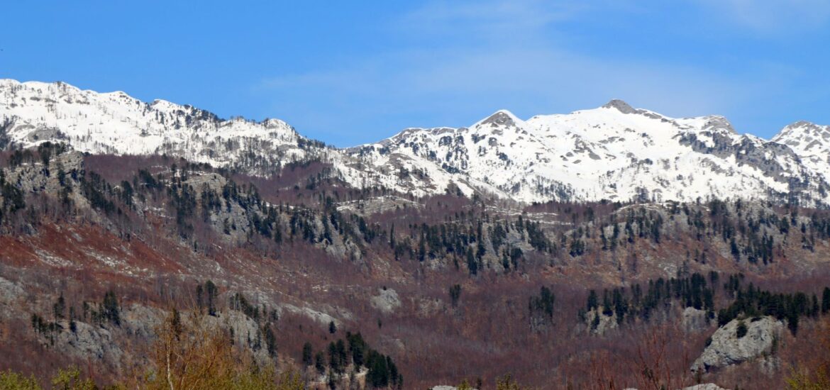
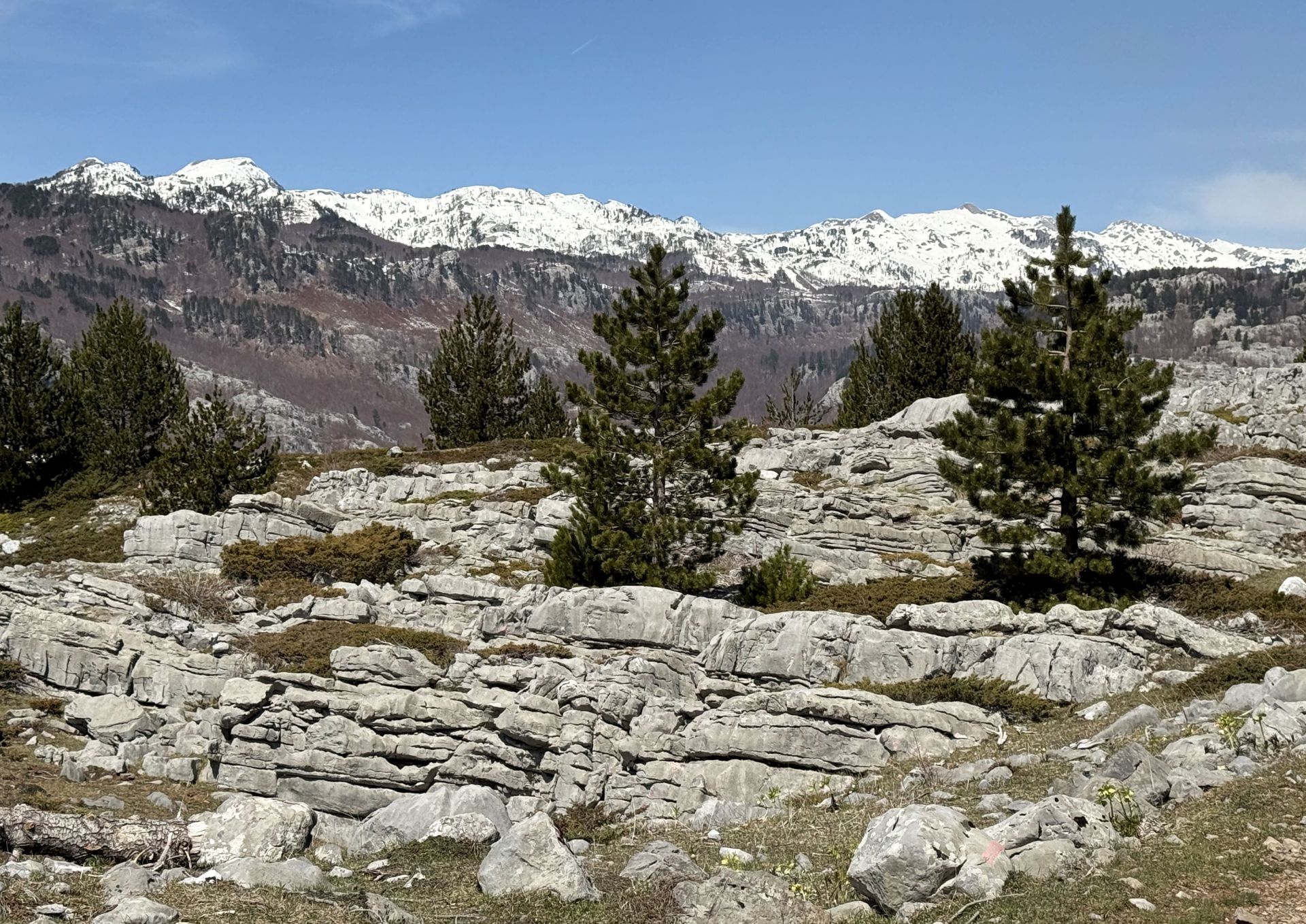
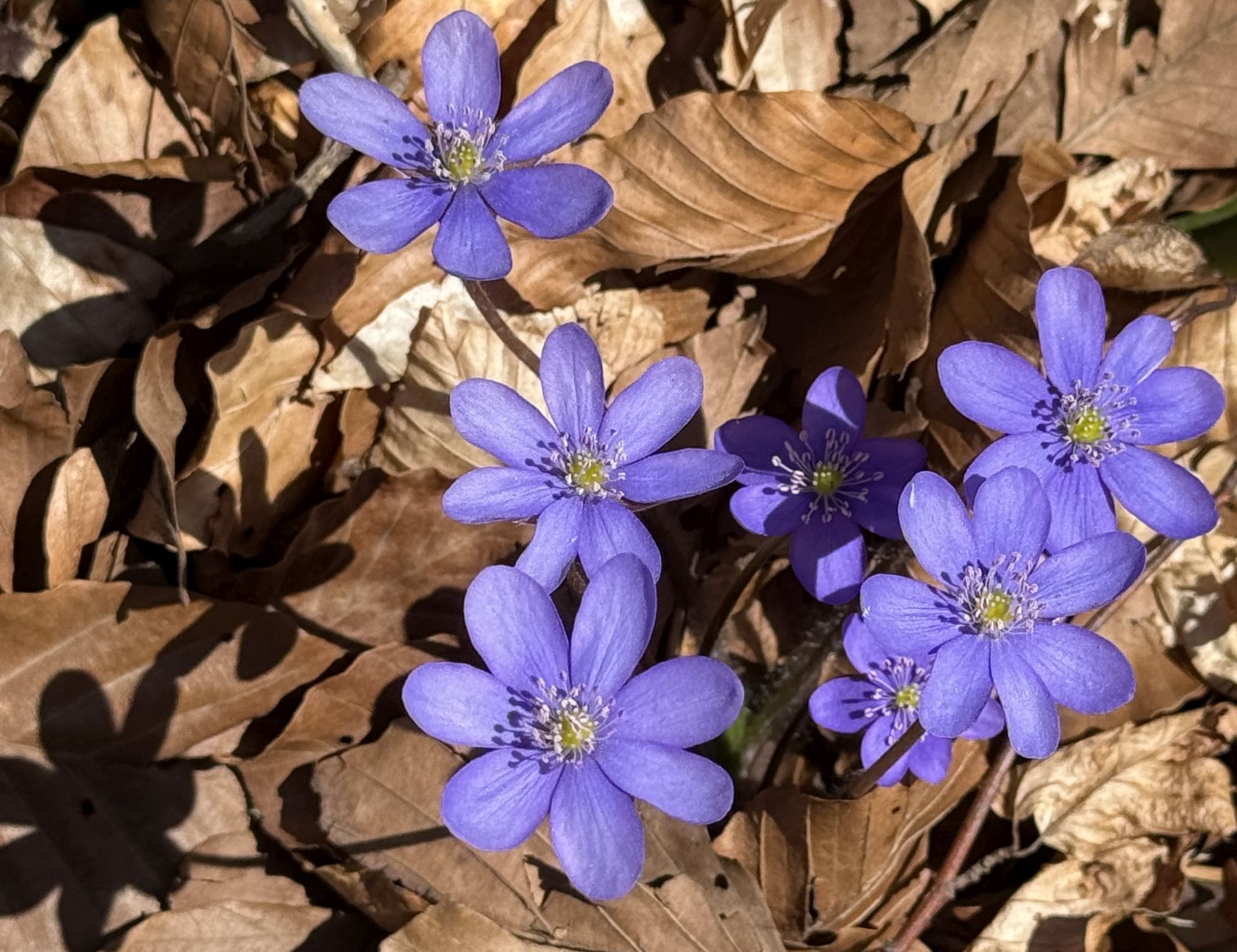
But on the plateau of Kučka Korita, at an altitude of more than 1,370 m above sea level, nature was just awakening. Many trees hadn’t leafed out yet, while the woodlands and karst areas, high above the Cijevna canyon, were already full of windflowers, primroses and violets. The dark pine trees created a sharp contrast with the white-grey karst rocks and the snow-covered Albanian Alps in the distance.
The name Kučka Korita refers to the Kuči tribe, who used this area as pasture and for agriculture. The toponym Korita comes from the Celtic language and means something like ‘windy plateau’. Nowadays, the place has become a kind of weekend settlement.
It was quiet on the plateau; only one pub was open, Konoba Plus. We parked our car, had a good cup of coffee and started the hiking tour. A marked country path – the former patrol path of border guards – took us past fields and meadows, churches and cottages, and further through beech forests, to a magnificent place, one of the most beautiful viewpoints in Montenegro: Grlo Sokolovo.
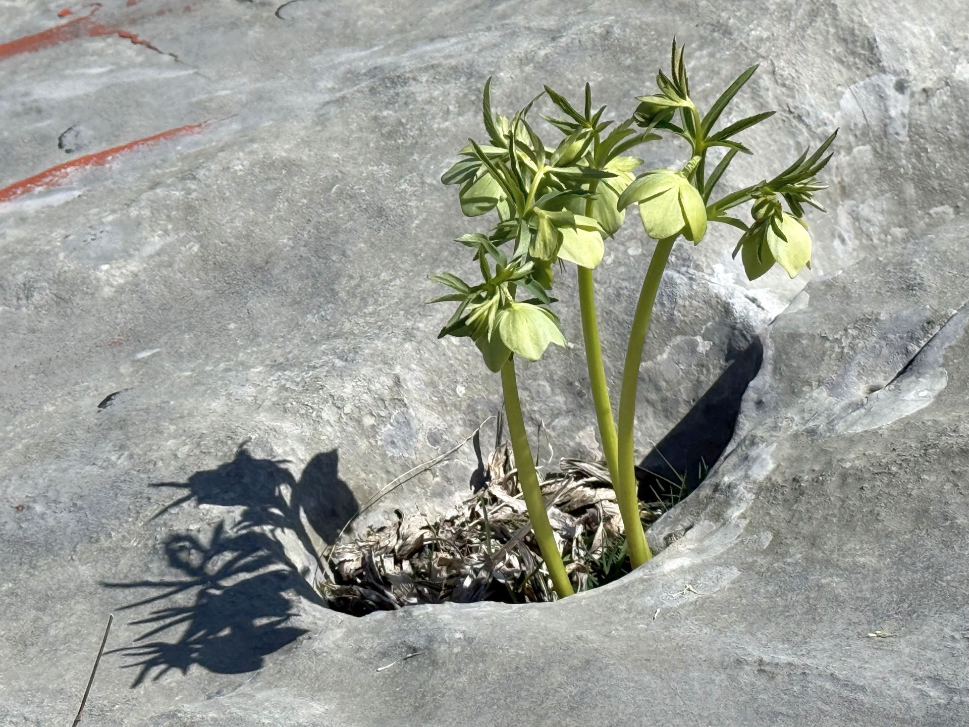
Along the trail, we discovered hellebores (Helleborus) among the rocks andbright blue grape hyacinths (Muscari botryoides) on the pastures, while windflowers or wood anemones (Anemona nemorosa) in white and purple colors grew among the beech trees.
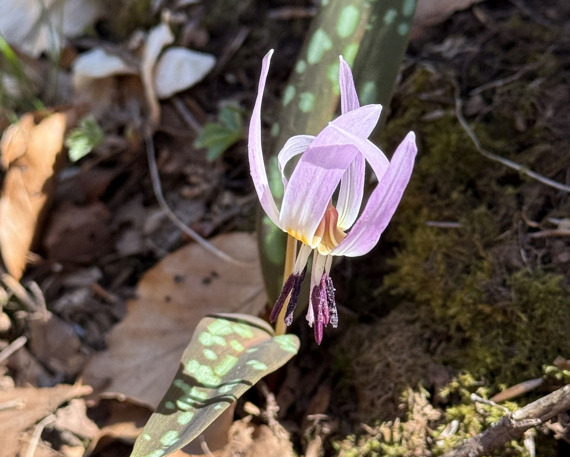
But in the woodlands close to the edge of the canyon, we also spotted one of my favorite flowers: the dog’s-tooth-violet (Erythronium dens-canis). Its white bulb is oblong and resembles a dog’s tooth, hence this common name. This flower is protected in most countries of Western Europe.
Of course, we also saw many other flowers and plants in this area: yellow violets, white and purple crocusses, cowslips, primroses, heart-leaved globe daisies, etc.
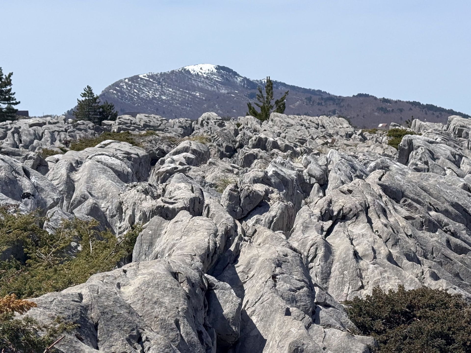
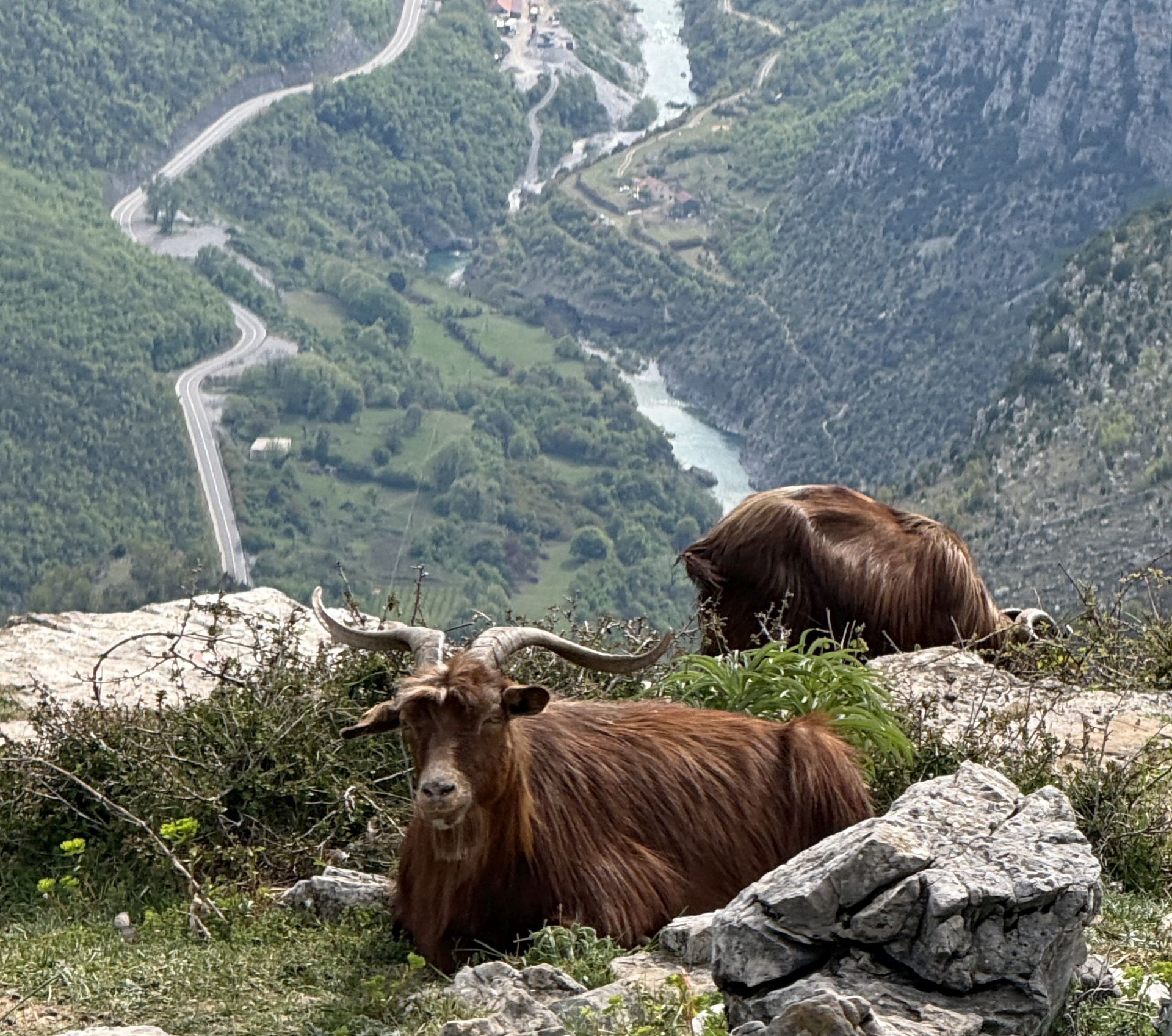
Approaching Grlo Sokolovo, we left the green pastures and grey karst rocks and continued through the beech forests, uphill, and finally downhill again with an spectacular view of weird-rocky landscape and the snow-covered Albanian Alps.
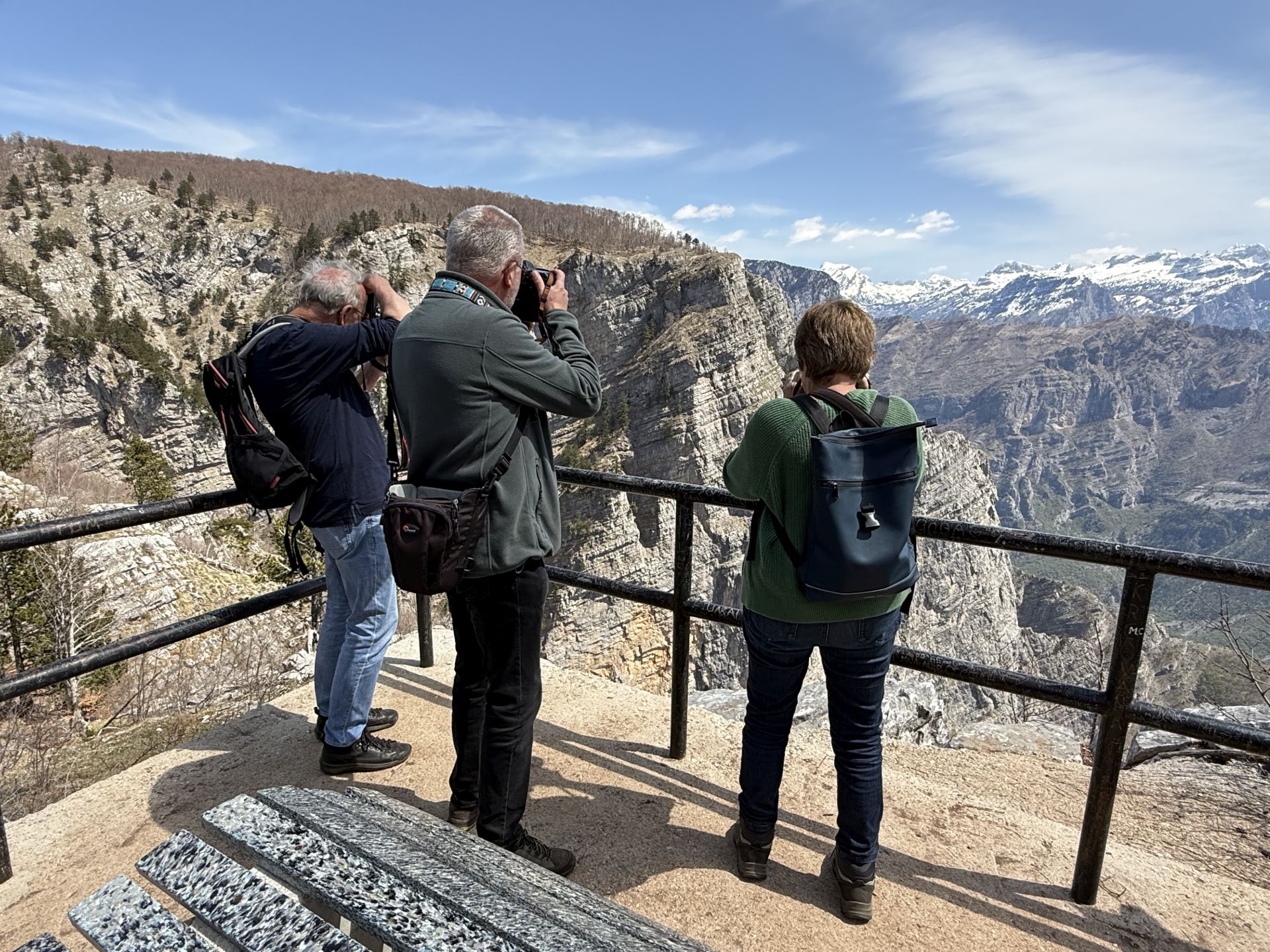
At an altitude of 1,386 m above sea level – at the place where there used to be a border post used by the border patrol of Tito’s Yugoslavia – there is now a lookout point with benches, an information board and warning signs. Numerous caves are scattered along the huge cliffs, and pine trees grow directly out of the steep rocks. And deep below, you can see the Cijevna river and the village of Tamarë in Albania.
By the way, why is this place called Falcon’s Throat? This name comes from a local legend about a wounded soldier who was lying helplessly at the foot of a cliff. A falcon saw him, flew with a soldier’s handkerchief to a nearby spring, dipped it in the water and flew back to the soldier to nurse him. For days, the soldier’s mother watched the falcon dip a handkerchief into the spring and follow him in amazement. So she finally found her son again and he was saved.
Finally, some practical information about the trail itself: the path is 4.8 km long and the hiking tour, which is not too demanding, lasts about 1.5-2 hours. Sturdy shoes are recommended. It is best to walk clockwise, because the second half of the tour – following the panorama point – is a bit more demanding, so for beginners it is better to return the same way. Otherwise, if you want to continue, the path runs further through dense beech forests and over a steep hill, and at the end you return to the Kučka Korita plateau.
If you are a lover of wild beauty and if you want to feel Montenegro’s enormous strength of nature, make this impressive hiking tour; you will never forget it!
P.S. If you continue the Circuit around Korita, don’t forget to make a stop at the village of Deljaj. Here you will find a beautiful panorama point, where you can see the Cijevna canyon and the road that runs from Dinoša to the Albanian border crossing at Grabom. An amazing experience!