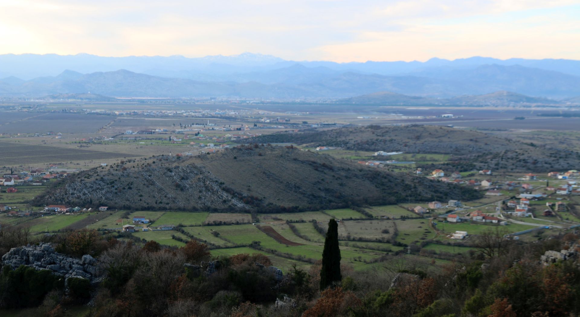
Malesia is a divided area located in northern Albania and eastern central Montenegro. The part covered by the Montenegrin municipality of Tuzi, home to the historical tribe of Hoti, is a rather unknown region with various hamlets and villages widely scattered over barren karst mountains and green valleys between them.
 I have always been curious to discover more about this area between Skadar Lake and the Cijevna (Cem) river. I have tried to find more information about it on the internet, but most data are given in Albanian – a language I don’t know. However, I found reliable sources on the websites www.dinarskogorje.com (in Serbian) and https://en.wikipedia.org/wiki/Hoti.(tribe). It was interesting to read more details about the turbulent history of the Hoti tribe and their homeland.
The official name of this area in Albanian is Malesia e Madhe, which means „Great Highlands“, and its inhabitants are Malisores (highlanders). The population of the Hoti region is almost entirely Catholic. Its oldest church (now ruined) dates back to around 1500.
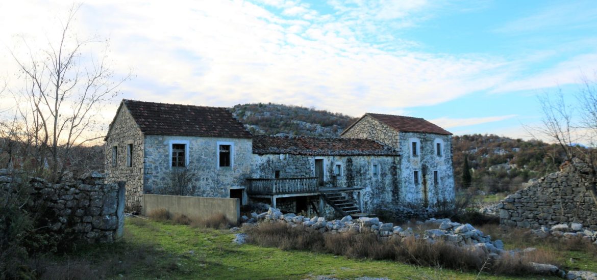
 Most inhabitants of the Hoti region in Malesia are farmers and cattle breeders. They are often poor and depend on financial support sent by family members living abroad. Many people have abandoned this area, mostly to the USA, and it is evident that quite a lot of houses are dilapidated. Will they ever be restored?
Hoti was mentioned for the first time in 1330 and it was fully formed as a community in the 15th century. In its long history, Hoti played an important role in regional politics as a leading community in the northern Albanian tribal structure. Through history, the situation changed and in the Second Balkan War and then after World War I, more than half of the Hoti region was given to Montenegro.
Last week, on a sunny winter day, we thought it a good opportunity to explore Malesia by car, using our car navigation and the website www.opentopomaps.org. It was a real adventure – driving through an almost abandoned area with narrow asphalt roads leading to – nowhere. Why nowhere? Simply explained, the roads stop close to the Albanian border, which can be crossed only at the official border crossing of Hani i Hotit/Božaj.
 No wonder that we didn’t see one single car during the whole afternoon. We only met a few farmers and shepherds, quietly tending their cows and sheep.
It was our intention to make a round trip through Malesia, but a short stretch of the road – between Paškala (?) and Krševo – turned out to be just a farm track or maybe a narrow off-road trail, and even a friendly old farmer whom we asked for advice didn’t recommend it. This does not mean that it is impossible to drive further. Under dry conditions and with a solid terrain vehicle you can certainly pass this stretch, which is probably around 5 km long. But this time, we decided to turn back and drive around (through Tuzi and Donji Milješ) in order to enjoy the view of the Cijevna river from above. Of course, you can also shorten the trip and explore individual stretches.
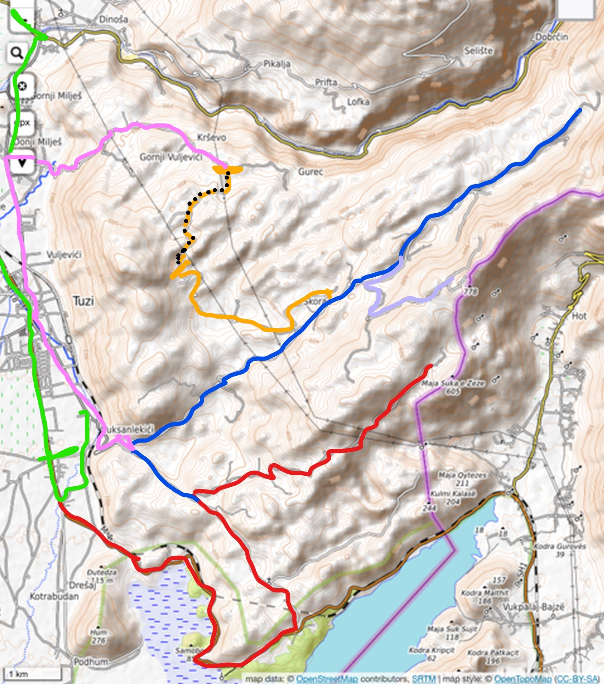
I indicated the roads we drove on the enclosed map with lines in different colours. The interrupted line shows the short road stretch that appeared to be an off-road trail.
Our trip
We started our trip in Podgorica and took the direction of Tuzi and the Albanian border.
- Vuksanlekaj (Vuksanlekići) – green line
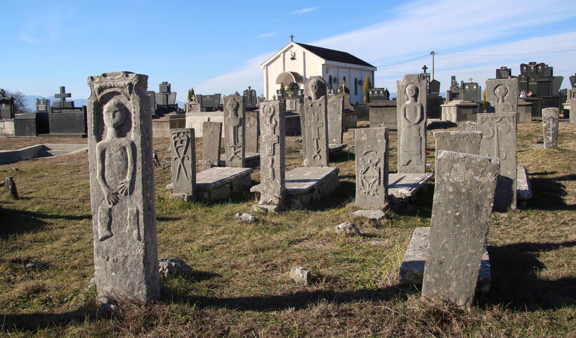
After we passed Tuzi (around 14 km from Podgorica) we noticed a modern funeral centre on the left side of the road and behind it a small Catholic church in the distance. We turned left and followed the narrow asphalt road to the church, where we visited the interesting cemetery of Vuksanlekaj, which I already described in my blog post „The mysterious cemetery of Vuksanlekaj“.
 Even years after I published this blog post (in 2017), I have not learned more about the origin of the typical tombstones that can be found here. Somebody told me that they date back to the 19th century, but several other sources state that they are much older. By the way, nobody could (or wanted) to explain the meaning of the symbols that can be seen on the nameless tombstones….
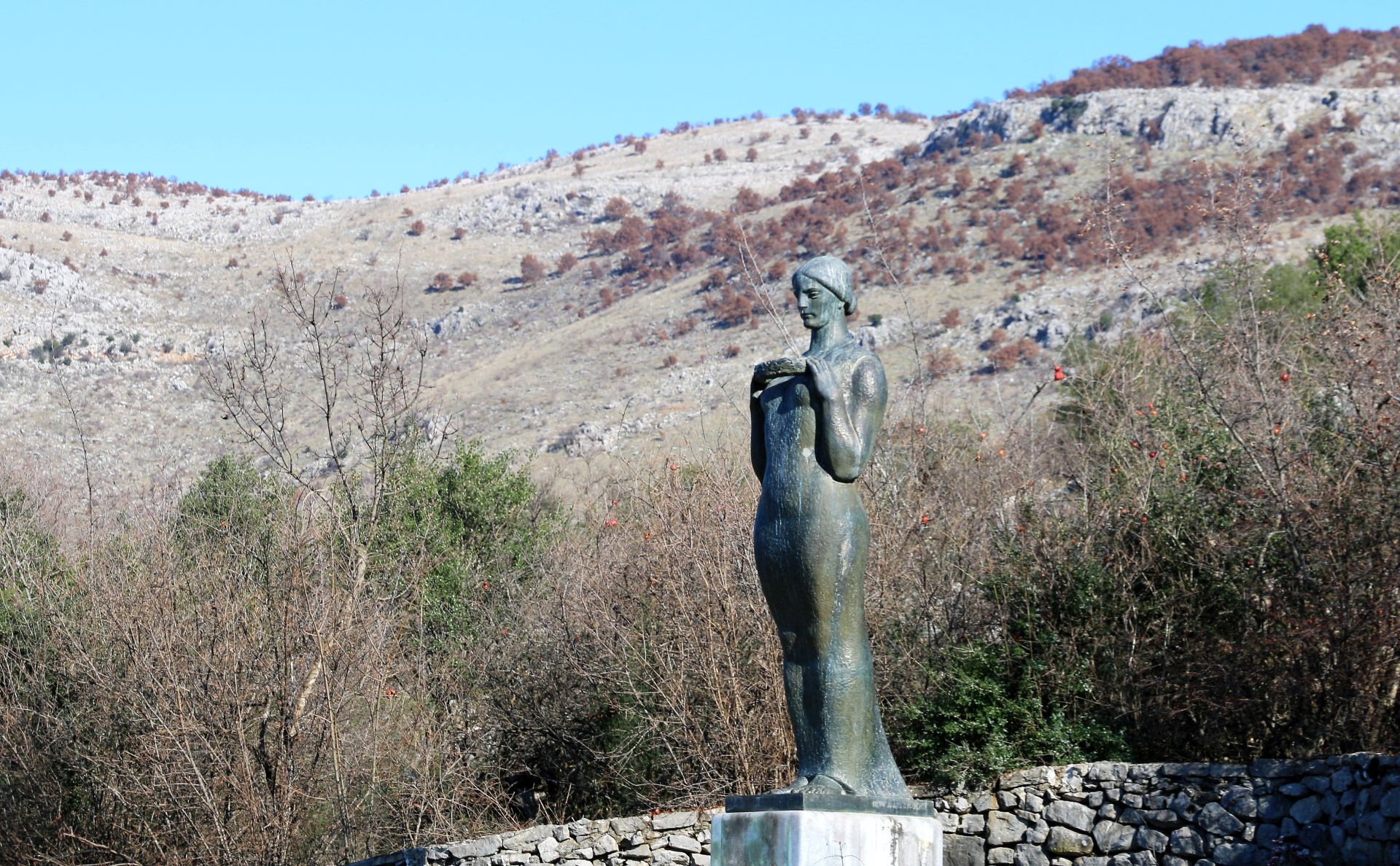
Behind the graveyard we could see an interesting statue close to the railway. We could only reach it by passing the Rujela river at the end of Vuksanlekaj (on the main road) and turning left immediately after the bridge. We then turned left once more and followed a very narrow paved road along some family houses en abandoned dilapidated farms.
At the end of the road we found a small neglected graveyard with anonymous old graves and a big sculpture of a woman in socialist-realistic style. The inscription read: Martyrs for freedom – erected by grateful descendants to the patriots who died in the Austrian prisoner camp in Vuksanlekić during World War I. It was a sad and abandoned place…..
- Prenkaj and Barlaj – red line
Back to the main road we continued our trip towards the Albanian border and just before the border crossing (more or less 20 km from Podgorica), we took a sharp turn left uphill. There were no signposts, but the road was paved. Soon we passed the new church of Drume.
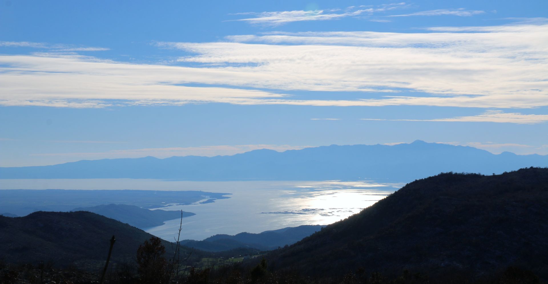
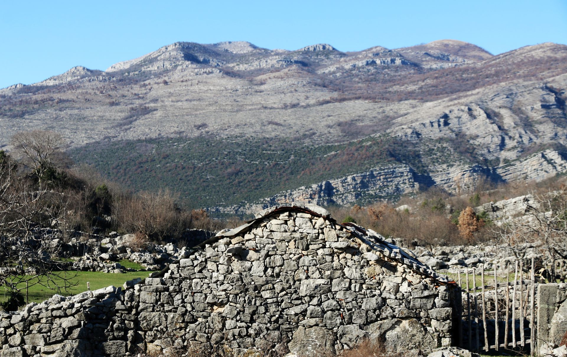
At the next junction we took another sharp turn to the right and we continued to Prenkaj. The view of Skadar Lake was wonderful, but the karst hills were rough and barren.
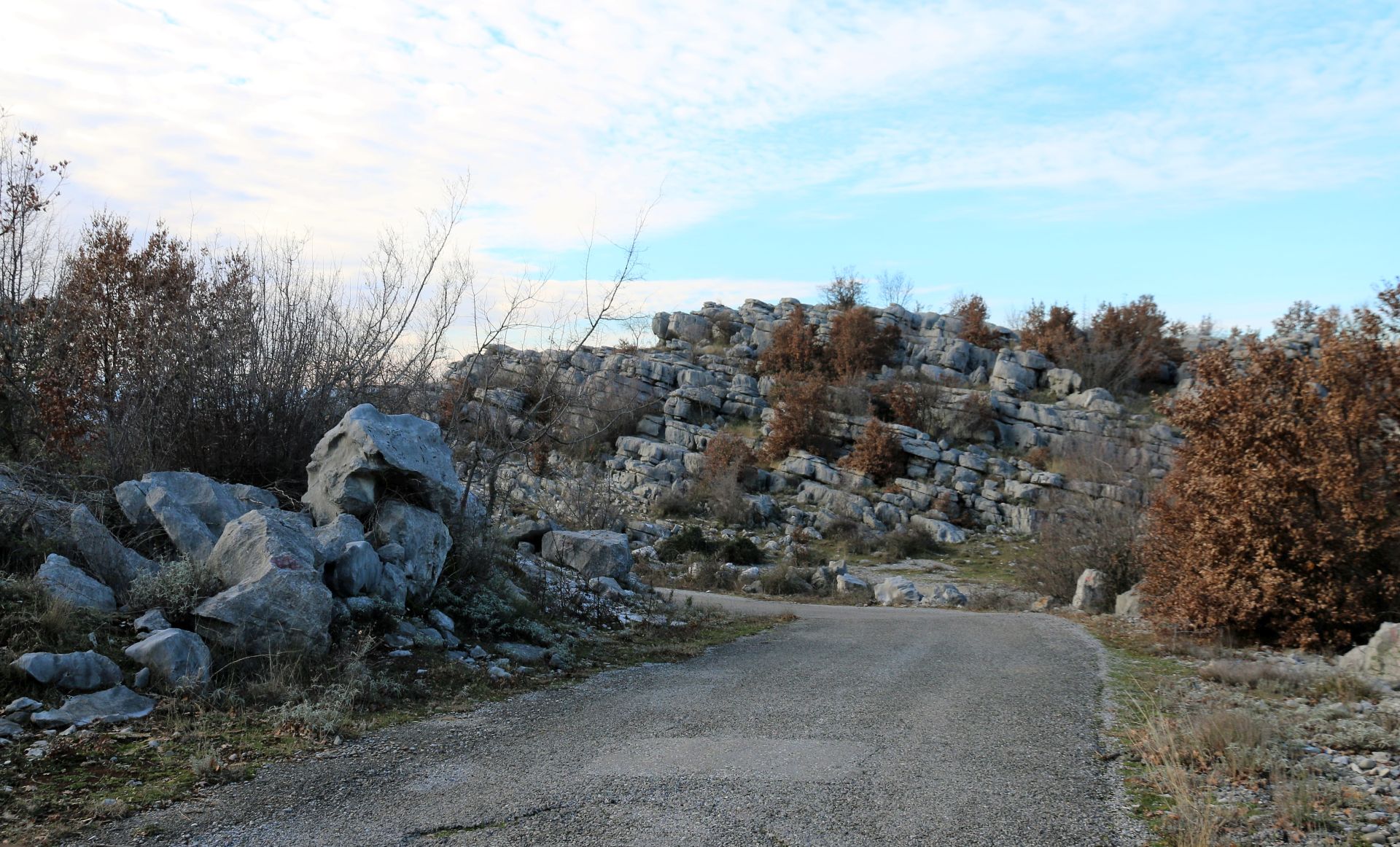
 The rocks were covered by Turkish oaks, pomegranates, juniper and other low bushes. There were picturesque karst formations along the road and finally we passed under some huge high-tension transmission lines. The border with Albania was close now.
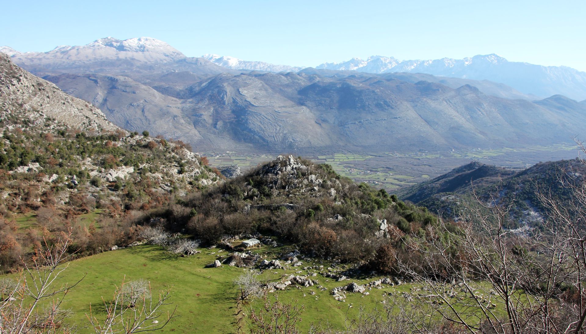
Here we had a breathtaking view of the Albanian snow-covered mountains and a huge green valley below them. Two shepherd dogs barked loudly, while they were tending a flock of sheep grazing in the meadows below us.
It was a magnificent place. We stood there in complete silence, admiring the glorious landscape in front of us.
Back to the junction we turned right, but before reaching Vuksanlekaj we turned right uphill in the direction of
- Skorać and Traboin – blue line
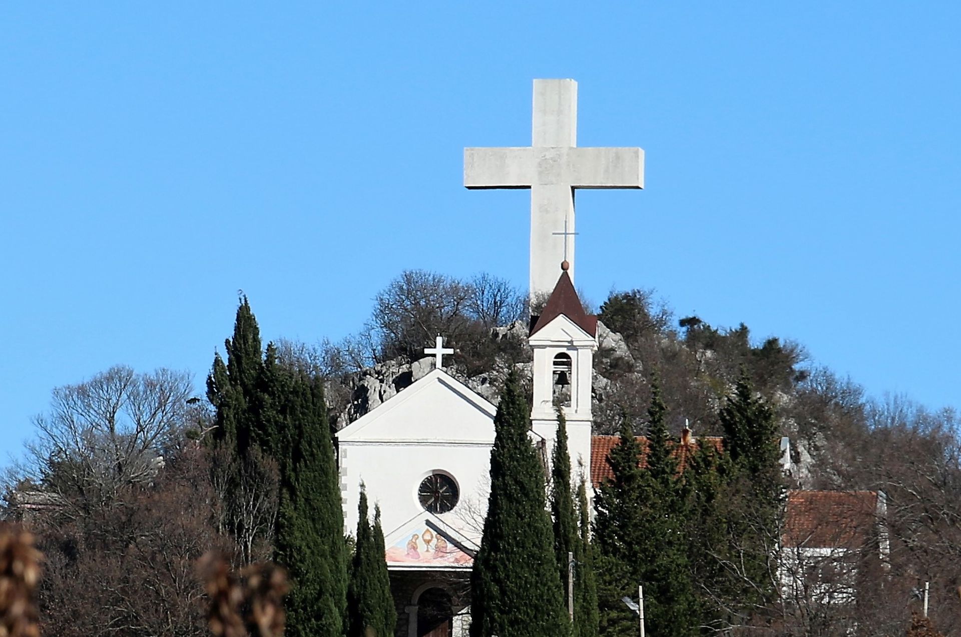
We passed through tiny villages with difficult names, and the first landmark we saw was the Hoti church with a big cross above it on the top of the hill. I know that there were German nuns living in the monastery in former times, but now it seemed to be abandoned. Old nameless graves could be spotted in the graveyard of the church.
The road continued uphill. Barren karst hills and green valleys alternated. We made a stop in Helmica, where a large cemetery could be seen on the left side of the road. Apart from family graves with huge marble tombstones, there were also many obviously very old graves decorated with various signs like suns, stars, crosses and even rifles and swords.
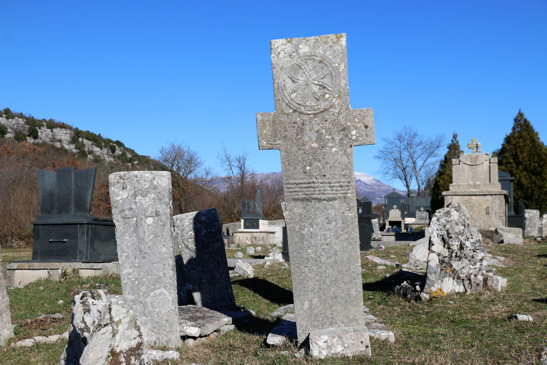 Again, it was impossible to find anything about these graves on the internet and we could just imagine how people lived here centuries ago.
We passed the village of Skorać on the right side and continued right ahead.
The landscape consisted of picturesque karst formations, dry stone walls and green meadows and fields.
We drove through Nabon and finally arrived at a village very close to the Albanian border: Traboin, the Montenegrin centre of the Hoti tribe.
That is where the road stopped and we had to go back to Skorać.
- Paškala off-road – yellow line
 We passed Skorać on the right side and then we turned right once more in northern direction. Although this road to Krševo was indicated on the map, it was not so easy as we thought. After a narrow and bumpy stretch full of potholes, we arrived at an abandoned hamlet (Paškala according to the map). It seemed to be impossible to continue, as the trail was obviously extremely bad. There was only one farm and we had a chat with a hospitable old farmer, who invited us for a cup of coffee – what we didn’t accept – and advised us to turn back – what we did.
Back in Skorać and further down the road, we took a side road uphill to the left, towards
5. Arza – purple line
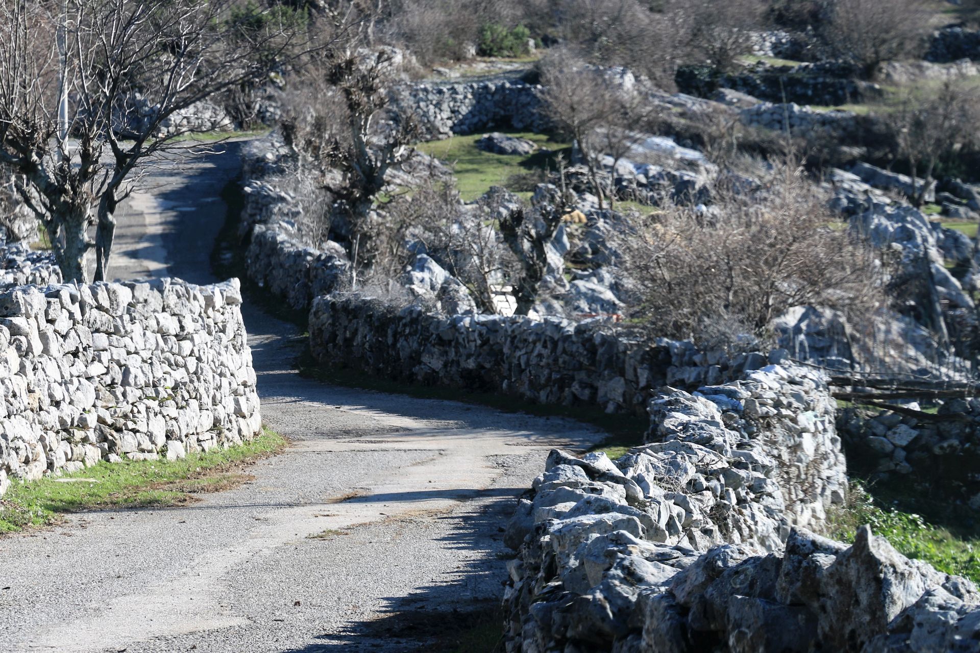 This short road was narrow, but very picturesque. It ran in between low dry stone walls and we were really glad that we didn’t meet any cars from the opposite direction! We followed the road up to the border station, which could be seen on the top of a hill.
- Donji Mileš and Krševo – pink line
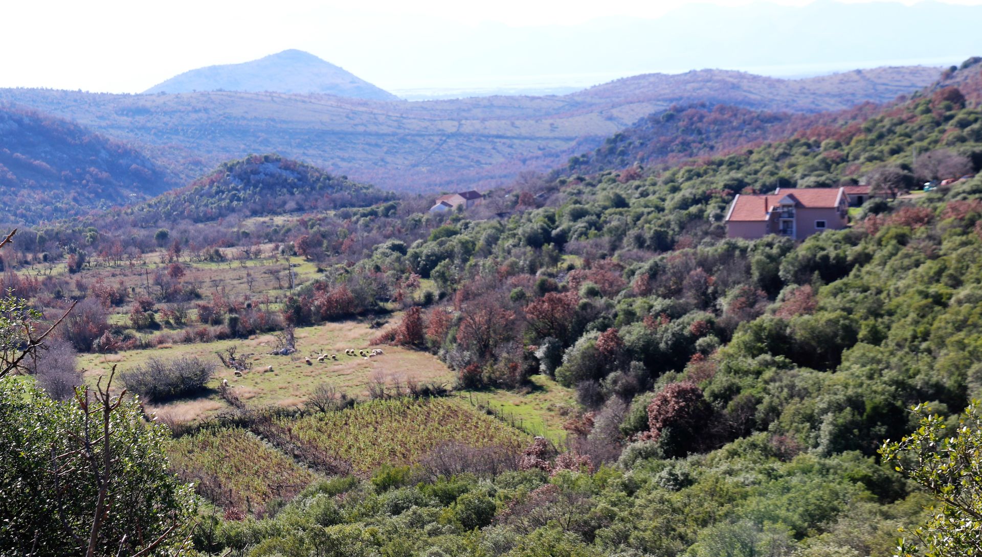
As we wanted to explore the area along the Cijevna river, we returned to Tuzi and took the road to Donji Mileš and further to Krševo. Driving uphill we had a beautiful view of the valley around Tuzi with the hill Rogamsko brdo (130 m) like a sore in the flat landscape. Further on we could see the Cijevna deep below us.
At the last junction near Gurec we reached the other side of the off-road trail that came from the direction of Skorać. Also at this end, the trail seemed to be pretty bad and narrow, and I had the idea that it was only used as a farm road.
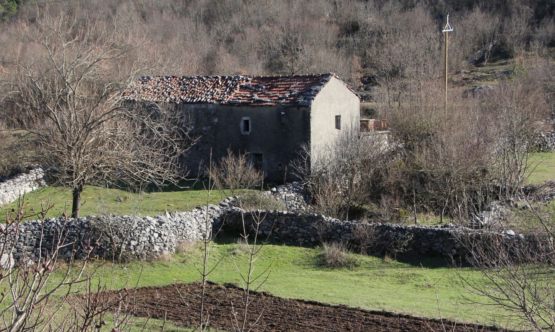
 We took photos of a few ruined old farms along the road and drove back, via Dinoša, to Podgorica.
It is difficult to describe this trip as a single tour. It was our goal to explore Malesia and the Hoti region and to get an impression about the landscape and the life of the Malisores. It will be a pleasure to return in spring, as I believe that the landscape will then be much more beautiful.
Did I succeed in triggering your curiosity? If you like roaming through unknown areas, explore Malesia and you will be impressed!
Hello, your comments are very accurate. I stem from this tribe. A good depiction of Hoti (and Malesia e Madhe) is Edith Durham’s High Albania. She accurately portrayed life about a 120 years ago. We have held many of the customs that she references in this book. Thanks for sharing your adventures:
https://digital.library.upenn.edu/women/durham/albania/albania.html