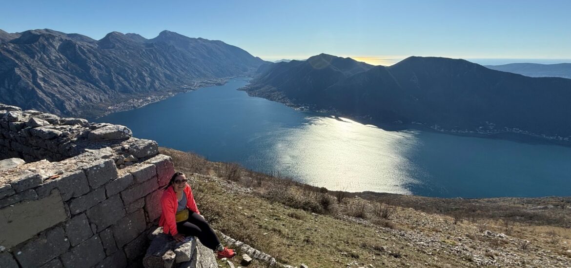
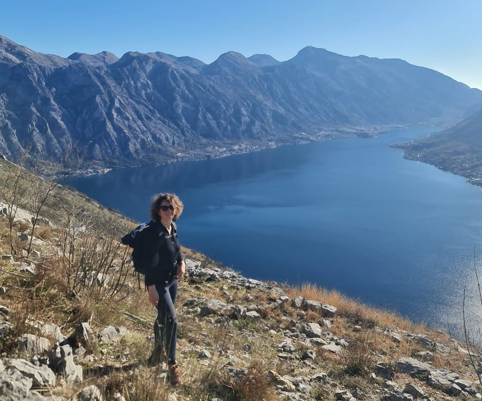
It is a wonderful experience to make a hiking tour to the Fortress of Sveti Andrija – Vranovo Brdo that is located at an altitude of 749 meters above sea level. My daughter Nataša and her friend Suzana made this trek on a bright winter day and enjoyed the breathtaking panoramas. Touched by their enthusiasm I decided to write a blog post about it, using the photographs they made on this beautiful sunny day in December.
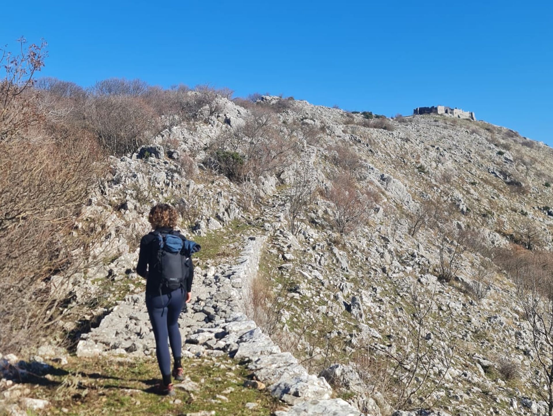
This fortress, also called Fort Vranovo Brdo (in translation: Mount Raven), was built between 1882 and 1884. It can be reached from Perast, where a winding Austro-Hungarian trail starts above the highway. The around two meters wide cavalry road – partly overgrown – leads uphill through small forests, past old military posts and around remains of villages.
The trail is 3.8 km long and it climbs up to 740 meters above sea level in numerous serpentines with a gradient not more than 15 degrees. By the way, this was a rule for the Austrian military engineering!
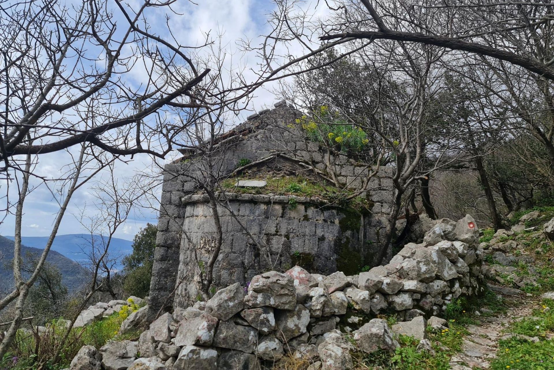
At the altitude of around 400 meters above sea level, the horse trail passes by the abandoned and almost disappearing village of Glogovac with the remains of St. John’s church (Sveti Ivan).
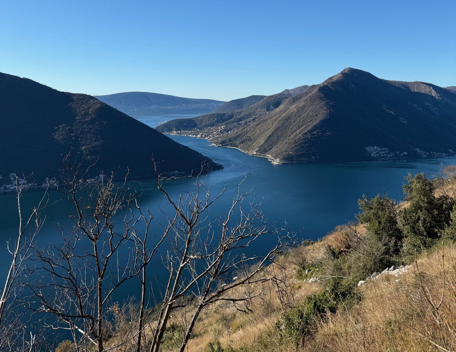
As you approach the top, the environment becomes barren and rocky, and the trail opens up to an amazing panoramic view of the Bay of Kotor.

By the way, most mountain roads around the Bay and through the hinterland of the Montenegrin coast were built by the Austro-Hungarians. Although they have not been maintained and repaired since World War I, many of them are still in a good condition.
Do you know that these roads were built without any binding material? Dry-stone walls on both sides of the road were built by domestic ‘masters of stone’ and everything was done under the surveillance of the Austro-Hungarian authorities, who gave a 100 year’s guarantee for their construction.
How long does it take to reach the fortress? This is a moderate hiking tour and, as I was told, for experienced hikers it takes around 3 hours to reach the fortress and 2 hours back to Perast, with regular stops for photographs and breaks. The hike is a unique experience with stunning views all over the Bay to the open sea!
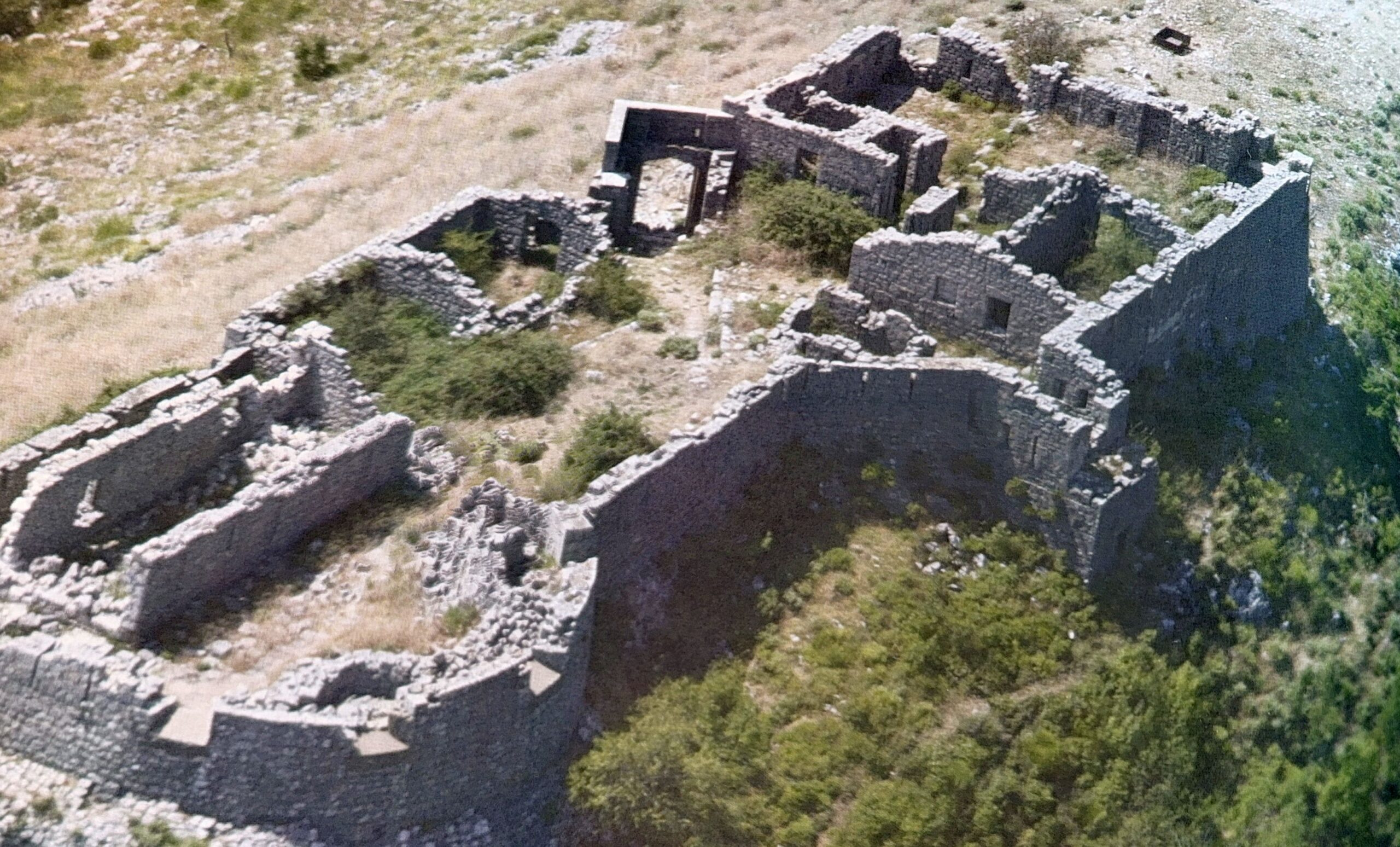
The Fortress of Sveti Andrija was built as a mountain fortress with barracks, two platforms for cannons and a defensive wall. Close to the fortress are the remains of a rainwater tank, as the soldiers were accommodated here in an environment without any water sources.
Unfortunately, the fortress is abandoned and in state of ruin. Like most of the other ’Blockhaus’ fortresses that can still be found along the coast, it was neglected by the state and left to the ravages of time.

However, the wall and all the built facilities remained (see aerial photo from the book ’WERK – Austro-Hungarian fortresses in Montenegro’). Two massive iron gates at the entrance of the fortress were left. Maybe they were too heavy to take them away?
Although the Bay of Boka Kotorska was suitable as a natural harbor, it must have been a challenge for the Austrian engineers to construct a defensive system in the mountains around the Bay. Moreover, it remains a miracle how they succeeded in building fortresses, roads, barracks and rainwater tanks without disturbing the environment. It can certainly be an example for today’s architects and civil engineers!
If you want to learn more about the Austro-Hungarian fortresses that represent a significant part of the architectural heritage of Montenegro, read the monograph entitled ‘WERK – Austro-Hungarian fortresses in Montenegro’ published by Radojica-Rašo Pavićević.
Start of the trail: 42.485638; 18.704054.
Breathtaking-let’s hope they don’t destroy it by building the awful oversized buildings. Definitely will take the hike when I return. Thank you for sharing. Drita