To those who spend their holidays in Budva (or Tivat) and have a car available, I would like to recommend a nice round trip through the region of Grbalj, a fertile valley between Budva and the Bay of Kotor.
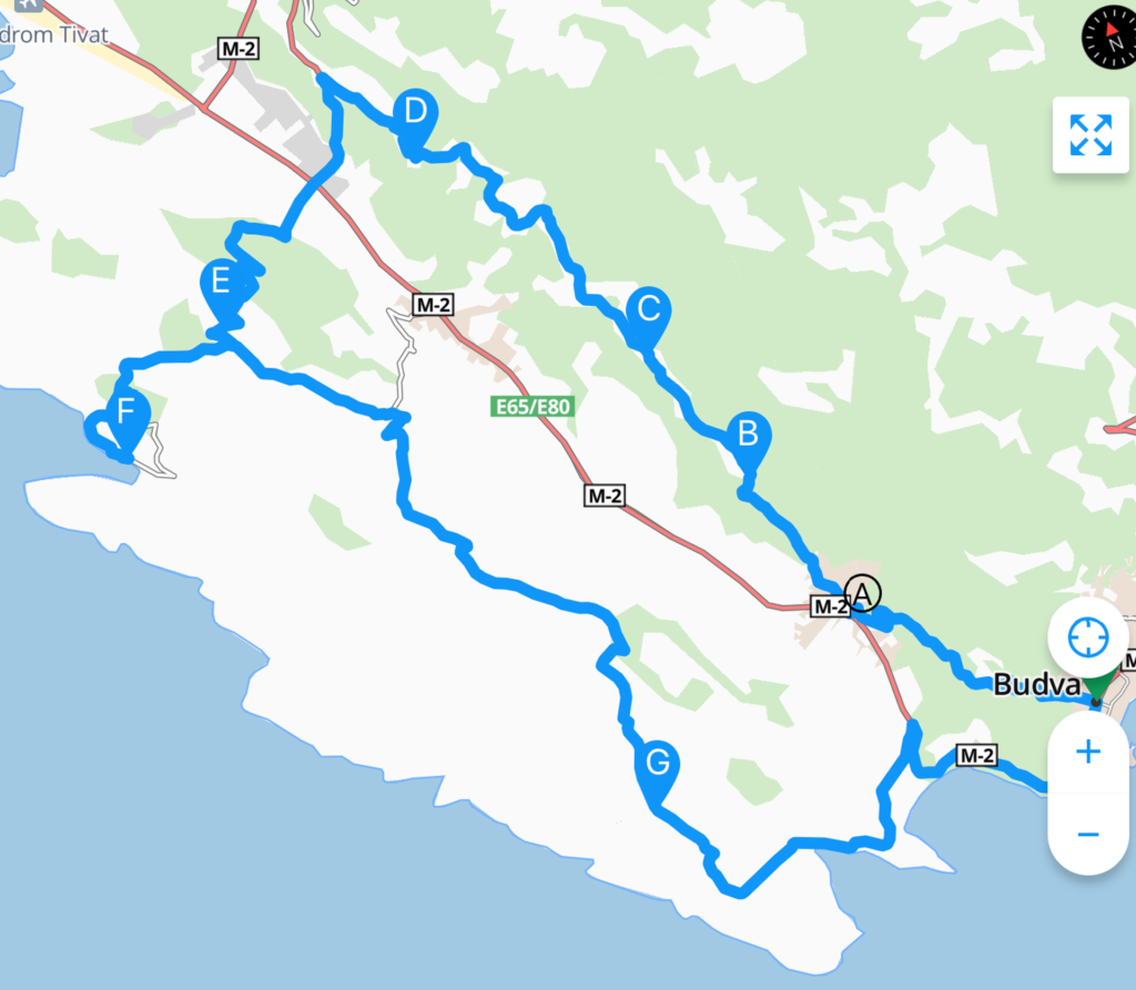 We explored this rural region last weekend and I was surprised to see how attractive it is. It consists of two parts: Upper Grbalj, located on the slopes of Mount Lovćen, and Lower Grbalj that stretches over the low western hills along the Adriatic Sea. Bigova is the only settlement situated on the coast. It is true, the Adriatic Highway from Budva to Tivat passes right through this area, but it is much more interesting to take the local roads, although they are rather narrow and at some places full of potholes.
Maybe the most curious fact about Grbalj is that you can find even 62 active Serbian-Orthodox churches here, within an area of 100 square kilometers. Most inhabitants of Grbalj are of Serbian origin, they are religious and they feel themselves as Serbs. That is why the signposts and names of the villages – at least in Upper Grbalj – are in Cyrillic script.
But where does this weird name – Grbalj – come from? Well, it was derived from Gripuli or Grupuli, a derivation of Acruvium, an ancient Roman city located in this vicinity.
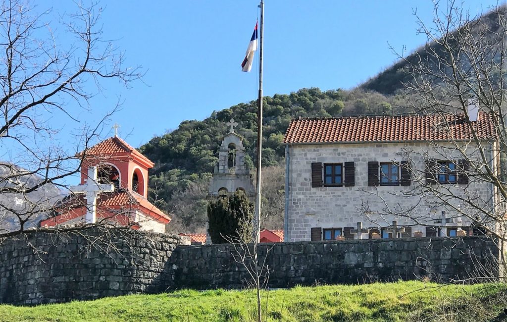 We started our tour in Budva, taking the road uphill (Topliški Put) to Lastva Grbaljska (A), where we wanted to visit the Podlastva Monastery. As this medieval monastery is located on raised ground, we had a magnificent view from the terrace.
According to legend, the monastery was founded by the Serbian Emperor Dušan in 1350, although the first written document dates from 1427. The church, dedicated to the Birth of the Holy Mother of God, has been burned, destroyed and renovated several times. The 1979 earthquake also caused a lot of damage. At the time when we were visiting the monastery, the church was very crowdy with families baptizing their children. It was a pity that we did not have the possibility to enter the church, as we had read that it contains beautiful frescoes.
 We then followed the road uphill to Upper Grbalj with its ten settlements. After the earthquake in 1979 had destroyed many houses in this region, the inhabitants left and settled elsewhere, but it is quite clear that many newcomers have started to build new houses here. No wonder, it is a beautiful area close to the sea!
The signposts are not very useful to foreign tourists, as they probably cannot read Cyrillic. So, start with following the yellow signposts to Gorovići (Горoвичи) and Šišići (Шишичи). By the way, brown signposts refer to the churches that can be found in every settlement. Most of them were renovated or are under reconstruction (it is a pity that some of them really lost their medieval character!), they are generally closed, but it is always interesting to explore some churches that are not located directly along the road.
 After Gorovići, we reached the village of Bratešići (B). We parked our car on the right side of the road, in front of the Church of the Holy Mother. The panorama of Jaz Beach and the Bay of Tivat was beautiful. Here we could also see how important this area is for agriculture: the southern part of Grbalj – behind Jaz Beach – consists of orchards, vineyards and vegetable gardens.
But a particularly nice surprise was the village of Šišići (C) with its “environmental entity”, protected by law. This is one of the few places in Grbalj where you can still see how these settlements looked like in the past.
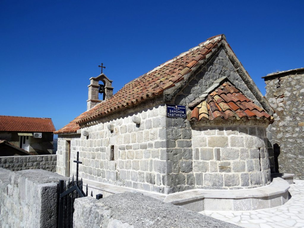
The earthquake in 1979 destroyed many old houses, but the church of Sveti Đorđe (St. George), a legacy of the Šovran brothers, was restored, together with a few other buildings, a chapel and an old threshing floor. The church is a typical example of 16th century village architecture with massive walls and asymmetric apertures in the walls, looking like gun ports.
 We continued the trip to Nalježići and Sutvara (D), turned left, passed the Adriatic Highway and took the road to Lješevići (E) and Bigova (F).
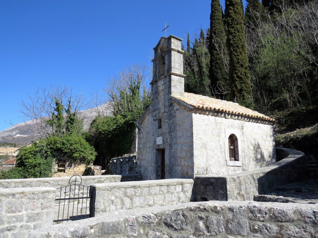
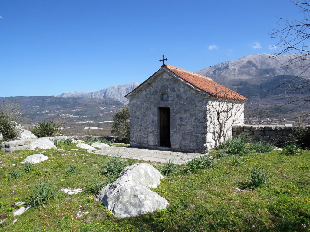
This area, Lower Grbalj, stretches over green hills along the Adriatic Sea. The charming little church of Sveti Đorđe (St George) near Lješevići, on the top of a hill, is a must-see (photo 1).
We turned right in a hairpin bend, and after less than a hundred meters of dirt road we reached the church with a great view of the surroundings – and of course, with the typical Serbian-Orthodox church flag that can be seen everywhere in this region.
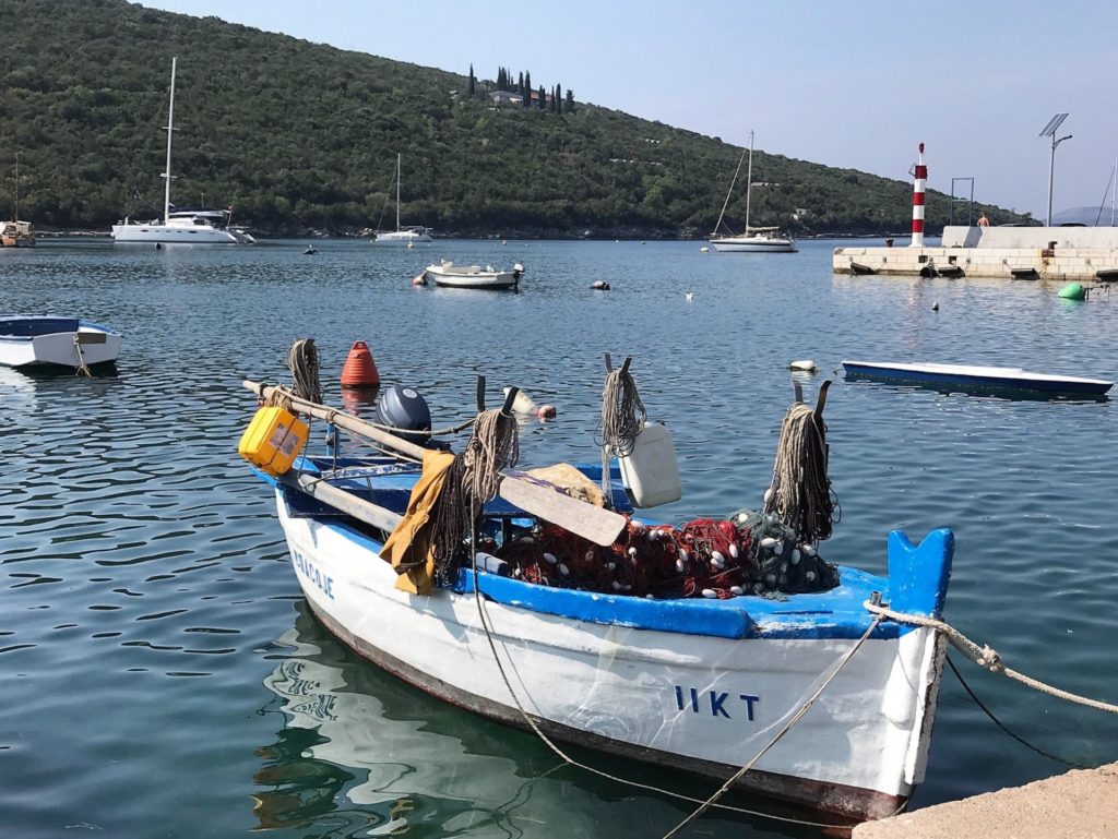
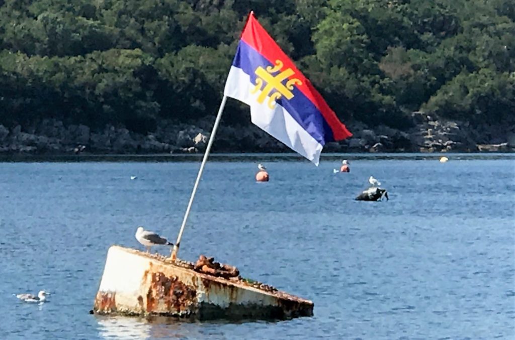
I would recommend you to make a small detour (13 km – turn right at the junction) to the charming fishermen’s village of Bigova, the only settlement in Grbalj that lies on the Adriatic Sea, around a small cove. The port is protected with a big “ponta” and the clear water invites for a swim. Moreover, there are a few good fish restaurants around the port and if you are lucky, you will see the Serbian-Orthodox church flag planted on a buoy in the middle of the port (see photo)!
Driving back to the junction, we kept left and continued to Vranovići and further to the villages of Pobrdje, Kubasi and Krimovica (G). This area appeared to be less densely inhabited, probably because it is less fertile; we passed through a landscape of endless Mediterranean scrub known as maquis.
 Finally, we approached the coast north of Budva, where the beaches of Ploča, Trsteno and Jaz are very popular and frequently visited by tourists during the summer season.
I really enjoyed this round trip through Grbalj and I am sure that you will be impressed too, first of all, by all those charming village churches and, of course, also by the attractive landscape.
You can easily find your way by following the route on the attached map with the appropriate letters. The tour has a length of 52 kilometers only, but the trip will take you around one hour and twenty minutes, as the roads are – at times – rather bad and narrow. Good luck!
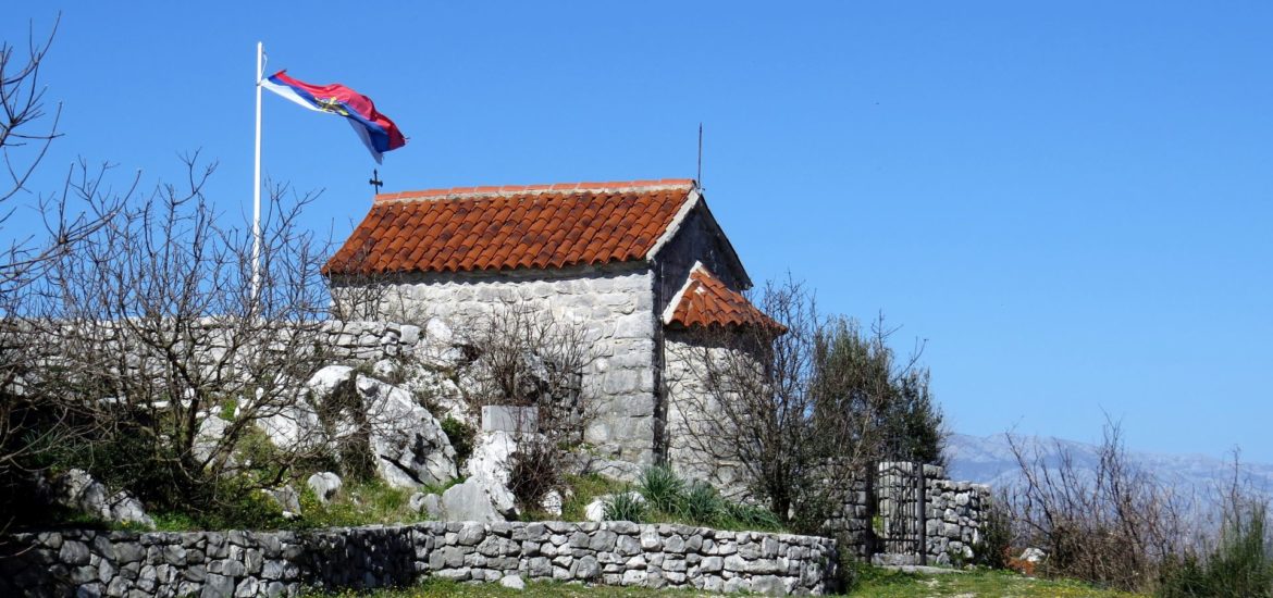
Tell me, please, where the photo of a small chapel with green grass and a mountain in the background was taken (photo 5)?
It’s a St.George church near Leševići. You may read more about it here: https://m.facebook.com/story.php?story_fbid=2075011365944115&id=100003058162955
Hi! I’m going to spend some days in montenegro with a friend…Can you please recommend some places to sleep?
Moreover, could you please tell me how are the roads? We want to rent a car to better visit the country…
Thanks!
Also a compani to rent a car
Very nice. Apart from the warm water my favorite in Montenegro are the old Serbian Orthodox churches and, even more, monasteries. Only wish they offered some basic accomodation to enable to stay near by.